Reliable 50cm High-Resolution Satellite Imagery
At 50cm resolution, SuperView-1 provides organisations with near-real-time intelligence to proactively identify blind spots, anticipate events and have confidence in the next mission-critical decision. Four identical satellites. Daily revisit. Global coverage. Archive from $14/km² delivered in 48 hours.
The Ideal Trade-Off Between Detail, Coverage and Cost
50cm high-resolution imagery gives you the detail you need for the widest range of professional, civil and military applications — at a cost that makes regular, high-frequency revisit practical for ongoing projects.
Buildings and roads visible. Suitable for overview mapping and land use classification at regional scale.

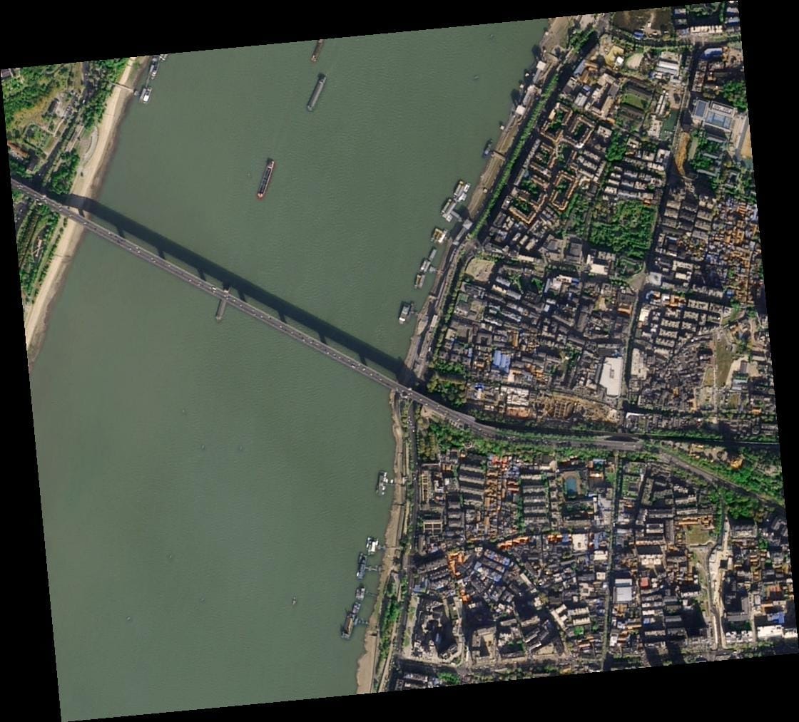
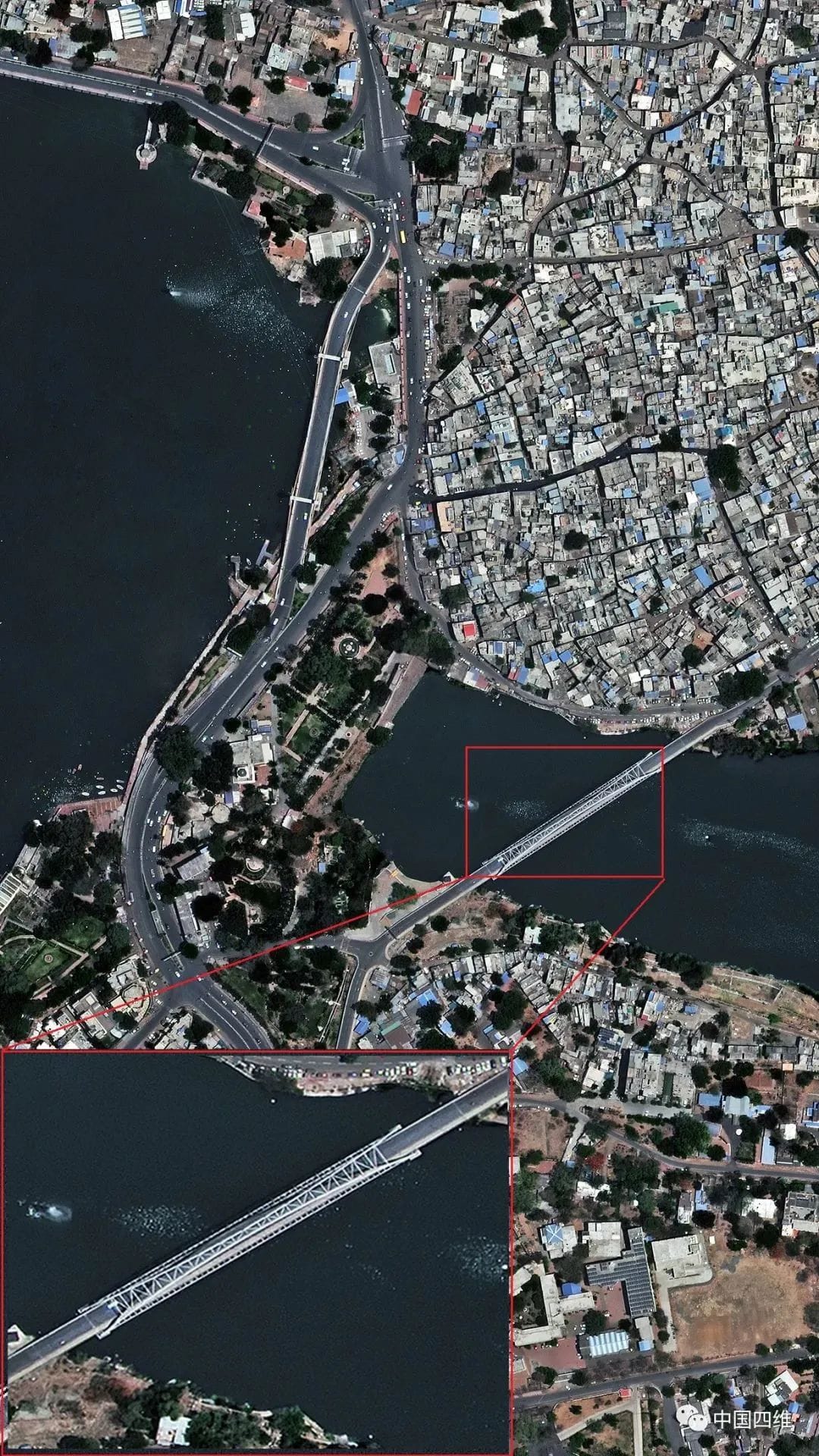
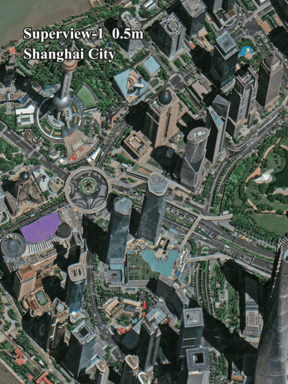
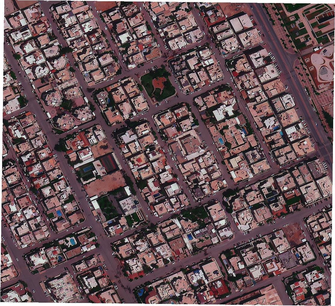
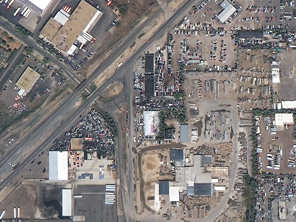
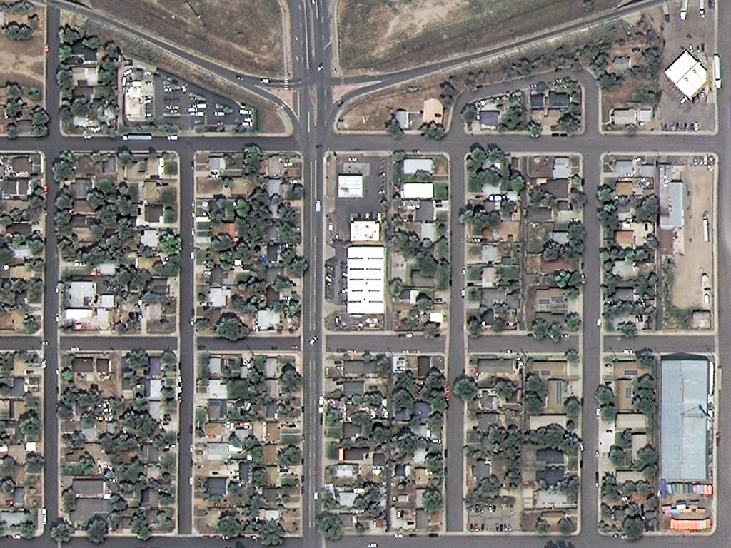
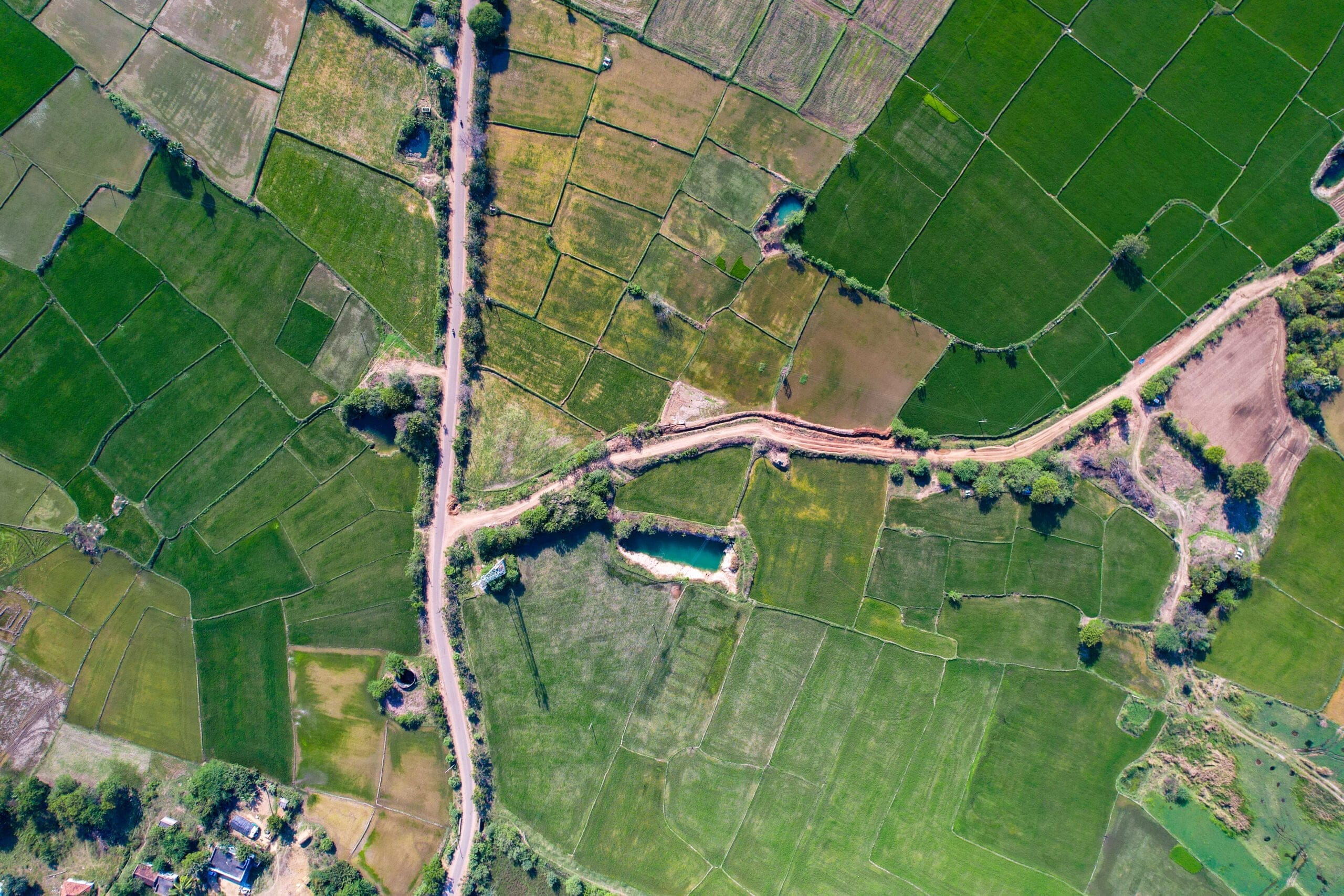
Individual buildings, vehicles, roads and infrastructure clearly visible. The most widely used resolution for civil and professional projects worldwide.
Vehicle types, road markings and construction details identifiable. Higher cost — suited to GEOINT, defence and engineering-grade precision work.
50cm SuperView-1 Satellite Imagery - China's First Commercial High-Resolution Constellation
SuperView-1 is China's first high-resolution commercial satellite constellation. Four identical agile satellites orbit at 530km in a sun-synchronous orbit, delivering consistent, daily revisit with a high probability of cloud-free capture for any location on Earth.
Each satellite carries a 50cm panchromatic sensor and four 2m multispectral bands. With up to 2 million km² of collection capacity across the constellation per day, SuperView-1 offers the coverage and reliability that large-scale and ongoing monitoring projects demand.
- Identify individual buildings, roads and infrastructure clearly
- Detect changes in land use, vegetation and development over time
- Generate stereo DEMs and 3D city models from agile multi-angle capture
- Map field boundaries and assess crop health with 2m multispectral data
- Support defence, civil government and emergency response workflows globally
Reliable, 50 Cm High-Resolution satellite Imagery from Around the World
With a fleet of four high-resolution tasking satellites, XRTech Group provides frequent daily revisit capability, delivering actionable insights for real-time decision making worldwide.
Rapid Revisit
Constellation designed for daily revisit anywhere on Earth. Capture the same location multiple times to track changes as they happen and stay ahead of fast-moving events.
High Resolution
50cm ortho spatial resolution images provide ample detail for precision mapping, infrastructure monitoring, urban planning and intelligence analysis across any terrain.
Extensive Archive
A global archive built since 2016 containing millions of square kilometres of imagery. Immediate access to historical data for your area without waiting for new collection.
Rapid Delivery
Archive imagery delivered within 48 hours. Emergency tasking delivered within 24 hours of capture. For urgent requests, 1.5-hour response with 1-hour data delivery is available.
High Accuracy
9.5m CE90 geolocation accuracy globally. Level 2A orthorectified products load directly into ArcGIS, QGIS and most GIS platforms without additional processing.
Stereo and 3D
Four advanced collection modes including long strip, multiple strips, target collection and stereo acquisition for precise 3D elevation models and digital twins.
Workflow Integration
Cloud Optimised GeoTIFF delivery compatible with ArcGIS, QGIS, ENVI and Google Earth Engine. No additional georeferencing or coordinate conversion required.
No Export Delays
As a non-US provider, XRTech Group delivers globally without ITAR or EAR export licence restrictions. Buyers worldwide receive data on standard commercial terms.
Contact XRTech Group to receive sample data for your area.
50 Cm SuperView-1 Satellite Technical Specifications
SuperView-1 consists of four identical agile optical satellites launched in two pairs. The first pair launched December 26, 2016. The second pair launched January 9, 2018. Operated by China Siwei and delivered worldwide through XRTech Group.
| Specification | Detail |
|---|---|
| Constellation | SuperView-1 (SV-1) — 4 identical agile optical satellites |
| Launch Dates | Pair 01/02: December 26, 2016 · Pair 03/04: January 9, 2018 |
| Panchromatic Resolution | 0.5m at nadir · 0.59m at 20° off-nadir · 0.71m at 30° off-nadir |
| Multispectral Resolution | 2.0m at nadir · 2.36m at 20° off-nadir · 2.84m at 30° off-nadir |
| Spectral Bands | Panchromatic + 4-band MS: Blue, Green, Red, Near-Infrared |
| Swath Width | 12 km at nadir · 14.1 km at 20° · 17.8 km at 30° · 28 km at 45° |
| Orbit Altitude | 530 km sun-synchronous · 10:30 AM equatorial crossing |
| Orbit Period | 97 minutes · inclination 98.13° |
| Revisit Frequency | 1 day at <45° off-nadir · 1.5 days at <20° off-nadir |
| Daily Acquisition | 750,000 km² per satellite · 2,000,000 km² across constellation |
| Dynamic Range | 11 bits per pixel |
| Geolocation Accuracy | 9.5m CE90 global average |
| Onboard Storage | 2 terabytes per satellite |
| Downlink | 2 channels at 450 Mbps each |
| Stereo Capability | In-track and cross-track stereo available |
| Processing Levels | Level 1B, 1C, 2A orthorectified |
| Delivery Formats | GeoTIFF, Cloud Optimised GeoTIFF · WGS84 and UTM projections |
Spectral Bands
Four Collection Modes
Long Strip
Continuous strip mapping for pipelines, roads and borders up to 500 km².
Multiple Strips
Large-scale regional mapping across multiple parallel passes.
Target Collection
Single focused capture of a specific facility or point of interest.
Stereo Acquisition
Two-angle capture for DEM, 3D city models and elevation data.
Need sharper detail? Compare 50cm with 30cm very high resolution imagery.
View 30cm Super High Resolution Imagery50cm Satellite Imagery Pricing — Fixed Per km² Rates
XRTech Group publishes fixed pricing for all SuperView-1 products. No hidden fees. No subscription. No export licence surcharge.
Previously captured imagery aged 90 days or more. Fastest and most cost-effective route to 50cm data.
Fresh satellite tasking on a date you choose. Cloud cover guarantee available as an add-on.
Prioritised scheduling for time-sensitive deadlines. Faster than standard new tasking.
Immediate satellite tasking for disaster response, intelligence and time-critical operations.
Add-On Options
How Organisations Make Decisions with 50Cm Satellite Imagery
50cm high-resolution satellite imagery is the workhorse of commercial Earth observation. It delivers the full spectrum of civil, commercial and military capability — from routine land monitoring to mission-critical intelligence.
 Defence and Intelligence
Reliable, Up-to-Date Intelligence as Events Unfold
50 cm resolution satellite imagery provides fast and accessible insights into security events, border activity and geopolitical changes. Task collections sub-daily, reduce risk with rapid revisit and capture unexpected events across remote locations, coastlines and border areas.
- Monitor regional conflicts and border areas daily
- Validate actions with rapid revisit tasking
- Extract insights with near-infrared and stereo capabilities
- Update military maps in strategic areas
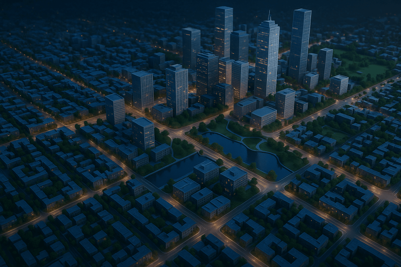 Urban Planning and Land Administration
Protect Public Land, Measure Policy Impacts, Enable Rapid Decisions
Manage and monitor infrastructure projects broadly, improve protection of natural resources and update maps and charts with the most recent data. 50cm imagery supports urban planning, housing, transportation management and land use mapping at scales up to 1:5,000.
- Monitor and detect changes to land use
- Assess urban sprawl and new infrastructure
- Analyse areas of interest and derive timely insights
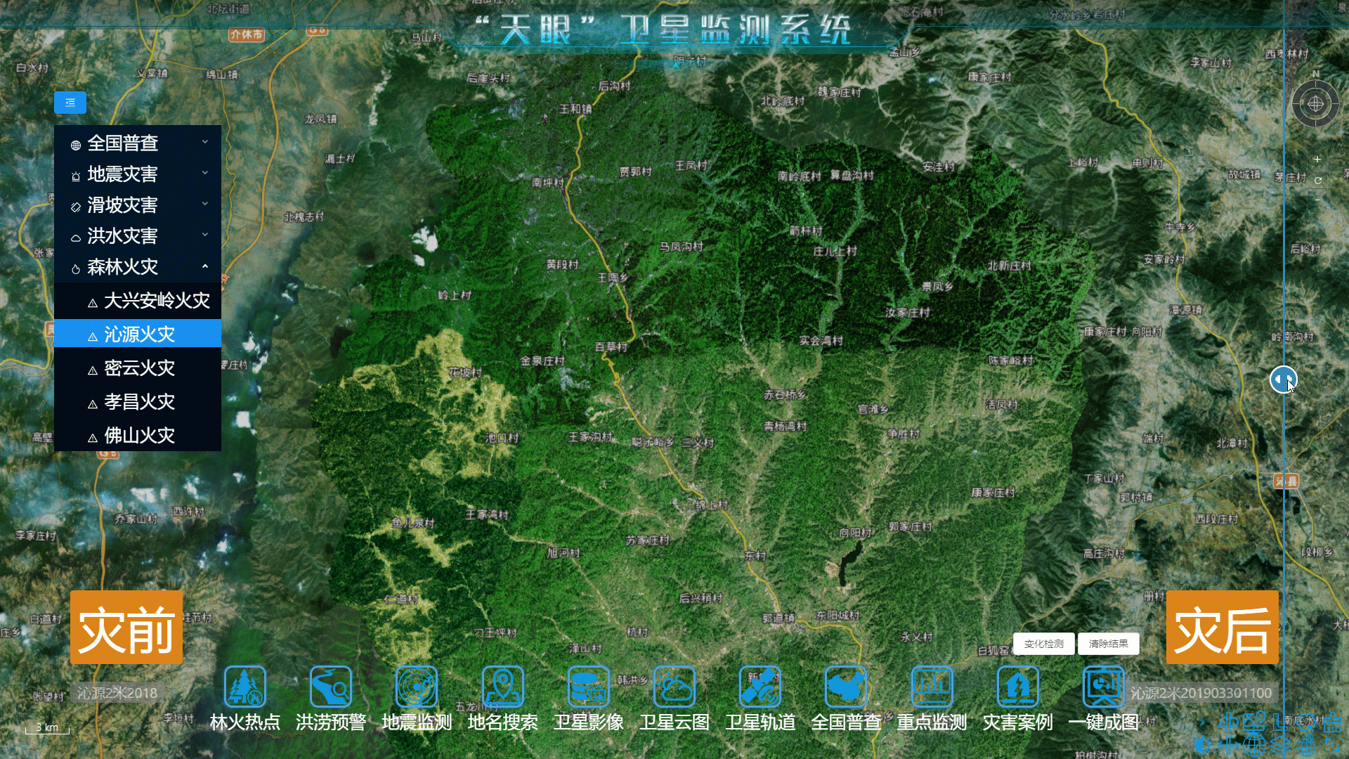 Forestry and Land Use
Monitor Forest Assets and Localise Clearing in Near-Real Time
Track changes in land use and land cover, prevent illegal and unpermitted clearing and manage forest health with high-cadence, 50cm high-resolution satellite imagery. Detect deforestation boundaries and coastal erosion with consistent revisit across large protected areas.
- Optimise timber harvest operations
- Monitor and manage forest health over time
- Prevent illegal land clearing in near-real time
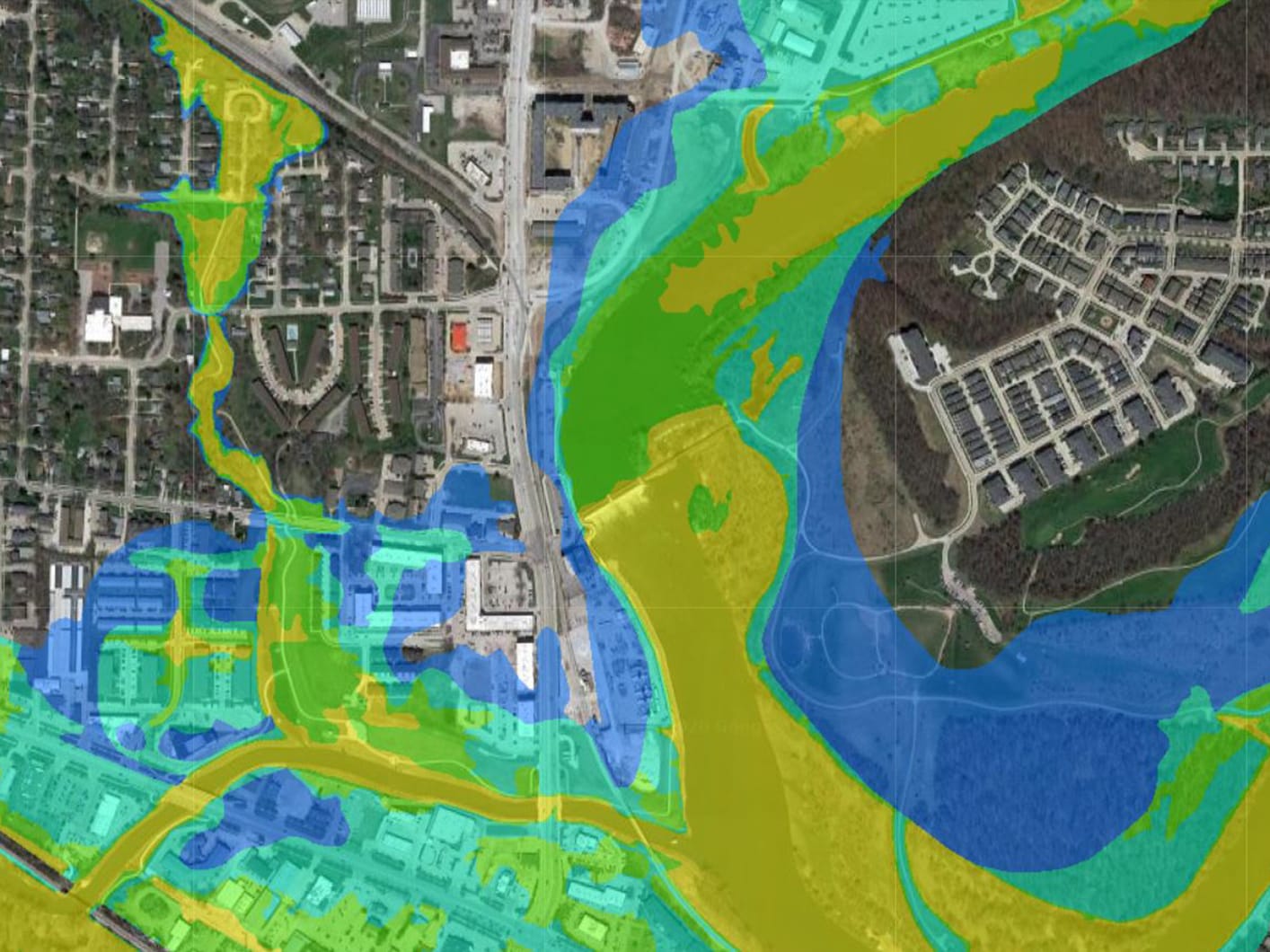 Emergency Response
Anticipate, Assess and Mitigate Disasters — Fast
Accessible, frequent and 50cm high-resolution satellite imaging helps anticipate landscape changes, identify potential dangers and assess disaster scope at speed. XRTech Group delivers emergency tasking within 24 hours of the satellite pass — fast enough to support active response operations.
- Understand disaster scope with before-and-after imagery
- Inform the most effective and rapid response mode
- Identify blocked routes, flooded areas and debris fields
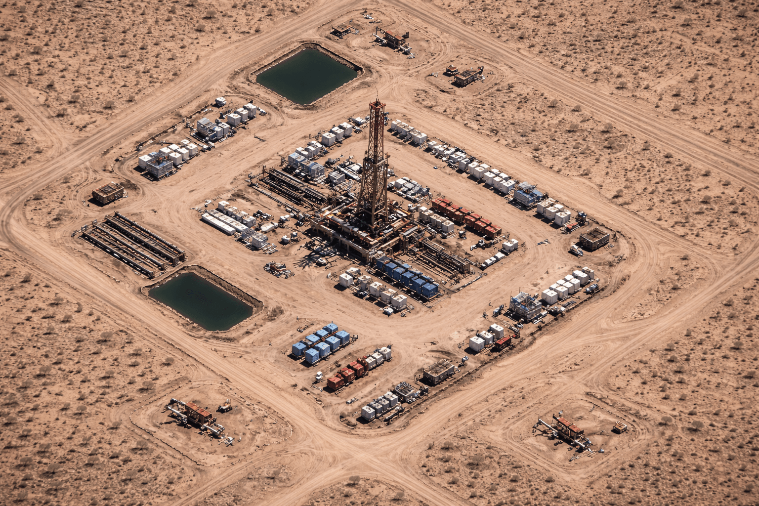 Energy and Infrastructure
Monitor Assets, Manage Risk and Evaluate Activity
Fast, reliable 50cm high-resolution satellite imagery helps monitor infrastructure development and growth across regions. Track pipeline corridors, manage reclamation projects, evaluate competitor activity and mitigate risk across remote operating areas without physical deployment.
- Monitor important assets and reclamation projects
- Manage and pre-empt risks to your business
- Evaluate production methods and equipment activity
 Agriculture and Crop Monitoring
Assess Crop Health and Manage Fields at Scale
Monitor fragmented landscapes, small parcels, experimental micro-plots and permanent crops with 50cm resolution combined with 2m four-band multispectral data. Particularly well suited for crop yield estimation, irrigation recommendations and agricultural input optimisation.
- Assess crop health and field variability remotely
- Map field boundaries and irrigation zones precisely
- Monitor large agricultural areas with daily revisit
Why Organisations Choose XRTech Group for 50 Cm High-Resolution Satellite Imagery
XRTech Group is the authorised regional reseller for China Siwei, the operator of the SuperView-1 constellation. Since 2019, XRTech has delivered 50cm high-resolution satellite data to governments, infrastructure firms and commercial clients worldwide.
130+ Satellite Network
Access optical, SAR, multispectral and hyperspectral sensors from a single provider. SuperView-1, SuperView Neo and the full China Siwei fleet through one contract.
Fast Delivery Worldwide
Archive in 48 hours. Standard tasking in under 7 days. Emergency in 24 hours. Urgent requests can be responded to within 1.5 hours through the Siwei Earth cloud platform.
No Export Delays
XRTech Group is a non-US provider. No ITAR or EAR export controls. Buyers worldwide receive data on standard commercial terms with no licence delays.
Transparent Pricing
Fixed per km² pricing with no hidden fees and no subscription. Archive 50cm from $14/km². Sample imagery available for your area on request.
Global Archive Since 2016
SuperView-1 has been building its archive since December 2016. Historical data for your area is likely already available for 48-hour delivery without new tasking.
Expert Support
XRTech Group advises on the right resolution, format and processing level for your project. WhatsApp support at +971 58 885 3151.

Satellite Imagery Specialists — Dubai, UAE
XRTech Group is the authorised distributor for China Siwei, the satellite division of CASC. The group delivers satellite imagery, drone solutions and AI analytics to clients worldwide from its Dubai headquarters.
Beyond raw imagery delivery, XRTech produces analysis-ready geospatial products from SuperView-1 data including orthorectified DOM, digital elevation models and 3D city models — all delivered in the formats your GIS workflows already use.
- Authorised China Siwei reseller since 2019
- Headquartered at Radisson Blu, Dubai Deira Creek
- Serving clients worldwide across every region
- No US export controls or ITAR restrictions
- Sample imagery available for your area on request