Satellite View of Dong'an Lake Sports Park, Chengdu
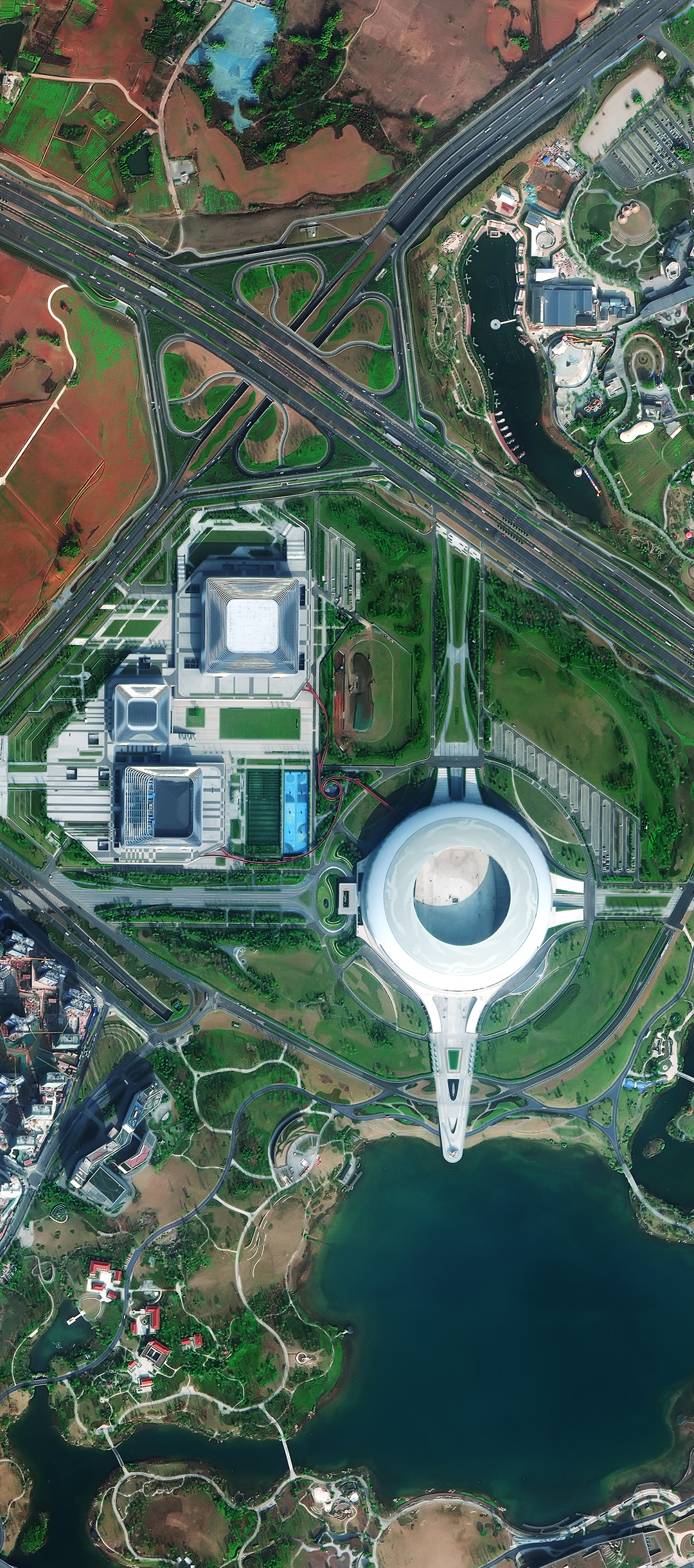
A sub-metre optical satellite image of Dong'an Lake Sports Park in Chengdu, with the main stadium, indoor arenas, the lake and a major expressway interchange.
This satellite view of Dong'an Lake Sports Park, Chengdu was captured from orbit, not by plane or drone. Click the aerial view to open it full size.
Aerial view of Dong'an Lake Sports Park, Chengdu from space
The round main stadium sits at the centre of the park, linked by a long walkway to the lake shore. Two indoor arenas with large roofs stand to the west, while an expressway with a cloverleaf interchange cuts across the top of the frame.
Large mixed sites like this are a good example of why wide-area, high resolution imagery is useful: one image covers roads, buildings, water and open land at the same level of detail.
Order archive images or new tasking, from 15cm HD and 30cm optical to all-weather SAR, delivered worldwide as GeoTIFF. Tell us your area and we send available images and a price, usually within 24 hours.