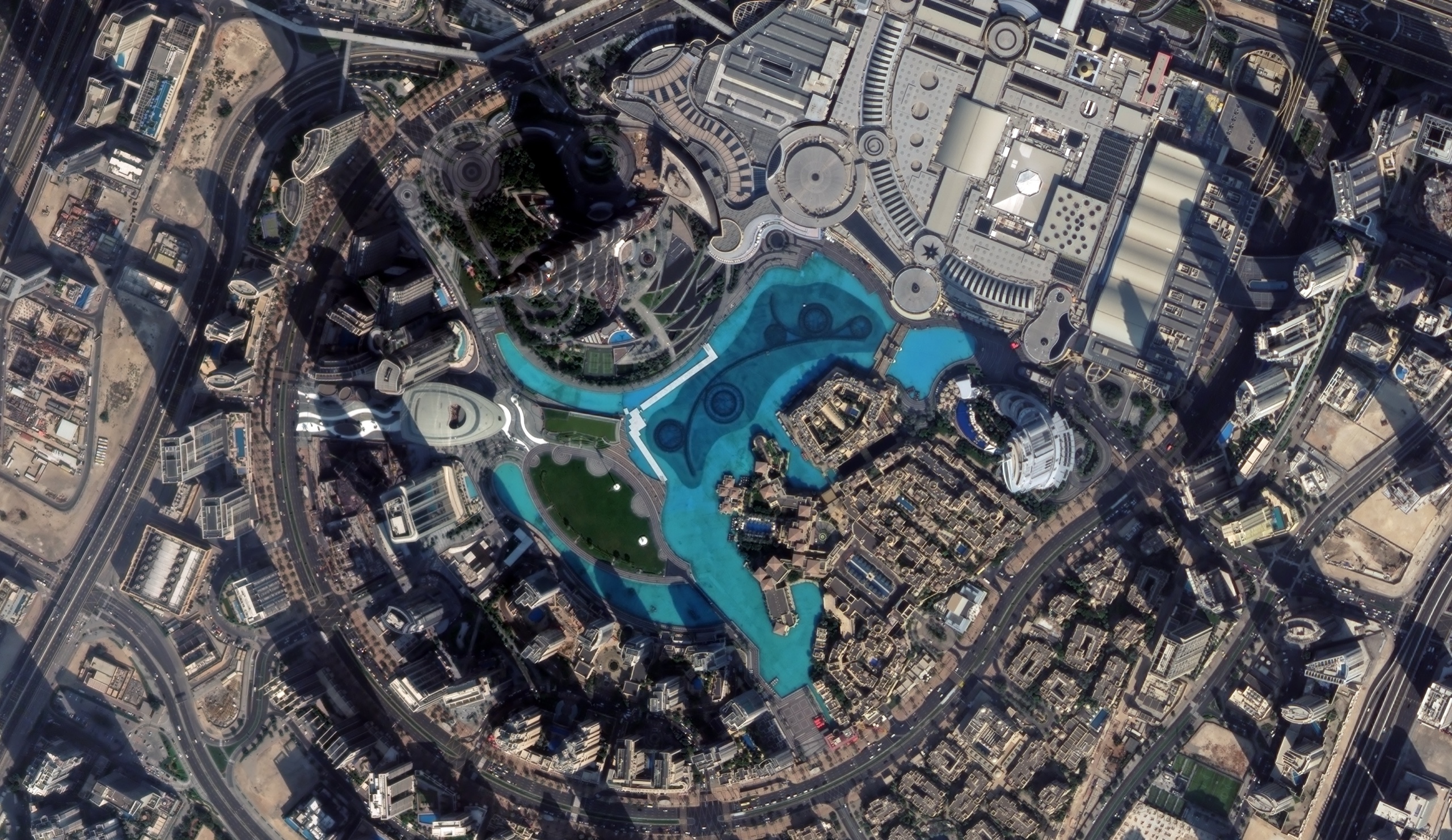
A very high resolution optical satellite image of Downtown Dubai, centred on the Burj Khalifa, the Dubai Fountain lake and Dubai Mall.
This satellite view of Burj Khalifa, Dubai was captured from orbit, not by plane or drone. Click the aerial view to open it full size.
Aerial view of Burj Khalifa, Dubai from space
From orbit the Burj Khalifa is easiest to spot by its shadow: a long dark band that stretches across the district from the base of the tower. Around it, the turquoise Burj Lake, the Dubai Fountain promenade, the curved roofs of Dubai Mall and the ring road of Downtown Dubai are all sharp enough to map.
Images like this are used to track construction, plan new developments and check how a district changes between two dates. Shadows also give planners a quick way to estimate building height when no 3D model exists.
What you can see in this aerial view
The Burj Khalifa base and its long shadow across Downtown Dubai
Burj Lake and the Dubai Fountain walkways
Dubai Mall roofs, car parks and access roads
High-rise towers, construction plots and the Downtown ring road
Order archive images or new tasking, from 15cm HD and 30cm optical to all-weather SAR, delivered worldwide as GeoTIFF. Tell us your area and we send available images and a price, usually within 24 hours.