About Us

# ABOUT US

Customized Platform Development For High ROI Business

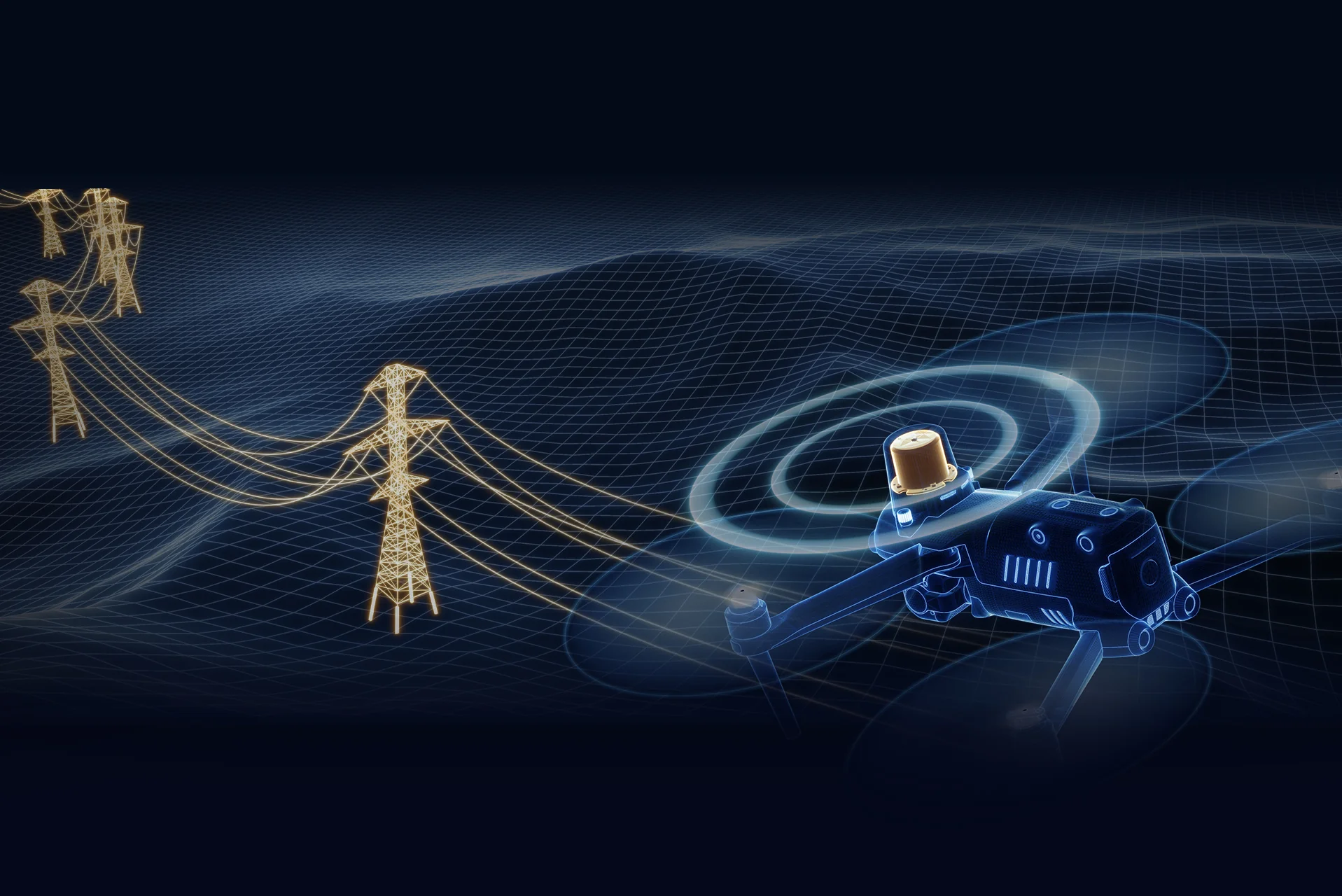
Welcome to XRTech Group, a pioneer in satellite imagery and 5G-connected drone solutions since 2019. We specialize in delivering high-impact, scalable solutions that ensure significant ROI for our clients.

# WHY CHOOSE XRTech

First to introduce 5G modules for DJI drone systems

With 8 years of expertise in 5G-connected drones, XRTech Group offers industry-first solutions like the M30/M30T battery swapping stations and single drone multi-station systems for scalable deployments. 

Our drone-in-a-box solutions with parachute systems ensure safety and efficiency, while our DJI Drones and DJI Docks provide secure on-premise data residency. Choose XRTechGroup for cutting-edge innovation and reliability.

# OUR BENEFITS

We Deal With Aspects Professional Solutions

At XRTech Group, we offer cutting-edge satellite imagery data and our services extend to advanced AI modelling and platform development. Our state-of-the-art 5G-connected drone-in-a-box solutions are designed for security and armed forces.

01

Satellite Imagery Solutions

We offer cutting-edge satellite imagery data, including Very High Resolution (VHR), High Resolution (HR), Wide Swath, SAR, and Optical imagery.

02

AI Modelling & Platform Development

Our services extend to advanced AI modelling and platform development suit for diverse business use cases.

03

5G Drone-in-a-box Solutions

Specially designed for security and armed forces, featuring on-premise deployment to guarantee data residency and real-time responsiveness.

# CORE VALUES

Our mission is built on four core principles:

High ROI and Productivity

We are committed to ensuring substantial returns for our clients.

Continuous Development

We strive to stay ahead of market dynamics through ongoing innovation and development.

Customer-Centric Approach

We prioritize incorporating client feedback into our solutions.

Impactful Innovation

We are dedicated to creating life-saving solutions through our innovative technologies.

Request Product Details

Satellite Imagery Advisor

Brief questions. Practical guidance. Get an indicative estimate instantly, and we only proceed to a formal quote once the basics are clear.

Advisor mode: this form will recommend the lowest resolution and type that fits your objective so you do not overpay.
Step 1 — Area & Location
1 / 4
Start simple: Upload a KML/KMZ/ZIP if you have it. If not, a bounding box or center plus dimensions works fine. We will calculate area for you where possible.
Upload AOI file (KML / KMZ / ZIP) — recommended
Preferred: a single polygon AOI. We compute the area automatically.
Enter corner coordinates (bounding box)
Use min/max latitude and longitude.
Enter center coordinate + width & height
Good for quick feasibility when exact boundaries are not available.
Describe location (city / region / site name)
We will follow up to confirm an AOI boundary if needed.
Advisor note: If speed is the priority, we usually check archive first. If you need a specific date window or fresh capture, choose new tasking.
Archive imagery
Previously captured imagery, typically faster delivery.
New capture (tasking)
Satellite is tasked for your AOI; weather and availability can affect capture date.
Not sure, advise me
We will recommend the most feasible option based on area, timing, and objective.
Minimum order guidance
Archive imagery: typically 15 to 25 km²
New capture: typically 50 to 100 km²
Feasibility depends on satellite, location, and timing.
Pick a date window. We will advise what is realistic for your area and cloud conditions.
Resolution guidance: Higher resolution increases detail and cost. We will recommend the lowest resolution that meets your objective.
I know what I need
Select 30cm, 50cm, 75cm, or 1m.
Advise me based on my objective
Answer a quick question about what you need to see.
Almost done. You will see an indicative estimate. If you agree, we will run feasibility and send a formal quote.
I understand this is an indicative estimate and request feasibility and a formal quote.
We handle requests confidentially. No data is shared with third parties.
Protected by spam filter and bot detection. Genuine enquiries only.
Live Summary
Updates as you answer
Area (km²)
AOI method
Coordinates / Location
Imagery type
Date range
Resolution

Indicative Estimate

Based on XRTech published pricing. Final price confirmed after feasibility check.
Complete Steps 1 to 3 to see an estimate.
Once you submit, XRTech will:
  • Archive: run a coverage check in your date range
  • Tasking: confirm window and issue order form or invoice

Quote Request Sent

Your satellite imagery request has been sent to admin@xrtechgroup.com. XRTech will review feasibility and send a formal quote within 24 hours. A free sample tile for your AOI is included in the quote response.