


Home » Satellite Data » Applications
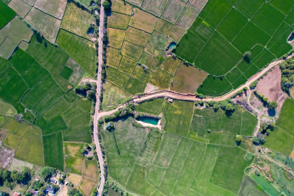
China Siwei leverages cutting-edge satellite remote sensing and AI technologies to revolutionize agricultural management. Our solutions provide comprehensive monitoring across the entire farming cycle, ensuring precision agriculture and sustainable resource management.
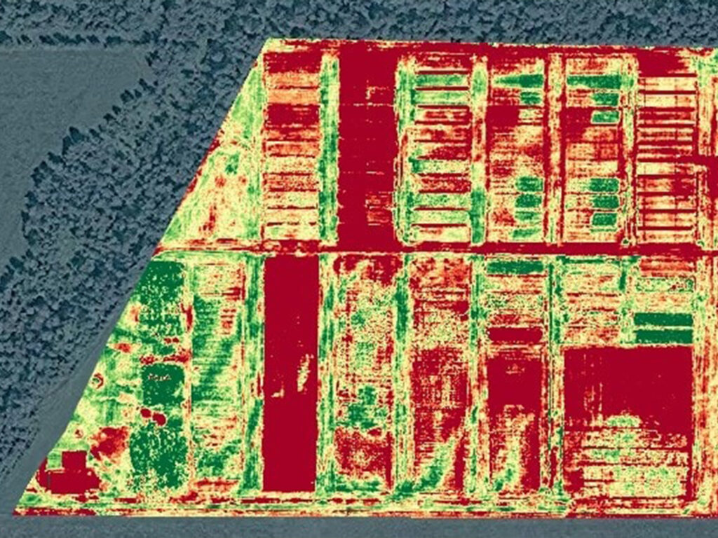
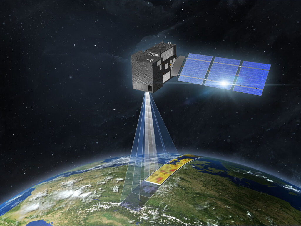
Multi-source satellite data enables real-time monitoring of crop growth, health, and maturity. Spectral analysis is used to estimate biomass, monitor soil moisture, and assess crop yield with up to 85% accuracy at the county level.
AI-powered growth management: Detect and analyze non-grain land changes, and classify crop types with accuracy exceeding 90%.
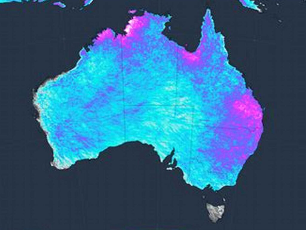
Remote sensing for soil moisture and fertility monitoring provides accurate data on soil health, supporting effective irrigation and fertilization strategies.
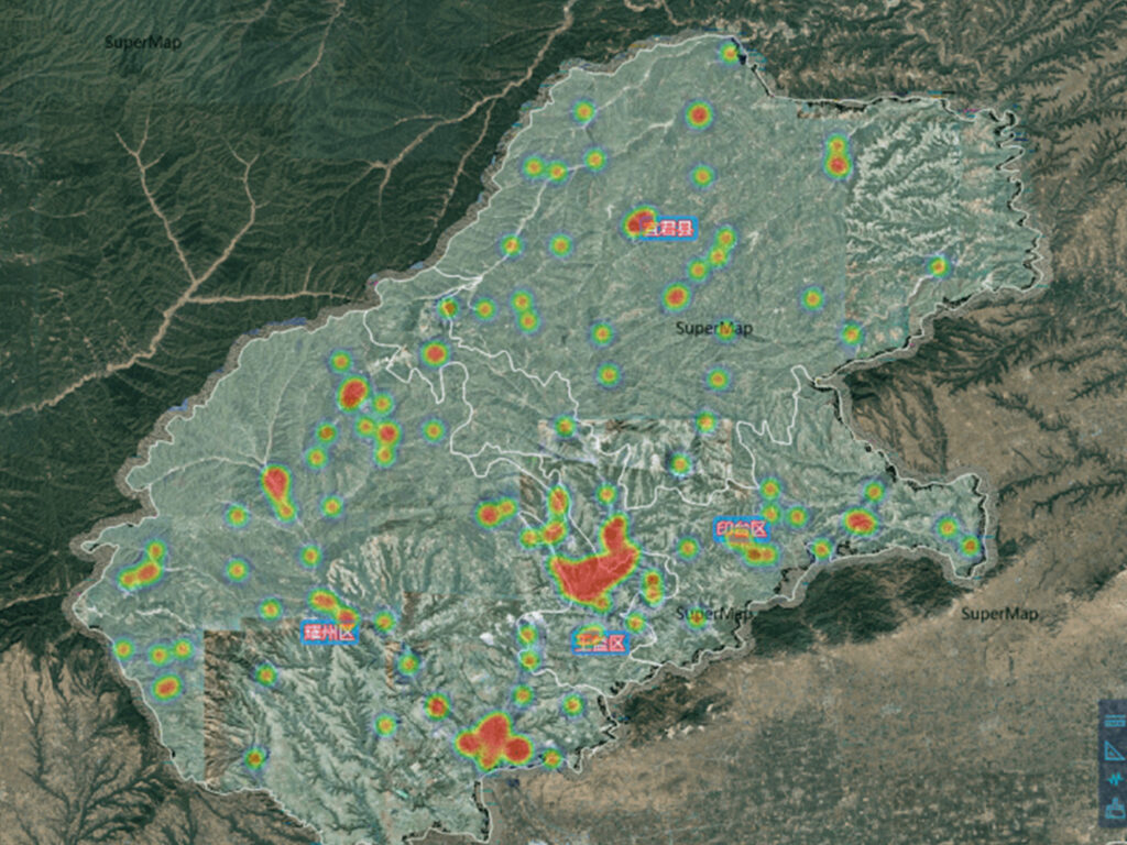
AI-driven models detect and classify agricultural risks, enabling timely interventions and reducing crop loss. The accuracy of these models can reach over 90% in specific scenarios.
Integrated satellite data for real-time weather monitoring and early warning systems help mitigate the impact of natural disasters on agriculture.
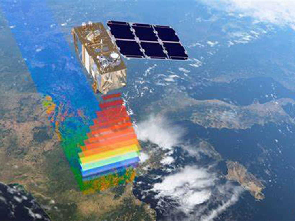
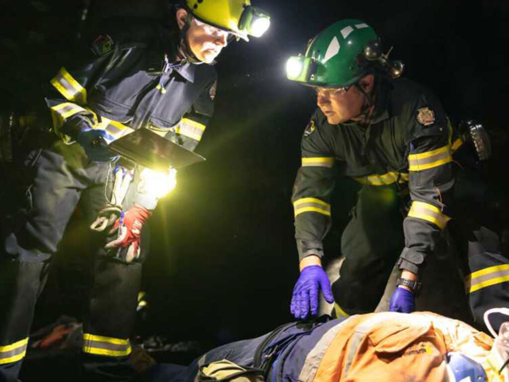
China Siwei provides real-time, AI-powered disaster monitoring and response solutions using a constellation of high-resolution satellites. Our systems offer comprehensive coverage, enabling quick assessment and effective management of natural and man-made disasters
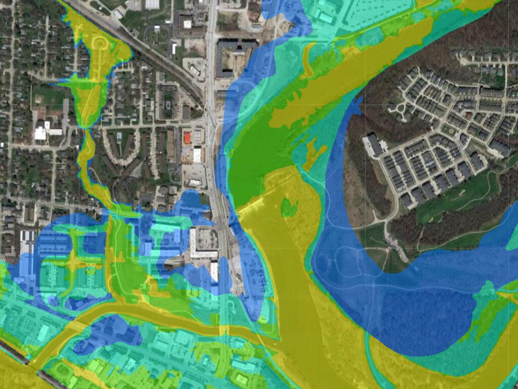
Real-time flood risk mapping using AI and satellite data to predict flood zones, monitor water levels, and assist in disaster response. These solutions have been applied in various flood scenarios, including the Venezuela Flood Response, where China Siwei provided actionable insights within hours.
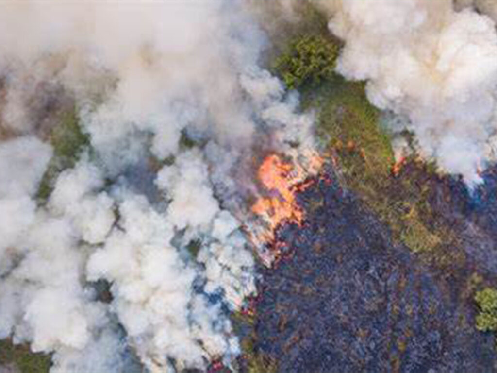
AI-based early warning systems for forest fires, including real-time fire detection, tracking, and damage assessment, using multi-source satellite data. Continuous monitoring allows minute-by-minute updates, reducing response times and limiting damage.
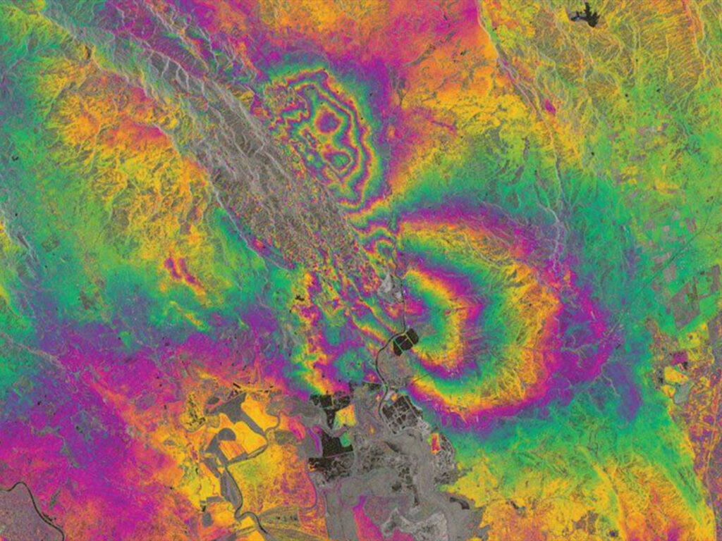
Satellite-based deformation monitoring of critical infrastructure like dams and bridges, identifying potential risks before they lead to disasters. This capability was effectively demonstrated in the monitoring of the Aswan Dam in Egypt.
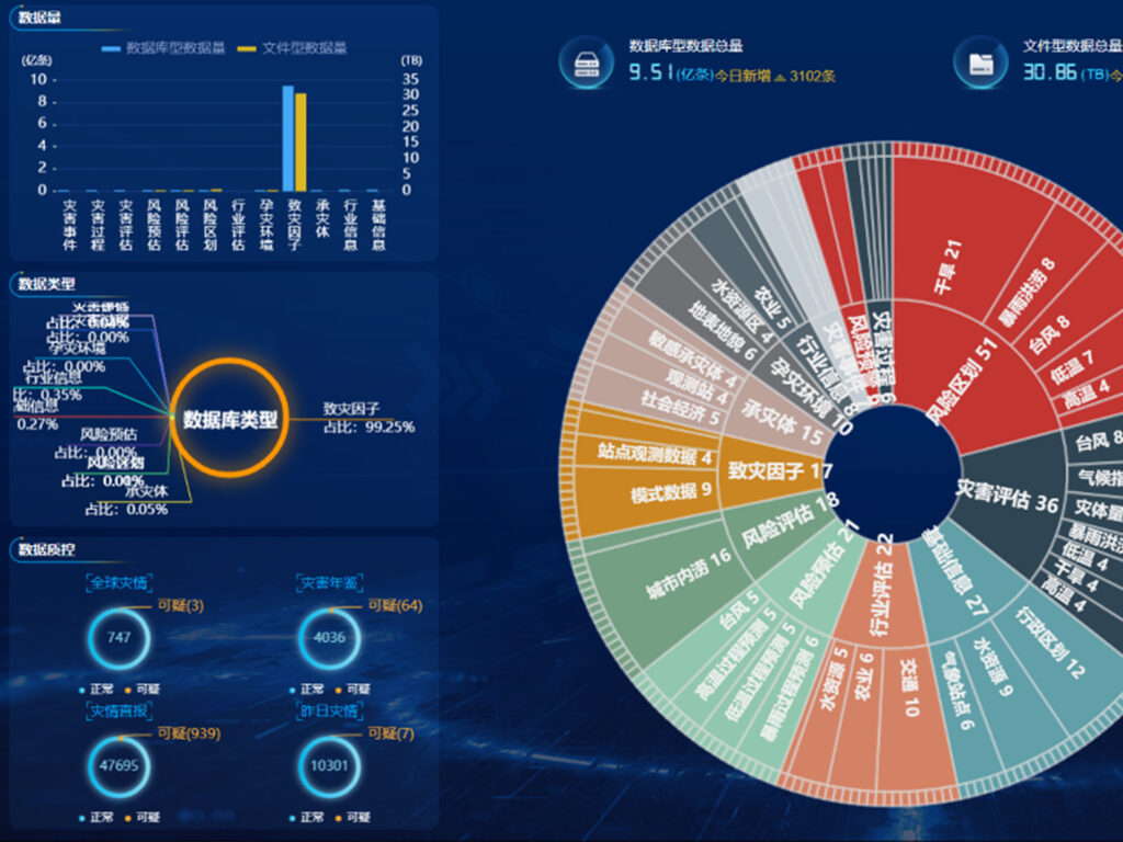
AI disaster platforms integrate satellite, aerial, and ground data, providing a comprehensive view of disaster scenarios for better decision-making.
China Siwei empowers smart cities with AI-driven solutions for urban planning, infrastructure management, and environmental monitoring. Our satellite and geospatial technologies enable cities to manage growth sustainably and efficiently.
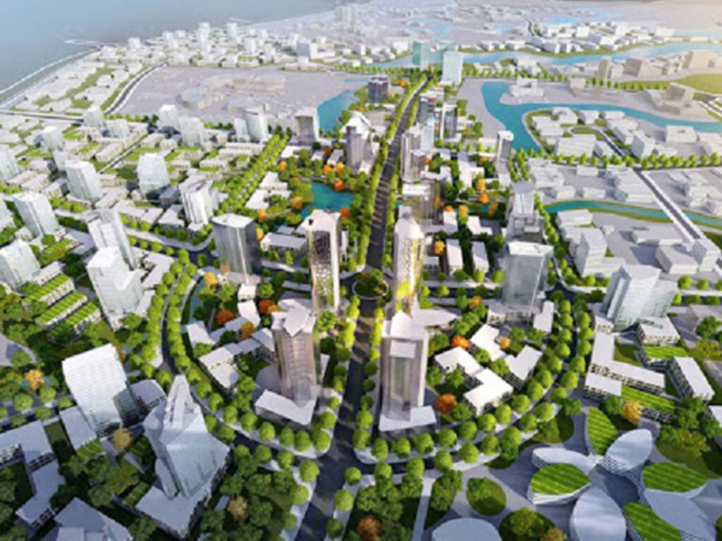
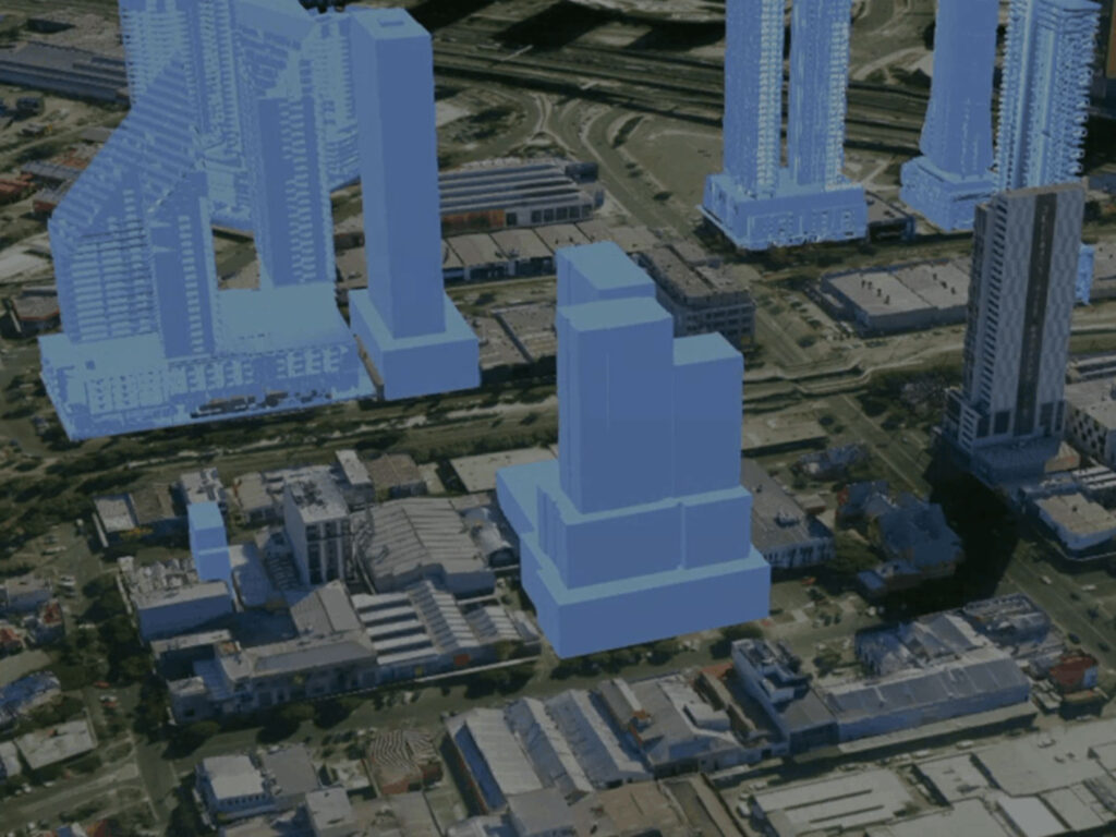
High-resolution 3D city models provide real-time insights into urban infrastructure, supporting planning, construction, and disaster management. AI-powered building contour extraction allows for precise urban planning and scenario modeling, essential for modern city management.
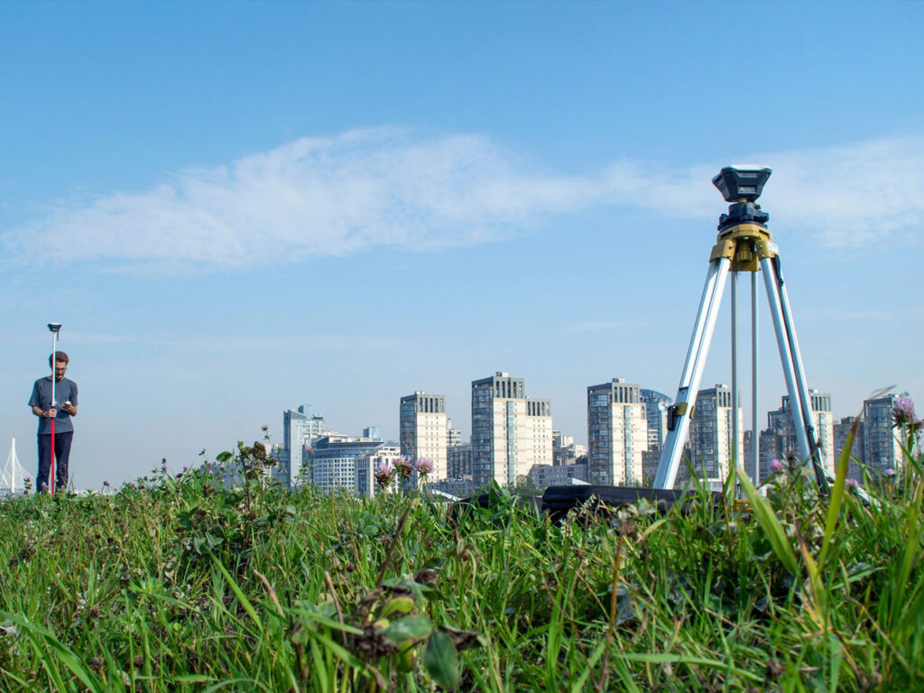
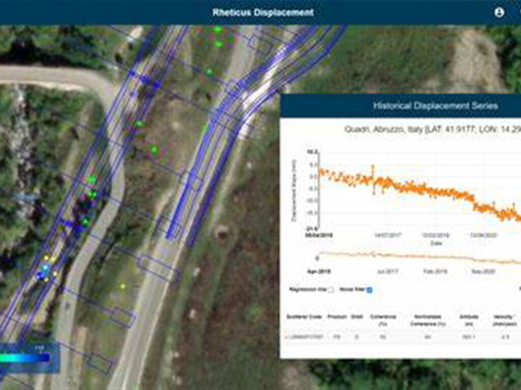
InSAR technology for monitoring urban infrastructure like bridges, roads, and buildings detects subsidence or deformation with millimeter-level accuracy.
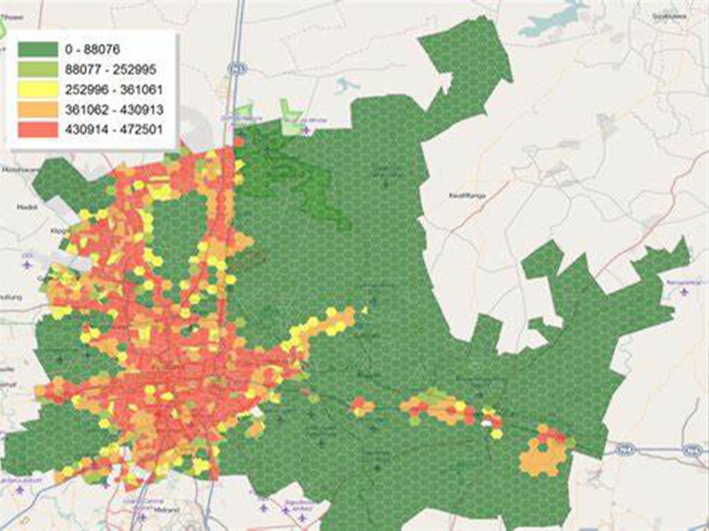
Satellite data enables real-time monitoring of urban expansion, identifying unauthorized constructions and optimizing land use.
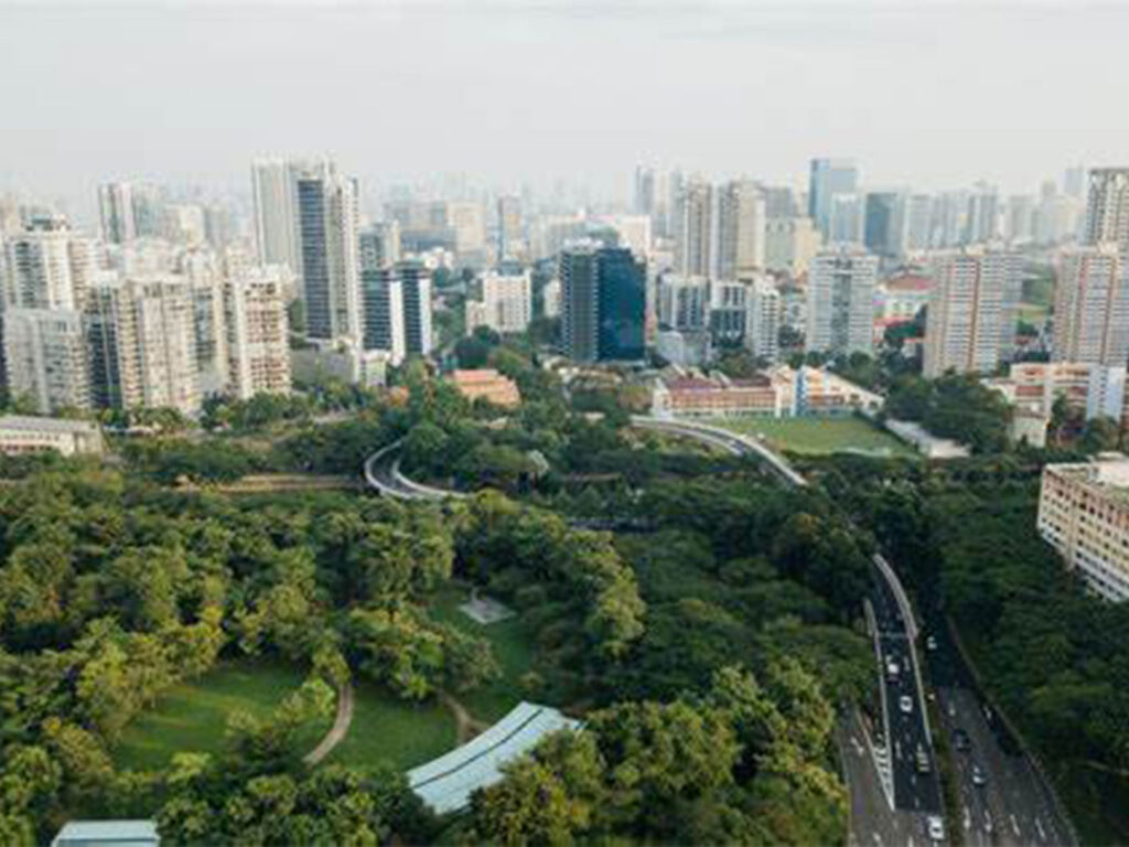
Air and water quality monitoring through multi-spectral satellite imaging ensures cities meet sustainability goals and improve residents’ quality of life.
China Siwei offers precise monitoring and management solutions for the mining and natural resource sectors, leveraging satellite data and AI to optimize operations, ensure safety, and promote sustainability.
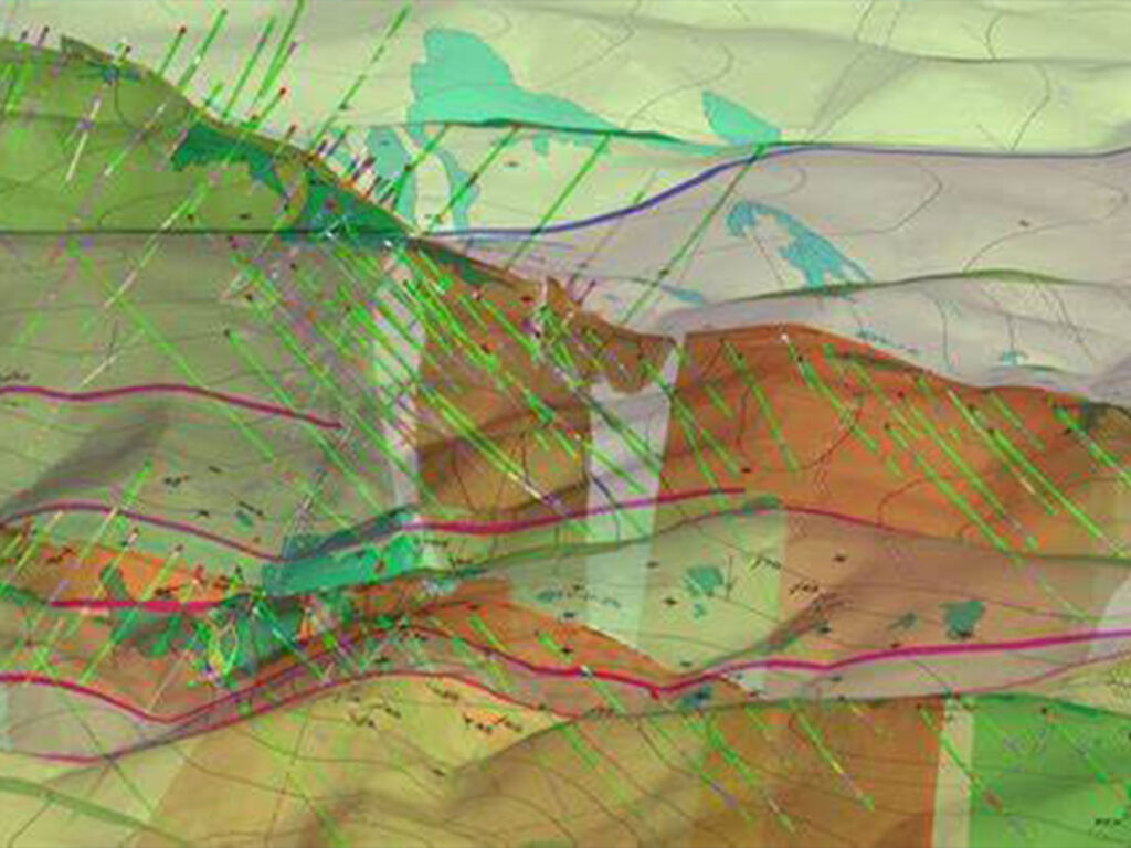
High-resolution satellite imagery aids in identifying mineral deposits, planning exploration activities, and monitoring environmental impact. 3D geological mapping using DEM and DOM datasets provides a comprehensive visual representation of mining areas, enhancing exploration and operational efficiency.
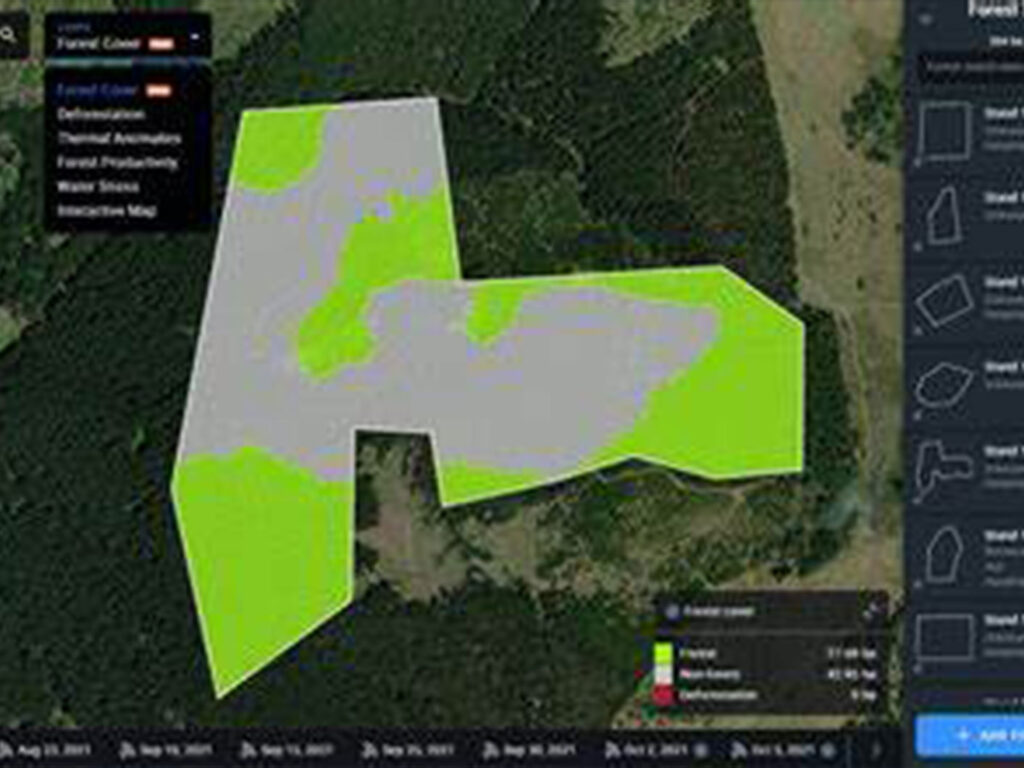
Satellite-based environmental monitoring tracks deforestation, water pollution, and land degradation around mining sites, ensuring compliance with environmental regulations.
Real-time monitoring of mining infrastructure such as tailings dams and pipelines, using InSAR technology to detect deformation and prevent disasters.
AI-driven disaster response platforms enable quick action during incidents like landslides or gas leaks, minimizing damage and ensuring worker safety.
China Siwei provides advanced geospatial intelligence solutions tailored to the needs of military and defense sectors. Our satellites deliver high-resolution imagery and real-time data, empowering national security and strategic operations.
High-resolution optical and SAR satellites deliver detailed imagery for reconnaissance, target detection, and battlefield management. AI-driven image analysis provides real-time monitoring of key areas, detecting military assets, and analyzing enemy movements.
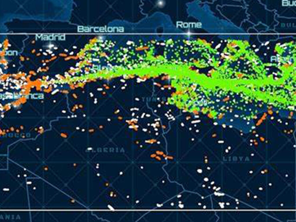
Multi-source satellite monitoring of borders and coastlines, identifying unauthorized activities, and enhancing border security. Real-time monitoring of naval assets and maritime routes ensures the safety of critical maritime infrastructure.
Deformation and subsidence monitoring of critical military infrastructure using InSAR technology ensures the safety and readiness of facilities.
AI-powered platforms provide rapid response during military crises, offering real-time data on infrastructure damage, troop movements, and logistics.
China Siwei is at the forefront of environmental monitoring, offering comprehensive solutions for tracking climate change, managing natural resources, and ensuring environmental sustainability. Our advanced satellites provide critical data for informed decision-making.
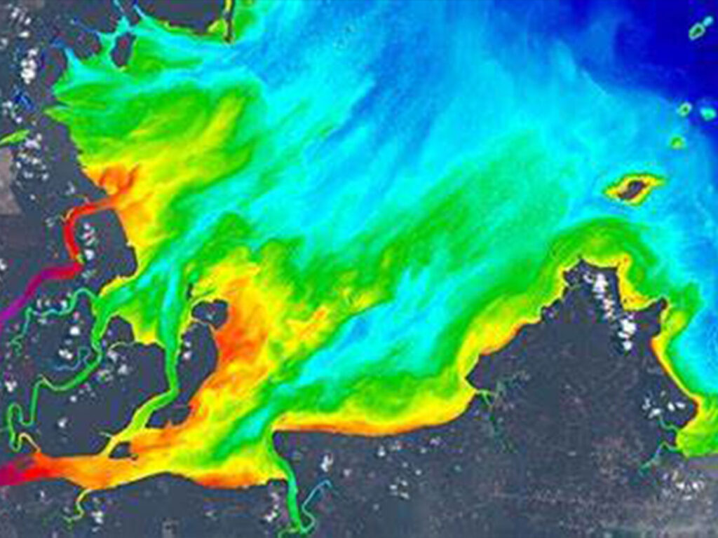
Multi-spectral and hyperspectral satellite imaging tracks water quality parameters such as chlorophyll concentration, suspended solids, and pollution sources. AI-driven water resource management provides real-time monitoring of rivers, lakes, and reservoirs to ensure sustainable water use and pollution control.
Satellite-based greenhouse gas monitoring provides accurate measurements of CO2 emissions, assisting in carbon inventory and reduction efforts.
Real-time monitoring of deforestation, land use changes, and illegal logging using high-resolution satellite imagery.
AI-powered air quality monitoring tracks urban and industrial pollution levels, helping cities meet air quality standards and protect public health.
Brief questions. Practical guidance. Get an indicative estimate instantly, and we only proceed to a formal quote once the basics are clear.
Your satellite imagery request has been sent to admin@xrtechgroup.com. XRTech will review feasibility and send a formal quote within 24 hours. A free sample tile for your AOI is included in the quote response.