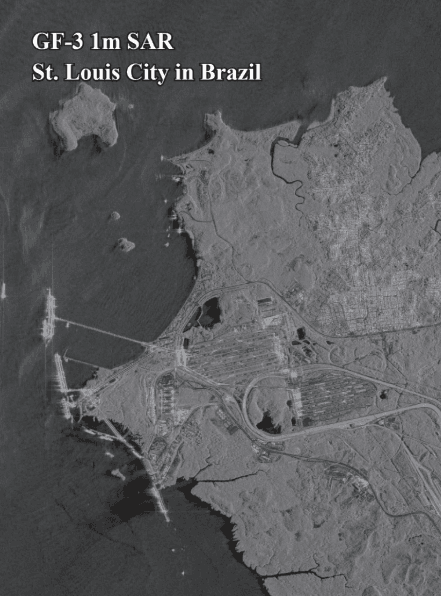
What is Synthetic Aperture Radar (SAR)? When people think of satellite images, they often picture colorful photos taken from space. These are called optical images, and they work like a regular camera, needing sunlight to see. However, what if it is cloudy, dark, or smoky? Regular cameras cannot see through these things. This is where […]
Understanding the differences between free satellite maps and powerful commercial satellite data for your needs in 2025. The world is constantly being watched from space by special cameras on satellites. These pictures, called satellite imagery, help us see and understand our planet. You might have used free satellite maps like those on popular online platforms such as Google earth, Google Maps […]
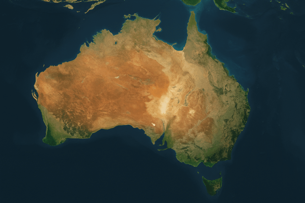
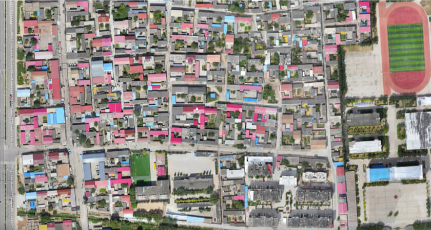
Finding satellite imagery Australia free can be very helpful! This guide shares the best satellite maps that cost nothing to use. Looking at Earth from space is amazing. Pictures taken by satellites, called satellite imagery, help us see our world in new ways. Sometimes, these pictures are needed for big projects, and companies like XRTech Group provide very detailed […]

The Top 30 Satellite Imagery Providers in The World (Updated for 2025) A simple guide to finding the best satellite company and satellite imagery provider for your needs in 2025. The world is seen from above by special cameras on objects called satellites. These cameras take pictures of Earth. These pictures are called satellite imagery. This information is very helpful for many […]

The Best Drone in a Box for Construction: Your Easy Guide for 2025 Imagine a special box that holds a drone, charges it, and sends it out to work all by itself! This amazing technology is called a drone in a box. In the world of construction, these smart systems are changing how work is […]
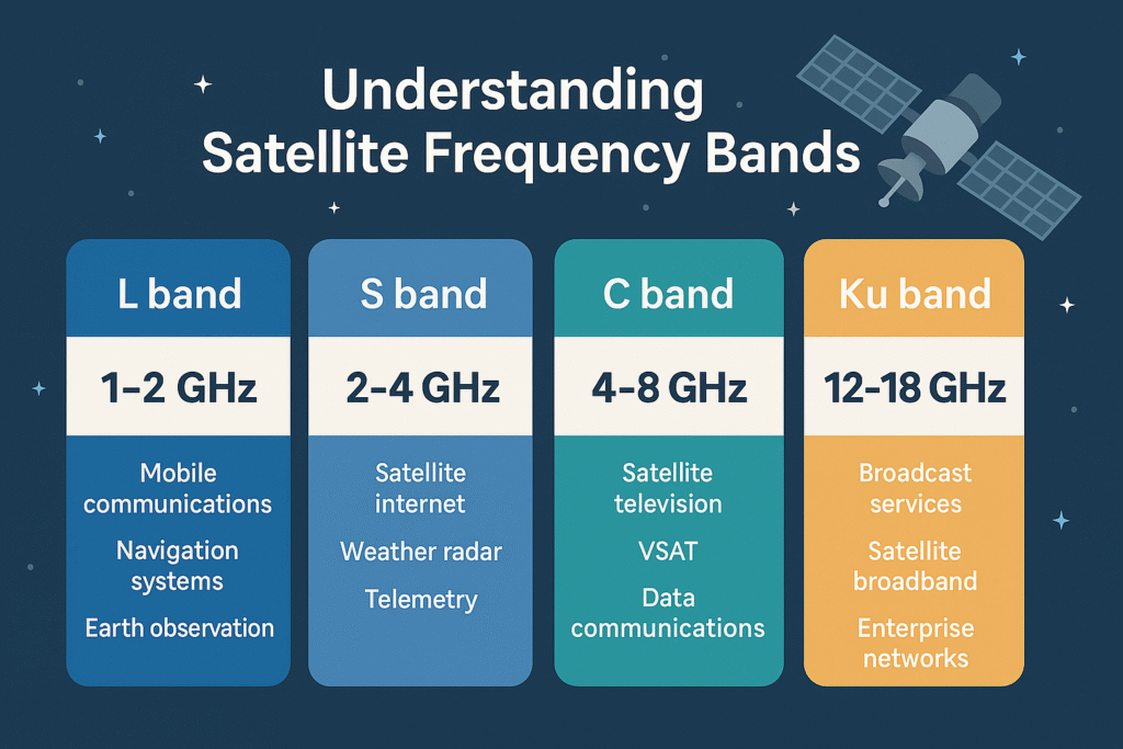
Understanding Satellite Frequency Bands: Your Easy Guide for 2025 Have you ever wondered how satellites send and receive messages? Just like radios need a specific channel, satellites use different “radio waves” to talk to Earth. These radio waves are part of what scientists call the electromagnetic spectrum, and they are divided into special sections known […]
Applications & Uses for Remote Sensing: A Comprehensive Guide for 2025 Have you ever heard of “remote sensing”? It is a special way to gather information about our Earth without actually touching anything. Think of it like taking a picture from far away to learn about what is happening on the ground, in the air, […]
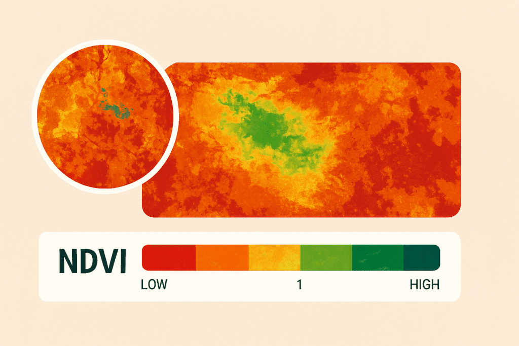
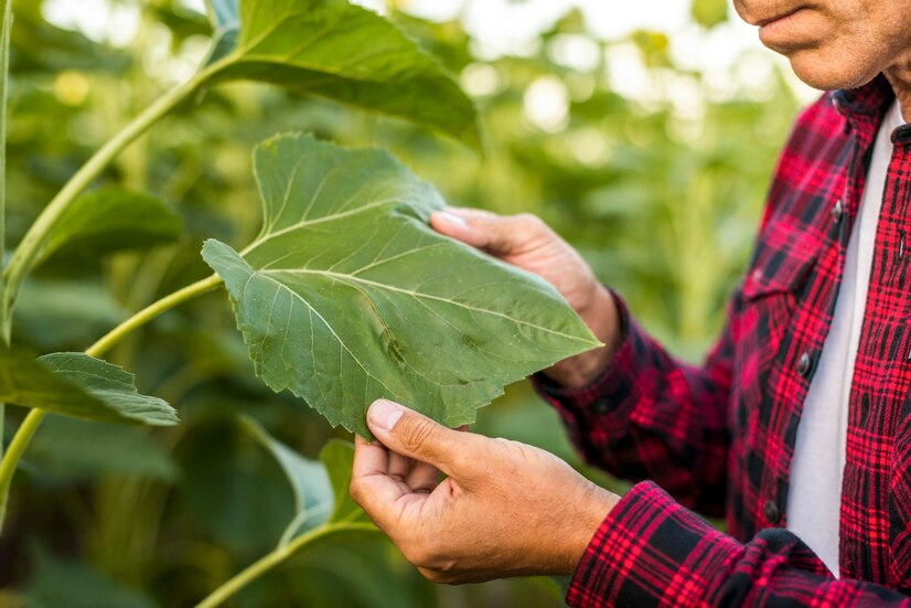
What is NDVI (Normalized Difference Vegetation Index)? NDVI, or Normalized Difference Vegetation Index, is a trusted method to measure how green and healthy plants are in any given area. By analyzing data from NDVI images captured through satellite or drone sensors, NDVI helps identify vegetation patterns and health across landscapes. The NDVI formula uses […]
In today’s world, where environmental challenges are growing faster than ever, Geographic Information System (GIS) technology is emerging as a vital solution. Climate conditions have changed. Forests are disappearing. Water sources are shrinking. Yet, tools like GIS for Environment offer hope because these systems can collect, manage, and visualize environmental data like never before. GIS […]
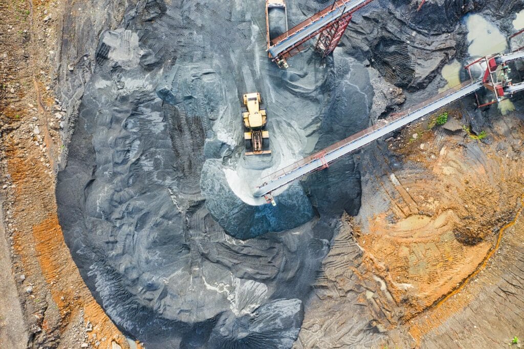
XRTech Group: Harnessing Satellite Imagery for Continuous Mine Monitoring At XRTech Group, the mission is clear: to bring advanced Earth observation capabilities to industries that shape our world. One such industry is mining, where satellite imagery for mining has emerged as a transformative technology. Our satellite mining solutions provide unparalleled insights, enabling mining companies to […]
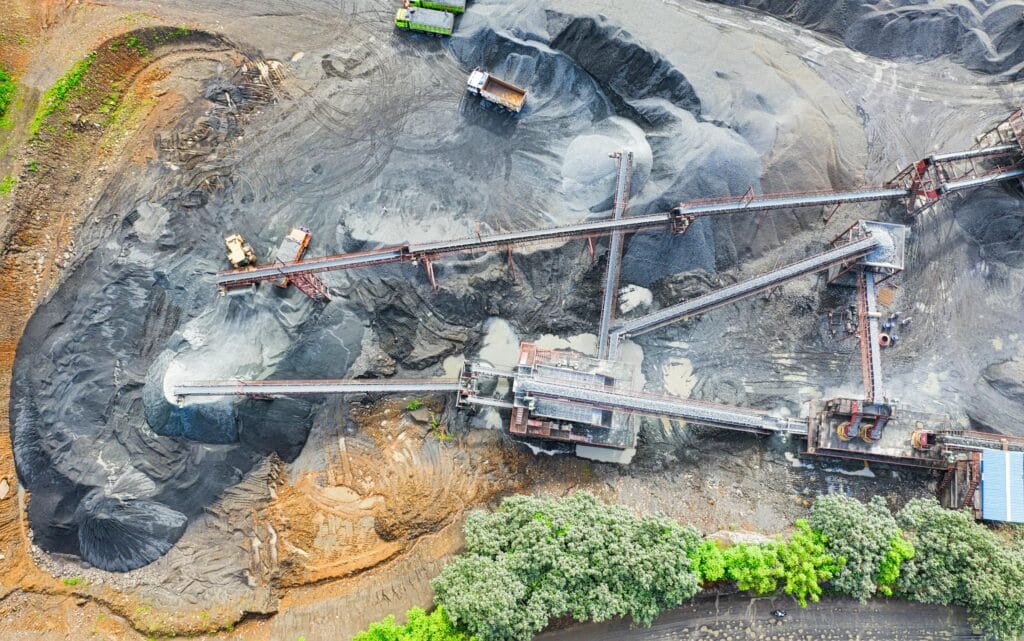
Did you know that using satellite imagery for mining can reduce exploration costs by up to 15-20%? With the increasing demand for mineral resources and environmental accountability, mining companies now rely heavily on advanced geospatial technologies to stay competitive and sustainable. At XRTech Group, geospatial data—including satellite imagery, GIS solutions, and drone-based solutions—has become […]
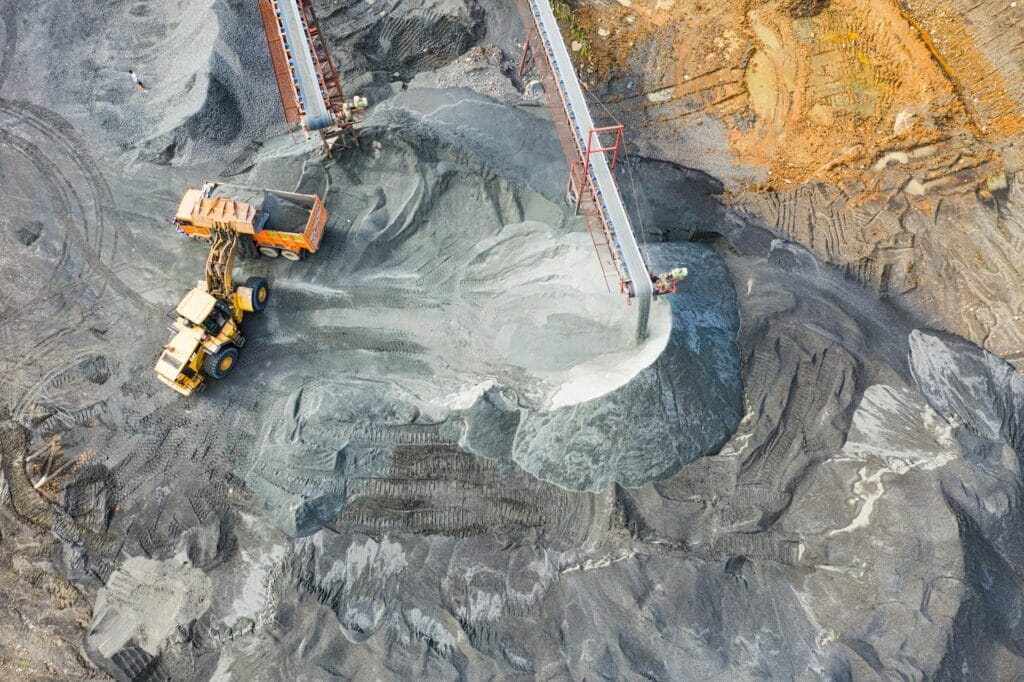
A New Era for the Mining Industry with Satellite Imagery for Mining The mining industry in 2025 continues to evolve at a rapid pace. Mining companies are now expected to meet higher Environmental, Social, and Governance (ESG) standards while improving productivity and safety across vast, complex terrains. For decades, the industry has depended on […]
Keeping infrastructure running safely and efficiently means regular inspections and accurate data collection are no longer optional—they’re essential. But relying on manual inspection teams often slows things down and increases operational costs. That’s where the drone in a box solution comes in, offering a smarter, safer, and more scalable way to handle industrial inspections without […]
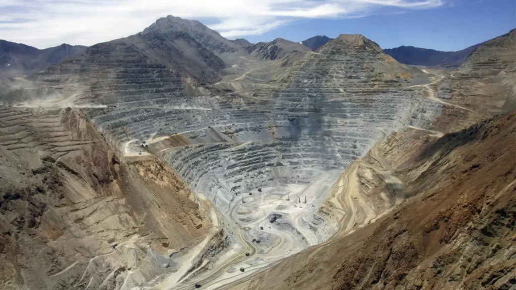
Mining powers the world we live in. From the smartphones in our hands to the satellites in orbit, everything relies on minerals pulled from deep within the Earth. But how these minerals are extracted isn’t one-size-fits-all. Each site, each resource, each rock type demands its own mining method. And at XRTech Group, we’re constantly […]

The mining industry is going through a major transformation, and much of that progress is due to the advances in satellite imagery & data. Satellite mining, powered by high-speed satellites orbiting Earth, is giving mining operators a new way to explore, monitor, and manage mining projects from space. The ability to access accurate and up-to-date […]

Understanding how fast does a satellite orbit the earth can feel like trying to catch a glimpse of a lightning bolt—fast, dynamic, and almost magical. Satellites are remarkable machines flying high above us, silently circling our planet at astonishing speeds. But exactly how fast do satellites orbit Earth, and why do they travel at these […]

How Do Satellite Orbits Work? Understanding Where Do Satellites Orbit and How Do Satellites Move Around Earth Satellites are an essential part of our daily lives. From navigation to weather forecasting, communication to scientific research, satellites enable countless services we rely on. But how do satellites orbit the Earth? Where do satellites orbit exactly, […]
Satellites stay in orbit around Earth without falling because two forces — gravity and centrifugal force — work together in balance. Gravity pulls satellites toward Earth, while centrifugal force pushes them outward as they move in orbit. Satellites keep moving forward while being pulled inward, which keeps them circling the planet. This steady motion prevents […]
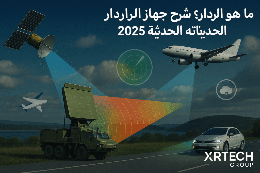
أنظمة الرادار: كيف تعمل وما هي تطبيقاتها؟ مقدمة عند طرح سؤال ما هو الرادار، يتبادر إلى أذهان الكثيرين صورة جهاز الرادار المستخدم في التنبؤ بالطقس، والذي يرصد الأمطار والثلوج والعواصف القادمة. هذا التصور صحيح جزئياً، لأن الرادار بالفعل يلعب دوراً محورياً في علم الأرصاد الجوية، لكن أهمية جهاز الرادار لا تقتصر فقط على هذا المجال. […]
أفضل برامج تصوير الأقمار الصناعية وأدوات الذكاء الاصطناعي لعام ٢٠٢٥ في عام ٢٠٢٥، أصبح استخدام صور القمر الإصطناعي وتقنيات الذكاء الاصطناعي أمرًا لا غنى عنه للمهتمين بمراقبة الأرض وفهم التغيرات البيئية. وقد ساهم هذا التطور في تحسين تحليل البيانات الجغرافية، مما أتاح لنا رؤية أعمق للأرض والتغيرات التي تحدث عليها مع مرور الوقت. تساعد هذه […]
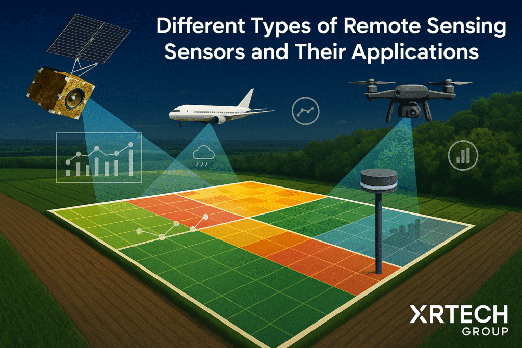
Different Types of Remote Sensing Sensors and Their Applications Remote sensing sensors play a key role in how we understand and monitor Earth. These sensors don’t need to physically touch the surface — instead, they capture information from a distance, whether from satellites, drones, aircraft, or even ground-based stations. Each sensor picks up unique data […]
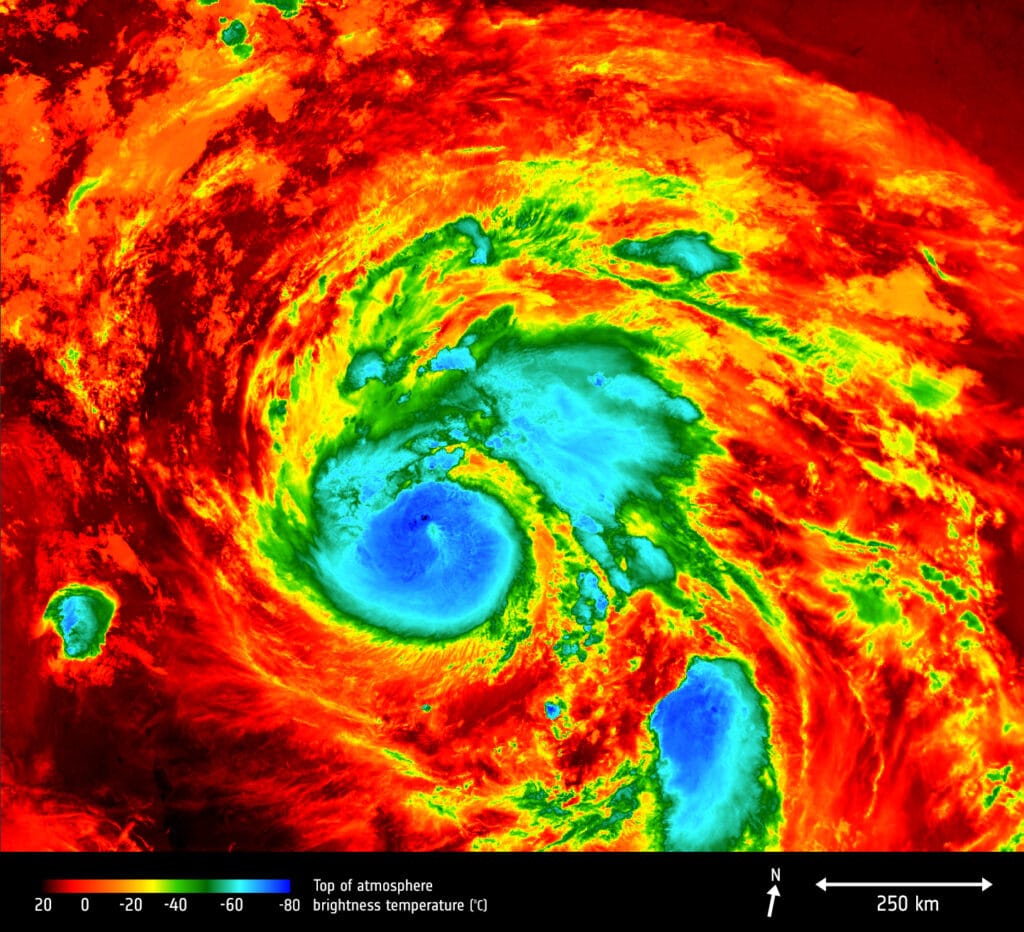
Satellite Hurricane Imaging Satellite imagery for hurricane planning gives governments, state agencies, and emergency responders a powerful way to prepare before a storm hits. These satellite images of hurricane show which areas might be at risk and help identify what kind of land could get flooded based on the hurricane’s strength. When they know […]
What are the best Google Earth alternatives? Some of the best Google Earth alternatives are: XRTech Group, Zoom Earth, OpenStreetMap, Sentinel Hub, NASA Worldview, USGS Earth Explorer, Bing Maps, Mapbox, ArcGIS Earth, Here WeGo, MapQuest, Landsat Explorer. Google Earth Pro has long been a favorite for viewing detailed maps, exploring 3D terrain, and analyzing satellite imagery. […]
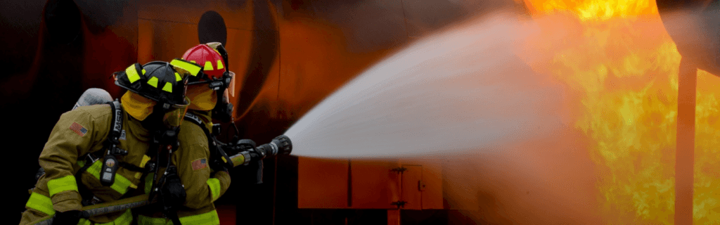
Firefighting has always been a dangerous and challenging job, but the introduction of drones is changing the game. XRTech Group’s drones for firefighting offer advanced tools and technology to help firefighters work more efficiently, safely, and quickly. Whether battling a blaze in a crowded city or tackling a wildfire in a remote forest, these UAVs […]
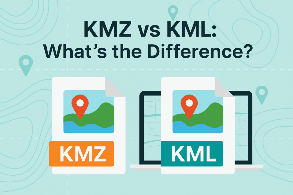
Introduction to KMZ vs KML If you’ve ever used Google Earth or any mapping tool, you might have come across KML and KMZ files. Both of these file types help us show locations, routes, shapes, and even images on a map. But even though they work in similar ways, KML vs KMZ files are […]
Where can I download Free DEM Images? You can download Free DEM Images from trusted sources like XRTech Group, USGS Earth Explorer, NASA SRTM, and other open data websites. These platforms let you choose your area and get elevation data for free. Accessing accurate terrain data has never been easier. These days, you don’t have to worry […]
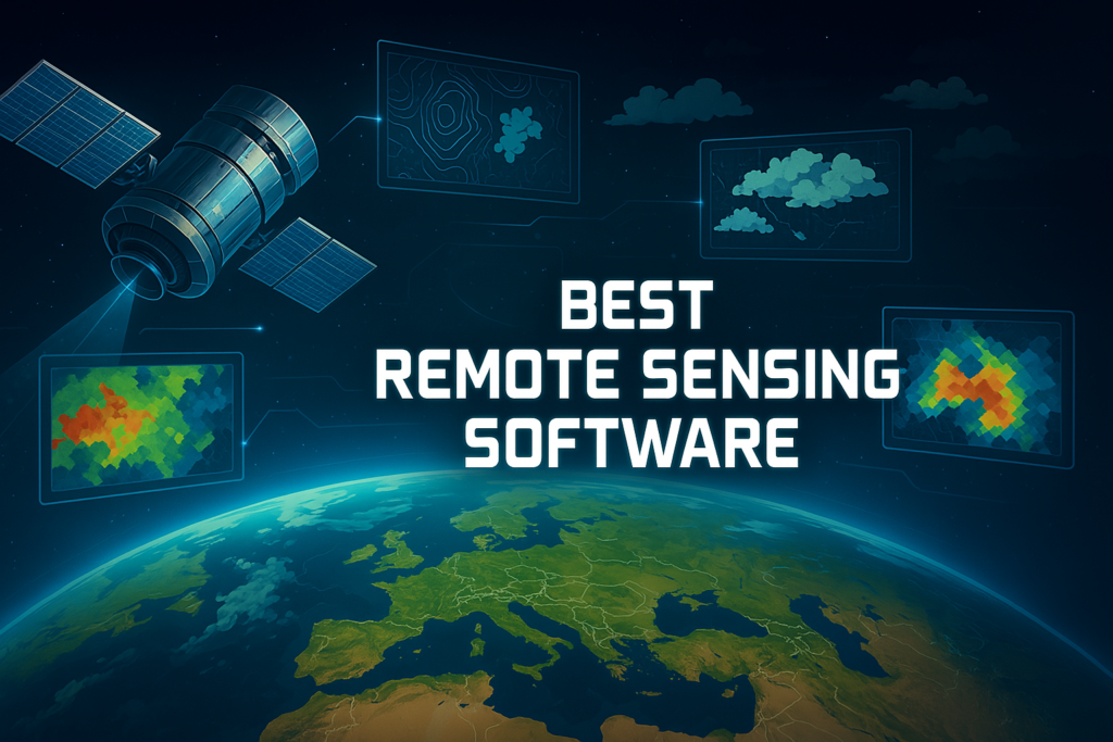
Understanding the Earth has always been important, but today it’s easier and more powerful thanks to remote sensing software. Whether you’re a scientist studying climate, a city planner mapping land use, a student working on a school project, or someone who simply loves learning about our planet, these tools make it possible to see and […]
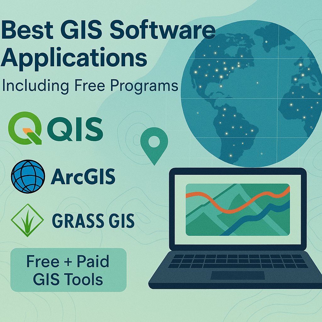
From ArcGIS and QGIS to SAGA GIS, JUMP GIS, MapInfo Pro, and Atlasco — choosing the right GIS software can feel overwhelming with so many options out there. But don’t stress. We’ve explored the most popular GIS mapping tools used across the industry. After testing dozens of them, we’re giving you a clear look at […]
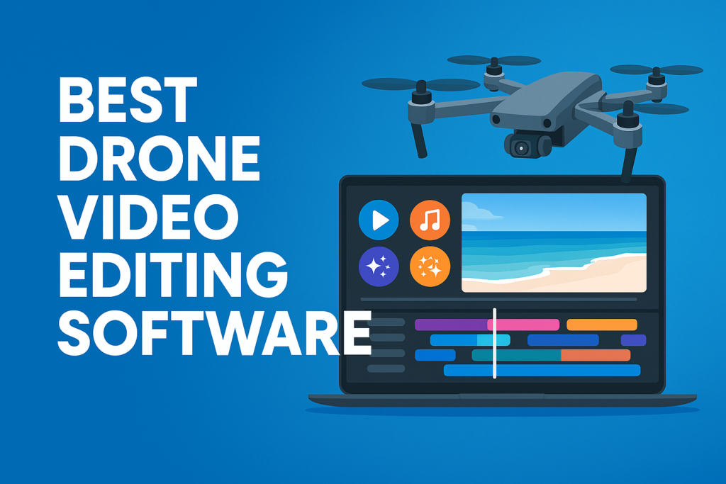
If you fly drones and capture videos—whether you’re a content creator, a real estate marketer, or just someone who loves filming from the sky—you already know that shooting footage is just one part of the job. After your drone is done flying and recording, the real magic happens when you sit down to edit. Raw […]
When someone buys an American drone, it’s not just about flying a cool gadget. It’s also about trust, safety, and supporting businesses that build right here in the United States. Many people want to support the local economy because it helps create jobs, keeps money in their communities, and gives them peace of mind knowing […]

What Are RTK Drones? Easy Guide for 2025 If you work in mapping, surveying, or construction, you’ve likely heard terms like RTK UAV, RTK Drone, or drone with RTK. These aren’t just fancy words—they’re powerful tools that make your work faster and more accurate. A drone with RTK uses Real-Time Kinematic technology to correct its […]
Buy high-resolution satellite imagery today and unlock unmatched insights from the skies. At XRTech Group, we specialize in providing the most advanced, high-resolution satellite imagery to meet your diverse needs. Whether you want to purchase high-resolution satellite images for real-time monitoring, historical data analysis, or on-demand imaging, we offers the best prices globally & seamless access to cutting-edge geospatial solutions. Our services are designed to empower commercial […]
In the ever-evolving world of geographic information systems (GIS) and satellite imagery, data visualization is a key factor in decision-making, planning, and analysis. One of the most commonly used file formats in this field is the KMZ file. It allows for compact, easy-to-share geospatial data that can be loaded into mapping software like Google Earth, […]
Keeping track of your property from above has become easier than ever. Satellite technology has advanced so much that anyone can now access updated satellite maps of their property in 2025 without spending money. Whether someone owns a home, invests in real estate, or works in land development, having real estate satellite imagery can be […]
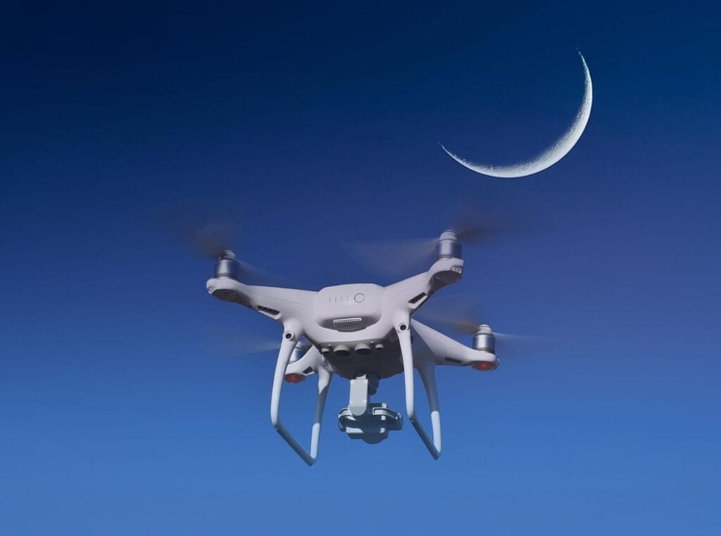
The start of Ramadan has always been determined by the sighting of the crescent moon. Traditionally, this has been done through visual observation by scholars and experts. However, for Ramadan 2025, the United Arab Emirates (UAE) is introducing AI-powered drones to assist in the moon sighting process. This innovative technology aims to improve accuracy and […]
In this blog, we are going to explore the best drones with amazing night vision cameras that can help you see clearly in the dark. Whether you need a drone with night vision for security, search and rescue, inspections, or nighttime photography, we’ve got you covered. So, let’s dive deeper into the details and find […]
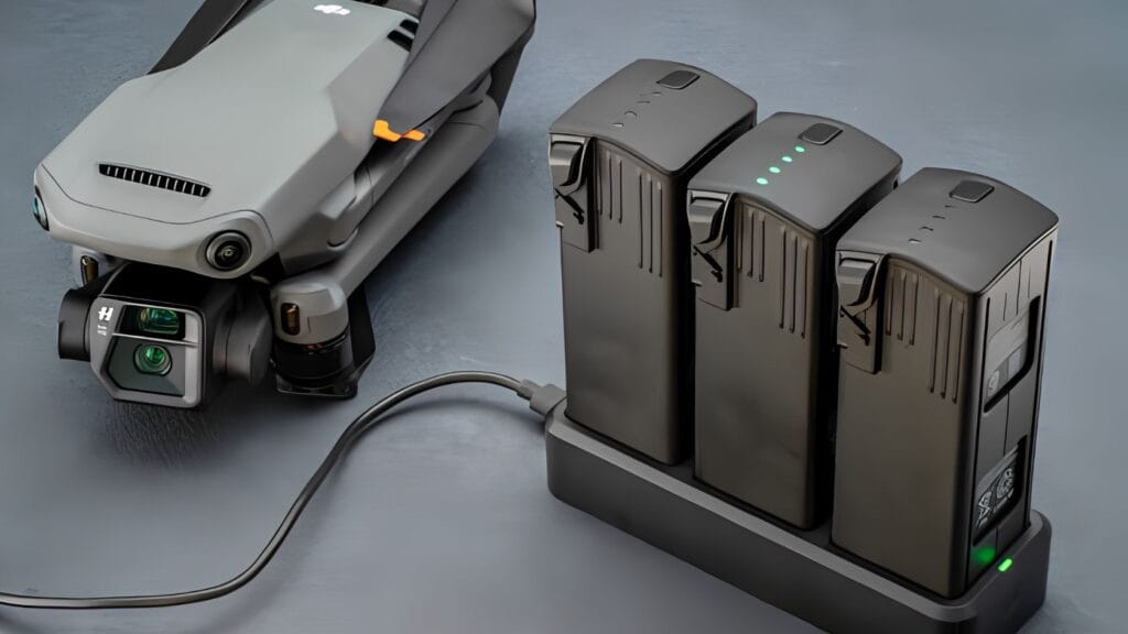
Introduction: How Long Can a Drone Battery Last? The lifespan of a drone battery depends on several factors, such as battery capacity, how the drone is flown, and the surrounding weather conditions. Typically, a drone battery with single charge allows most drones to stay in the air for 20 to 30 minutes, but this time […]
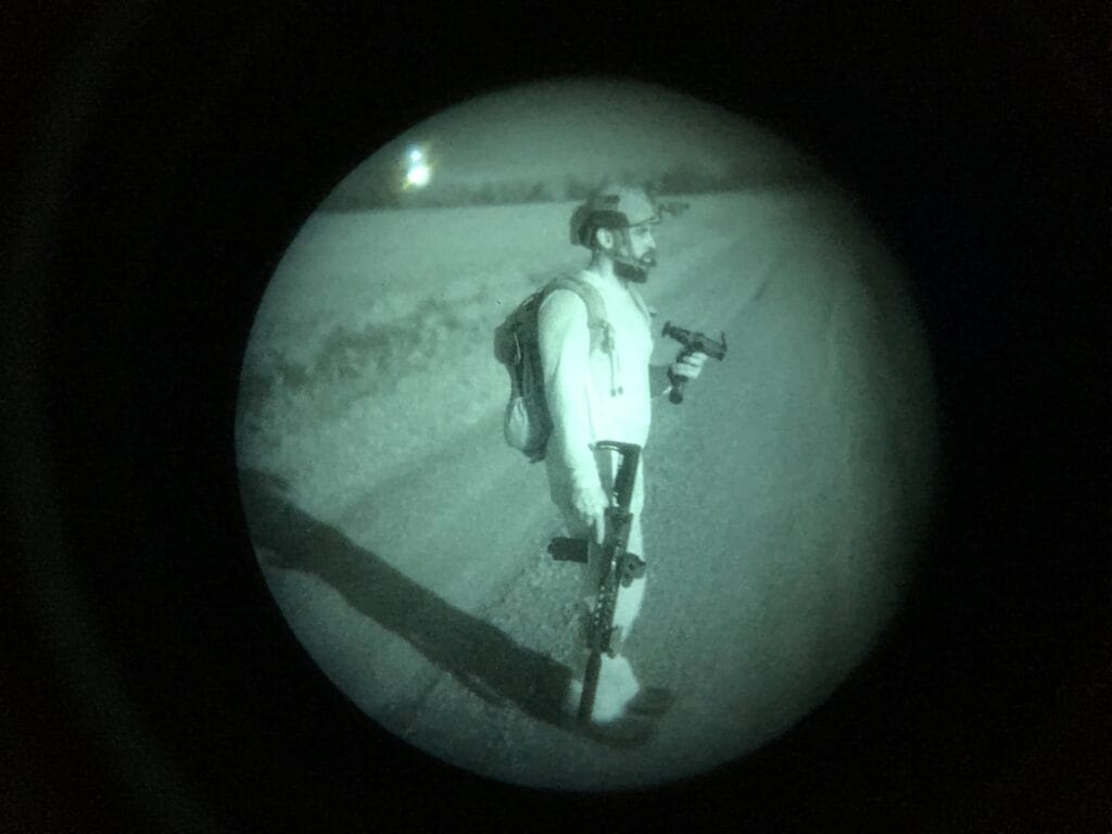
1. Introduction Today let’s talk talk how does night vision work! Imagine walking on a quiet street at night when it is so dark that you cannot see a thing. Now, think about if someone were to give you a pair of magical glasses that could make everything bright and clear, even in the dark. […]
In 2025, flying a drone has never been safer. If you are looking for a drone with collision avoidance that can detect and avoid trees, buildings, cars, and people, this guide is for you. The latest obstacle avoidance drones come with smart sensors that help prevent crashes, keeping your drone safe and reducing the risk […]
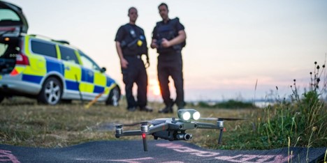
Drones for Law Enforcement: Your Full Guide to learn How Police UAVs Enhance Safety & Security When you were a child, you might have seen police cars speeding through the streets or heard helicopters flying over your neighborhood at night. They were out there keeping people safe, searching for suspects, or protecting important events. But […]

Introduction to Long Range Drones If you’re new to drones and wondering how far can a drone fly or what are the longest range drones, you might compare them to airplanes flying between countries. However, drones operate differently. Long range drones are advanced aerial machines designed to travel vast distances and stay in the air […]
Introduction: How Do Drones Work? If you are new to drones and wondering how do drones work, you might think they fly just like airplanes. While both use air to stay in the sky, drones work differently. Unlike airplanes, drones do not need long runways or big engines to take off. Instead, they use small […]
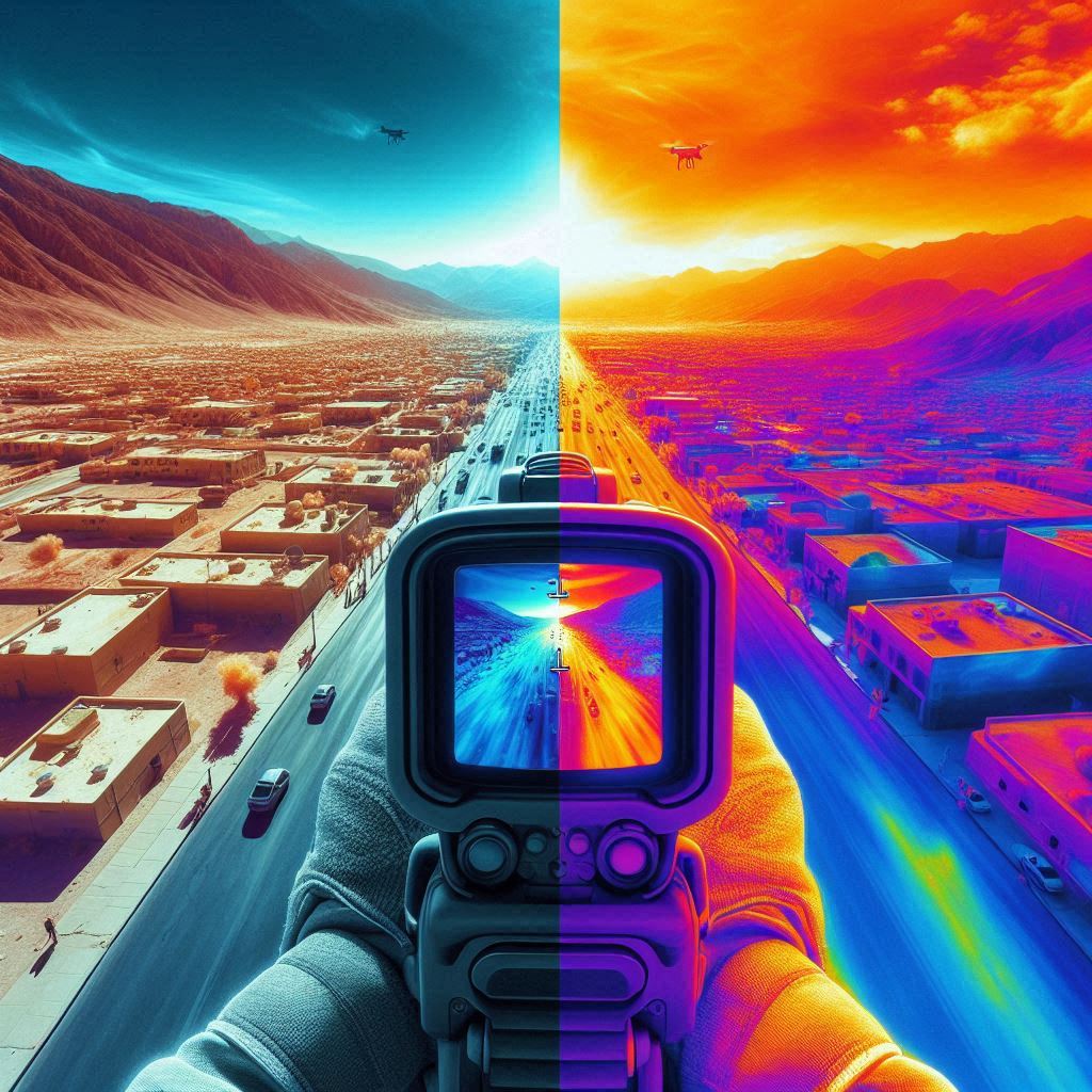
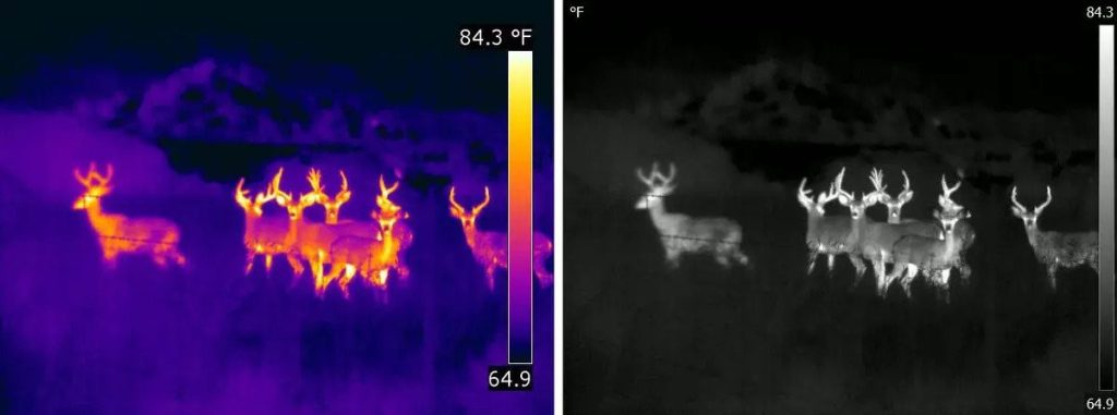
Introduction to Thermal vs Infrared In today’s world, there is much talk about thermal vs infrared technologies. These two methods of imaging help us see things that our eyes cannot. In simple words, thermal vs infrared compares two ways of capturing images: one by detecting heat and the other by capturing light that is not […]
Introduction: Why Drone Altitude Matters for Every Pilot Have you ever wondered how high your drone altitude can go? Whether you’re capturing sunset photos, checking a rooftop for damage, or helping farmers monitor crops, drone altitude plays a big role in getting the job done. Think of it like climbing a ladder—the higher you go, the more you can […]
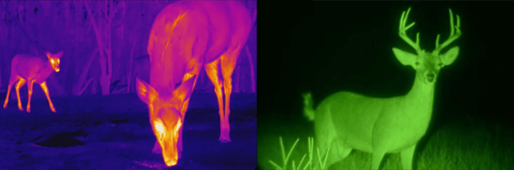
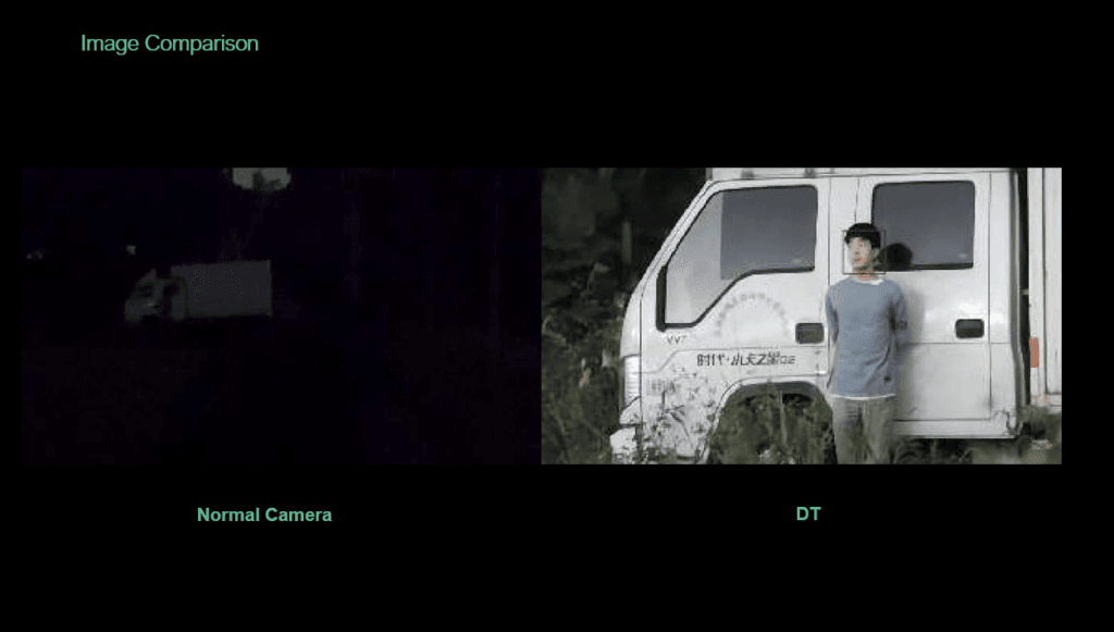
Introduction to Thermal and Night Vision Technologies When it comes to thermal vs night vision, many people think they work the same way. But that’s not true. They both help you see in the dark, but they use very different technologies to do it. Night vision needs some light to work, while thermal imaging detects […]
When buying a drone, people usually focus on things like speed, flight time, and camera quality. But one important thing that’s often missed is the range—or how far a drone can fly from its controller before losing connection or running out of battery. Whether you’re flying a drone for fun or using it for work, […]
Drones have changed the way we see the world. They help us capture amazing aerial pictures and perform important tasks like surveillance. They offer new opportunities that we couldn’t reach before. However, with great power comes great responsibility, especially when flying drones. Knowing the rules and the physical limits of how high drones can fly […]
The first DJI drone marked a huge moment in drone history. DJI, a company based in China, started by creating a drone that changed the way we look at technology in the air. The first DJI drone, called the Phantom 1, was released in 2013. It was a big step forward because it made flying […]
What is the Fastest Drone in the World? Know the Top Drone with High Speed The world of drone technology has seen exciting improvements, especially when it comes to how fast drones can fly. Over the years, engineers and designers have worked hard to build fastest drones by improving their designs and adding powerful engines. […]
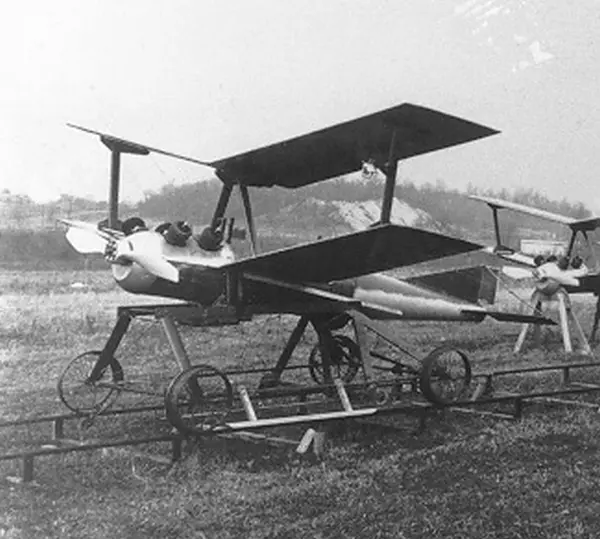
Who invented the drone, and when was the first drone invented? These are questions that lead us to the fascinating journey of drones, or unmanned aerial vehicles (UAVs). A drone is a flying machine that can be remotely controlled or programmed to fly on its own. It comes in different sizes, shapes, and designs. Drones […]
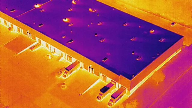
Thermal Camera Drones: A Powerful Tool for Heat Detection Thermal Imaging Camera Drones are becoming an essential tool for identifying heat patterns from above. These Thermal drones make it easy and affordable to measure temperatures on commercial rooftops, solar plants, wildfires, and more. In the past, expensive manned aircraft were required, and scheduling was often […]
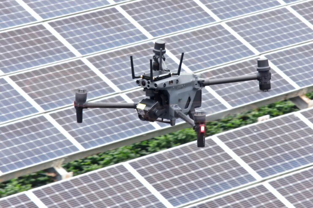
Drone for Solar Panel Inspection Solar companies are moving away from older inspection tools, like handheld devices, and choosing to use drones for solar panel inspection instead. This change is helping solar companies track the condition of their solar panels faster and safer. With the rise in solar energy, it’s important to not only add […]
Real estate photography has been revolutionized with drones, making properties stand out with stunning 360-degree aerial views. These detailed images show every aspect of the property, from its design to the neighborhood, creating excitement among buyers. By using a drone for real estate photography, sellers can make their listings more attractive and valuable, increasing the […]
Complete Guide for Choosing the Best Drone for Roof Inspection Drone for roof inspection services have become one of the most popular ways to evaluate roof conditions. These inspections are not only beneficial for homeowners but also widely used by real estate agents, insurance adjusters, and construction professionals. The aerial imaging capabilities of a drone […]
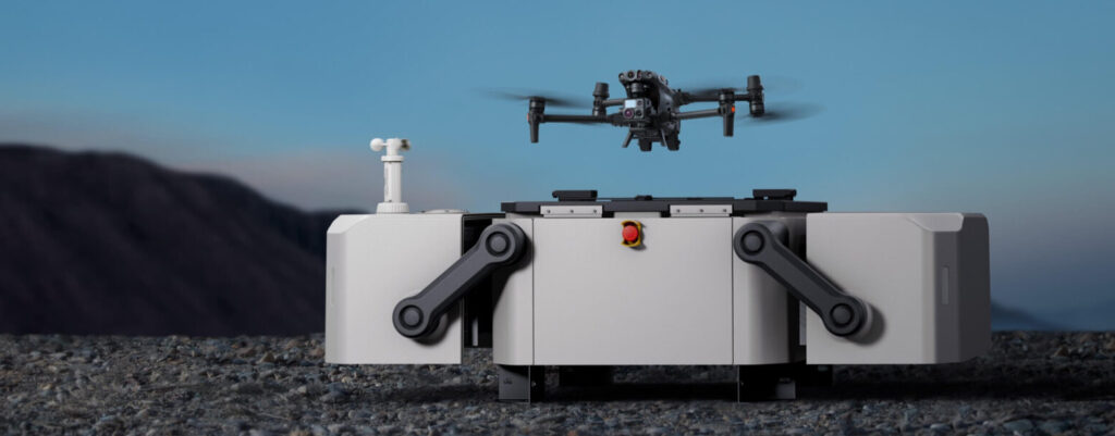
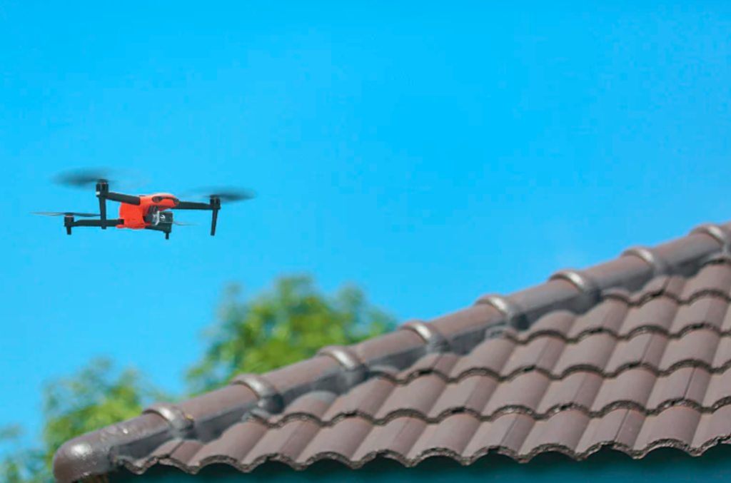
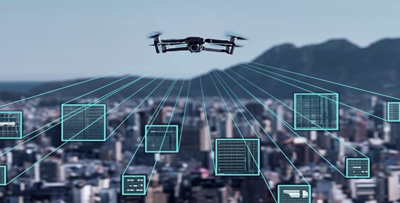
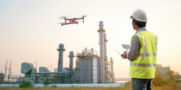
Introduction to Autonomous Drones in 2025 In 2025, industries across the globe are increasingly turning to innovative autonomous drones to tackle complex challenges. These advanced aerial systems are being used to improve productivity and reduce operational risks, especially in large-scale critical infrastructure and heavy industrial sites. Maintaining sensitive equipment, ensuring safety, and meeting strict regulatory […]
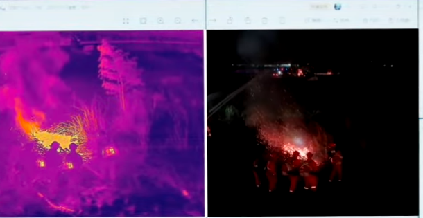
The Role of Thermal Imaging Drones in Enhancing Enterprise Operations Thermal imaging technology, combined with the maneuverability of a drone, offers countless benefits for businesses and organizations. This combination has become a game-changer in many industries. The growing list of uses for thermal imaging drones is largely due to advancements in drone technology and the […]
UAE Drone Ban Lifted: New Drone Law Dubai, UAE 2025 Exciting news has arrived for drone enthusiasts across the UAE! The long-anticipated UAE drone ban lifted announcement has opened the skies for individual drone use starting January 7, 2025. This milestone reflects the UAE’s commitment to blending technological advancements with safety and innovation. However, the […]

XRTech Group vs. Maxar Technologies: A Detailed Look at Commercial Satellite Imagery In the ever-evolving field of commercial satellite imagery and geospatial technologies, XRTech Group and Maxar Technologies are two prominent names. Although both companies excel in their domains, they bring different strengths, technologies, and business strategies to the table. XRTech Group primarily serves as […]

Dubai is famous for its tall skyscrapers, luxury hotels, and amazing buildings. The construction companies in Dubai that build these impressive structures are some of the best in the world. Whether you want to build a house, office, or big project, the best construction companies in Dubai have the skills, knowledge, and tools to turn […]
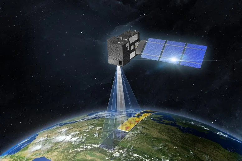
Introducing Stereo Satellite Imagery Stereo Satellite Imagery opens up an exciting new way to explore the Earth’s surface, offering unmatched 3D insights and precise elevation details. This advanced technique captures overlapping images from two slightly different angles, creating a stereoscopic view similar to how human eyes perceive depth. By combining these images, detailed 3D models […]
How often does google earth update imagery? Know everything Google Earth: Exploring Our World at Your Fingertips Google Earth is an amazing tool that lets you explore our planet in three dimensions. With it, you can travel the world without leaving your home. From satellite imagery to aerial photos, it covers almost every corner of […]
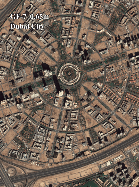
Top 10 Best Drone Filming Companies in Dubai: Leaders in Aerial Videography and Photography Introduction: Why Drone Filming Company in Dubai is Popular Dubai, a city known for its innovation and growth, has quickly become a global leader in drone filming. With its impressive skyscrapers, vast deserts, and stunning landscapes, Dubai is the perfect place […]
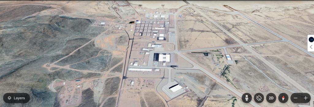
Area 51, a remote military base located in Nevada, has long been a source of intrigue and speculation. Its connection to top-secret military projects and rumored extraterrestrial activity makes it a fascinating topic for researchers, enthusiasts, and conspiracy theorists alike. Thanks to advancements in satellite technology, we now have access to high-resolution satellite images of […]
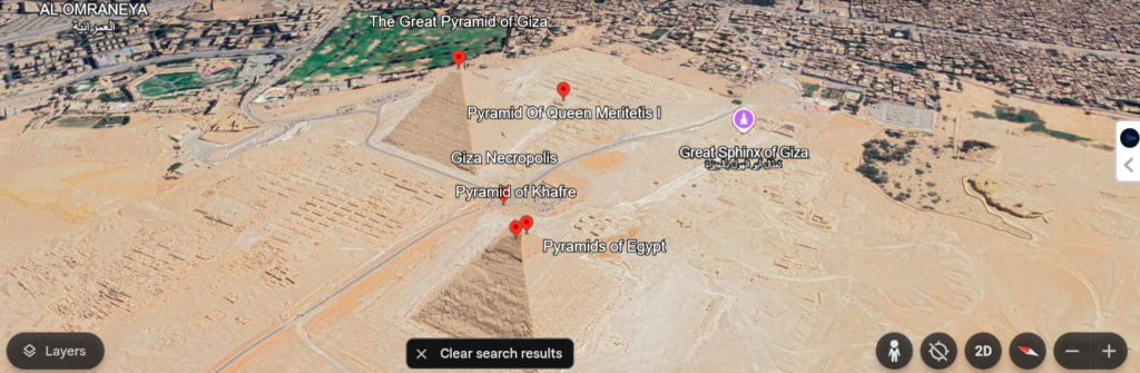
Satellite View of Egyptian Pyramids: Unlocking History with XRTech Group The Egyptian Pyramids have always fascinated people worldwide. These ancient wonders, especially the Pyramids of Giza, continue to inspire awe with their sheer size, precision, and historical significance. With the advancement of satellite imaging technology, we now have access to breathtaking satellite views of the […]
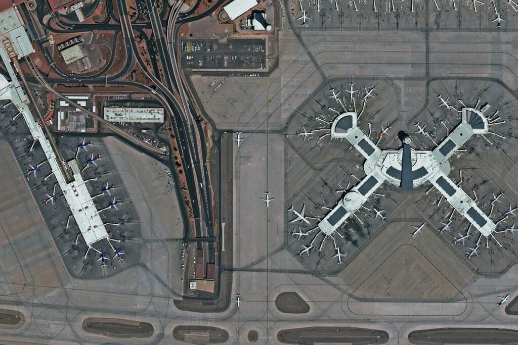
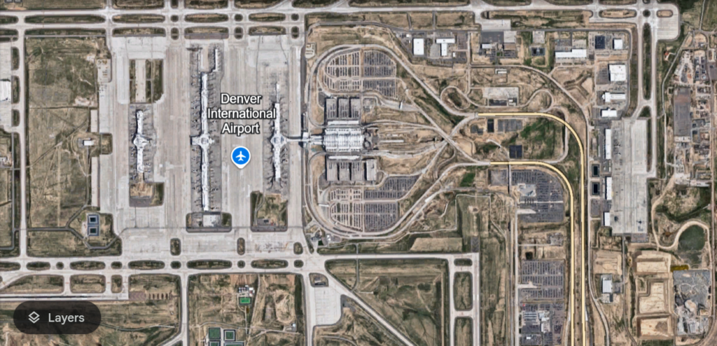
Free Aerial View of Airports – Satellite Imaging with XRTech Group Airports are dynamic hubs of activity, connecting cities, countries, and people worldwide. The aerial view of airports offers a unique perspective, capturing the intricate layout of runways, terminals, and surrounding areas. With advancements in high-resolution satellite images for Airports, it has become easier to […]
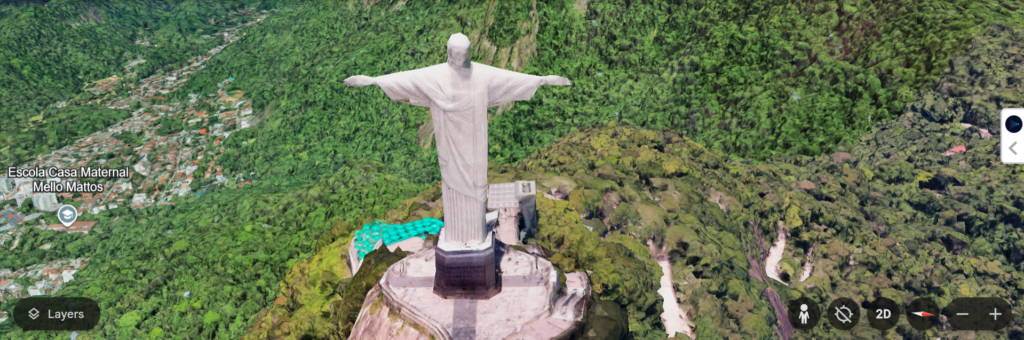
High-Resolution Images of the New 7 Wonders of the World: A Stunning Aerial View The New 7 Wonders of the World are among the most iconic and breathtaking landmarks on Earth. These seven cultural and architectural marvels have captivated millions of people globally, with each one representing a unique blend of history, art, and craftsmanship. […]
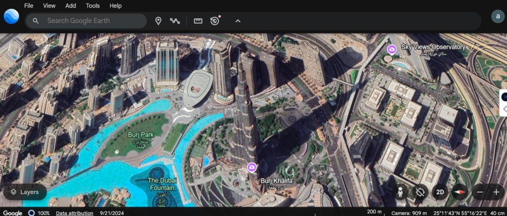
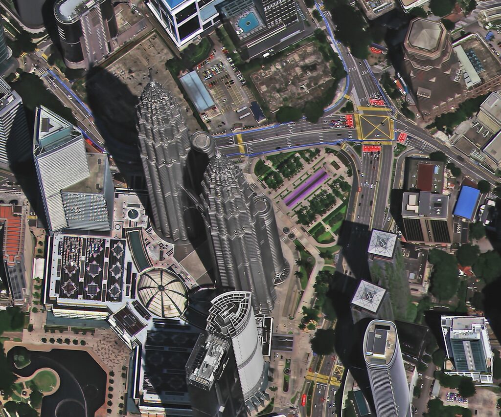
Discover Burj Khalifa from Space: A Complete Guide to High Resolution Satellite Images and Aerial Views The Burj Khalifa in Dubai is not only a remarkable architectural feat but also an iconic symbol of modern engineering. Standing at a staggering 828 meters, it holds the title of the tallest building in the world. Have you […]
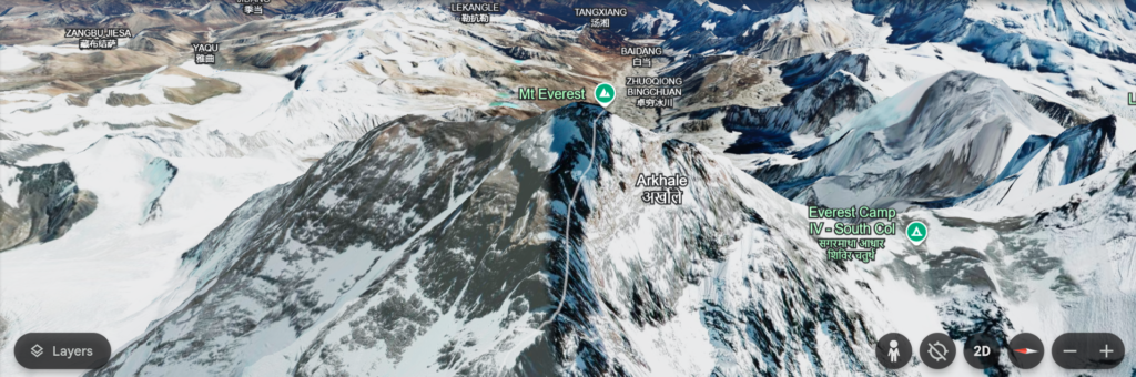
Free Satellite Imagery of Mount Everest: High-Resolution Aerial Views and Satellite Maps Mount Everest, the highest peak on Earth, has always captivated explorers, adventurers, and geographers alike. With its towering presence reaching 8,848 meters above sea level, the mountain stands as a symbol of human ambition and natural grandeur. For those unable to visit this […]
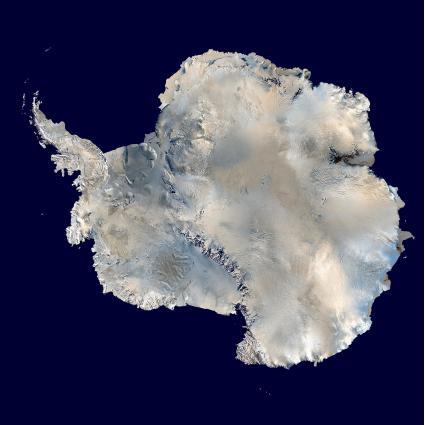
The Power of Satellite Imagery of Antarctica: Uncovering the Secrets of the Frozen Continent Get the best satellite images of Antarctica with high-resolution at XRTech Group. Antarctica, the vast and uninhabited frozen continent, is home to some of the most extreme conditions on Earth. It is a place of scientific exploration, environmental importance, and breathtaking […]
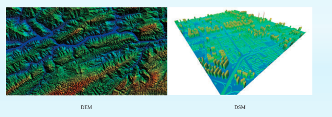
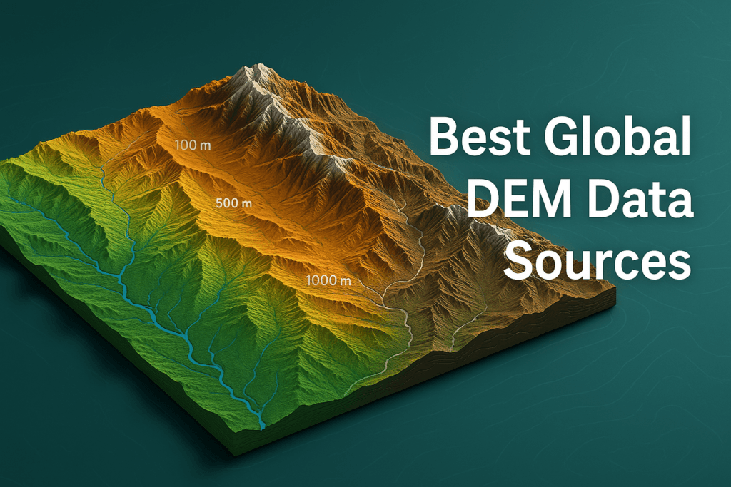
Introduction: Understanding Digital Elevation Models (DEM), DSM & DTM in Satellite Imagery Have you ever wondered how we map the Earth’s surface with such incredible detail? How can we measure mountains, rivers, forests, peaks, natural habitats, valleys, and even urban skylines and human-made infrastructure so accurately? The answer lies in Digital Elevation Models (DEM), Digital […]
A Complete Guide to Satellite Imagery: Types, Uses, and How to Access High-Resolution Data Satellite imagery has revolutionized the way we see and understand our world. Have you ever wondered how satellites capture detailed pictures of the Earth’s surface from space? These images, captured by satellites orbiting our planet, help us monitor changes on Earth, […]
Best 15 AI Drones of 2025: A Comprehensive Review AI Drone Technology: Transforming the Way We Work and Live Imagine a drone flying through a dense forest at night. It avoids trees, navigates tricky paths, and finds a missing person in minutes. Sounds impossible, right? But it’s not. This is what drones with AI can […]
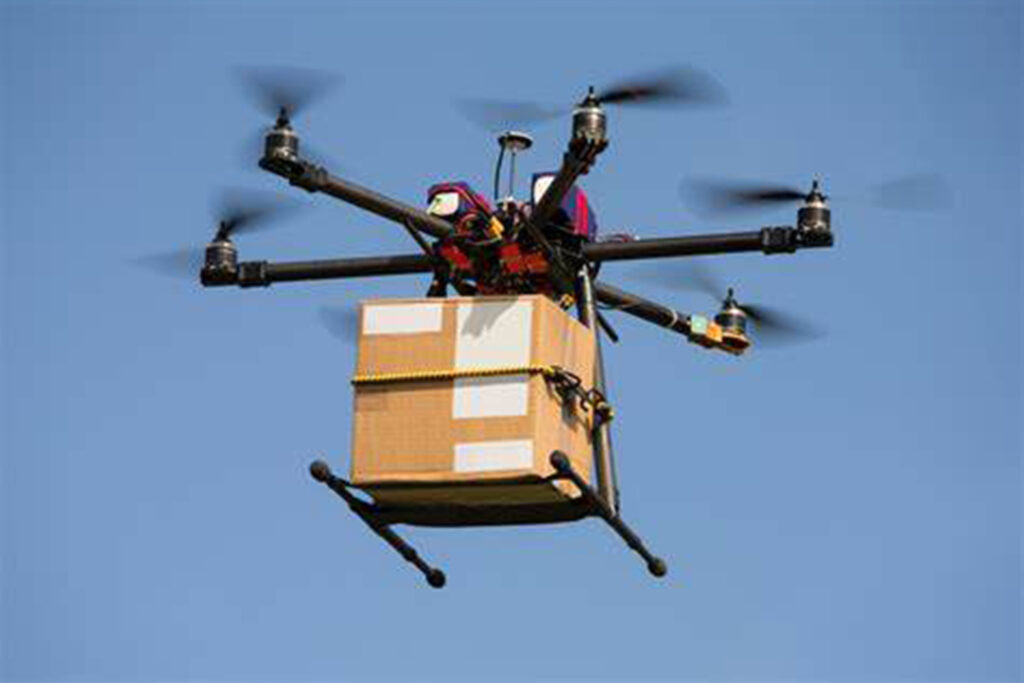
Dubai’s Drone Delivery Milestone and What It Means for the Future Dubai has officially launched a revolutionary new system that will change the way goods are delivered within the city—drone deliveries. This is an exciting leap for the city and a big step forward in the field of smart logistics. The Dubai Civil Aviation Authority […]
Can I Take a Drone to Dubai? Drone Flying Guidelines for Tourists Drones have become a popular gadget for capturing stunning views and creating unforgettable memories. If you’re planning a trip to Dubai and wondering, “Can I take a drone to Dubai?” the answer is yes—but with some essential steps and regulations to follow. Flying […]
Navigating Drone Transport Through Dubai, UAE Airports: Drones are becoming increasingly popular worldwide for personal and recreational use. However, in the UAE, strict regulations govern their import, registration, and operation. Whether you’re a tourist or a resident, understanding these rules is crucial to avoid penalties and ensure smooth handling of your drone. This guide breaks […]
Soybean Farming: Expert Techniques for Planting and Cultivation Planting soybeans is a straightforward process, as this hardy crop can endure high temperatures, resist pests and diseases, and doesn’t require much fertilization. How to grow soybeans can be simplified, as soybeans thrive with the right balance of sunlight, warmth, and moist soil. Despite this, the early […]
How Can I See a Live Satellite Picture of My House in Real Time? Can I See a Live Satellite Picture of My House in Real Time? This is a question many people ask out of curiosity or for practical reasons. Advances in technology have made satellite imagery more accessible than ever. Platforms like Google […]
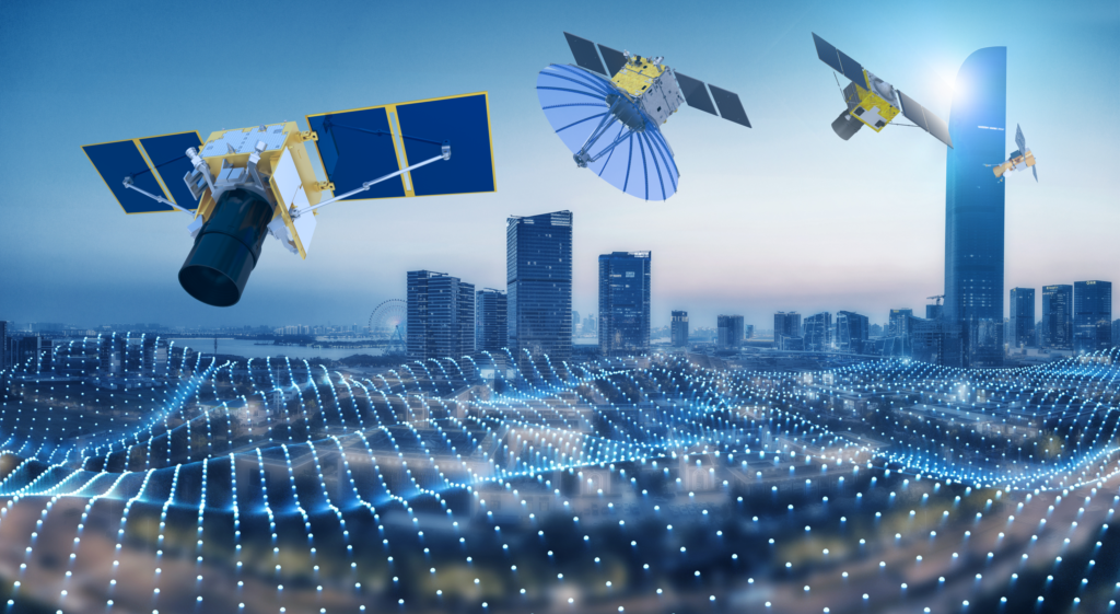
Have you ever looked up at the sky and wondered, what is a satellite, Satellite Types, and how does it affect our daily lives? Honestly, satellites are not just objects floating in space—they are powerful tools that make our modern life much easier and more connected. From helping with GPS navigation to predicting the weather, […]
Where to Get Updated Free Satellite Imagery & Maps in 2025 When it comes to “High-Resolution FREE Updated satellite imagery 2025″, the options are endless, depending on what you’re looking for. Some platforms let you easily view the data directly in your browser, while others allow you to download and analyze it for deeper insights. […]
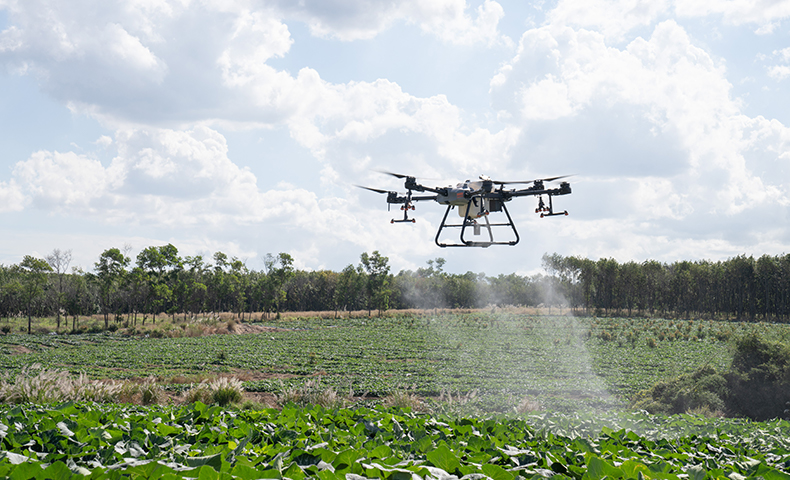
UAV Drone for Agriculture: Revolutionizing Farming with Advanced UAV Technology Farming today is much more than just planting seeds and waiting for them to grow. Farmers are using smart tools like UAV drones for agriculture crop monitoring and spraying to make their work easier and more efficient. These drones, also called UAVs (Unmanned Aerial Vehicles), are helping […]
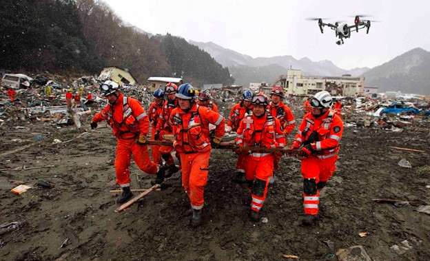
Drones are now game-changers for Search and Rescue (SAR) missions. They provide emergency teams with tools to react swiftly and safely. Unlike old methods, drones for Search and Rescue offer quick, efficient ways to find missing people, rescue trapped animals, and assess dangerous areas. With XRTech Group’s top-notch drones for Search and Rescue, rescue teams […]

Top 10 Best Drone for Construction | Features, Benefits, & Full Guide in 2025 Drone for construction is becoming an essential part of how buildings are planned and built today. Companies that don’t use these high-tech flying machines risk falling behind in the competitive construction industry. Understanding how drone for constructions can enhance workflows at every […]
Comparing DJI’s Thermal and Night Vision Drones for Optimal Performance Drones have revolutionized industries across the globe, and with the introduction of thermal imaging technology, their capabilities have expanded even further. Whether it’s for industrial inspections, search and rescue, firefighting, or night-time surveillance, DJI’s thermal camera drones are setting new standards. This guide explores the […]
Autel EVO Lite Enterprise VS DJI Mavic 3 Thermal Imaging Drone: Which is Best for You? When it comes to choosing the right drone for industrial use, the stakes are high, right? You want something reliable, advanced, and easy to handle, don’t you? The Autel EVO Lite Enterprise and the DJI Mavic 3 Thermal are […]
Drone Pilot Career: Exploring Job Opportunities in the UAV Industry Over the last decade, the drone pilot career has grown tremendously, offering numerous opportunities in various industries. As the demand for drone technology expands, so do the job opportunities for drone pilots. This guide will help you understand the types of drone pilot jobs available, […]
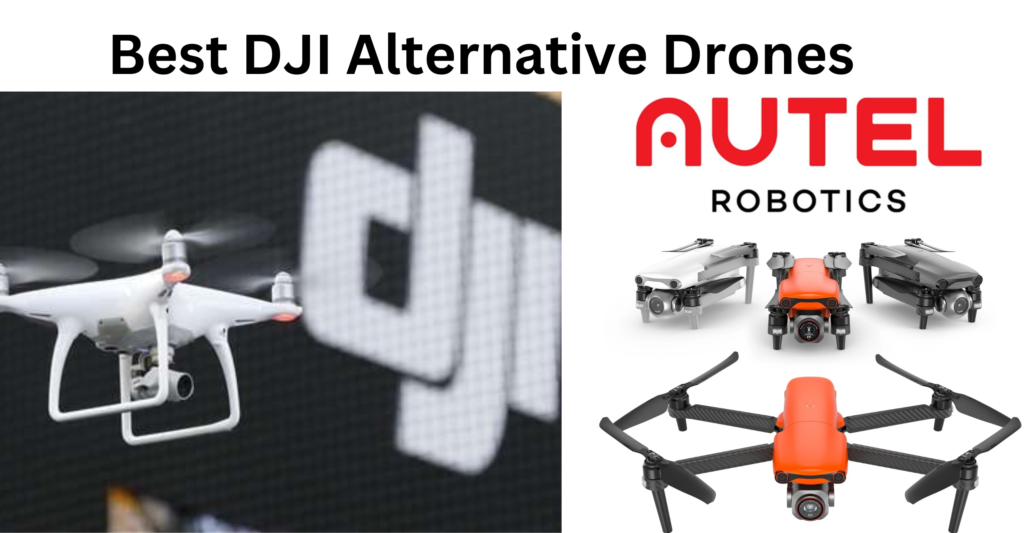
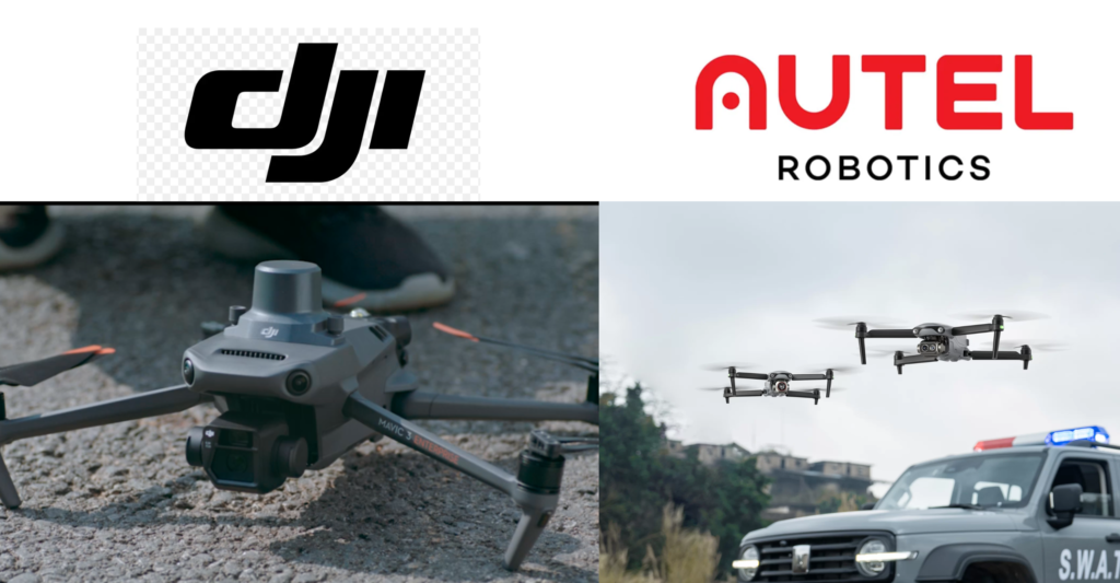
Top 16 Best DJI Alternative Drones – Check Out Biggest DJI Competitors 2025 DJI alternative drones have gained significant attention in recent years, with DJI remaining the world’s largest drone manufacturer, commanding an impressive market share of over 70%. DJI Headquartered in Shenzhen, China, and founded in 2006 by Frank Wang, DJI offers a diverse range of […]
Introduction to Drone Photogrammetry Photogrammetry is a technique used to collect accurate measurements from a series of overlapping 2D images to create 3D models of objects, terrain, or landscapes. It’s essentially a way of turning flat pictures into detailed, three-dimensional representations, using the angles, distances, and positions captured in the images. Now, with drones photogrammetry […]
Introduction to LiDAR with Drone Technology LiDAR, which stands for Light Detection and Ranging, is a technology that uses laser light to measure distances and create detailed maps. When combined with drones, LiDAR becomes an even more powerful tool. This combination allows us to gather accurate 3D data over large areas quickly and efficiently. Choosing the […]
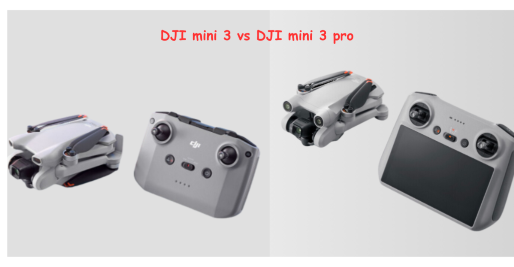
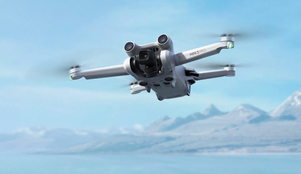
DJI Mini 3 Vs DJI Mini 3 Pro: Key Differences Are you not able to find out which is the best DJI mini drone, worry not we are going to answer you in few minutes with out complete guide of DJI Mini 3 vs DJI mini 3 Pro. When it comes to choosing the perfect […]
GCAA & DCAA Guide to UAE Drone & UAV Regulations and Fly Zones In the UAE, drone & UAV have gained significant popularity for both recreational and commercial purposes. As exciting as it is to fly a drone, there are strict rules and regulations set by authorities to ensure the safety of airspace, privacy, and […]
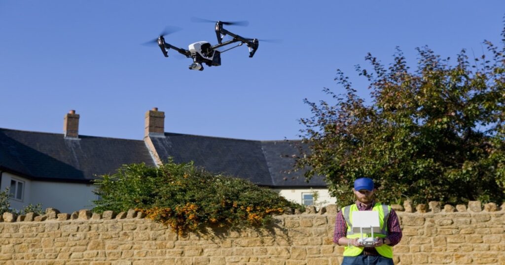
Understanding UAV License & Drone Pilot Permit in the UK Drones, or unmanned aerial vehicles (UAVs), have become increasingly popular in the UK for both personal and commercial use. From capturing stunning aerial shots for photography and videography to conducting professional tasks like surveying, mapping, and inspections, drones are revolutionizing various industries. Whether you are […]
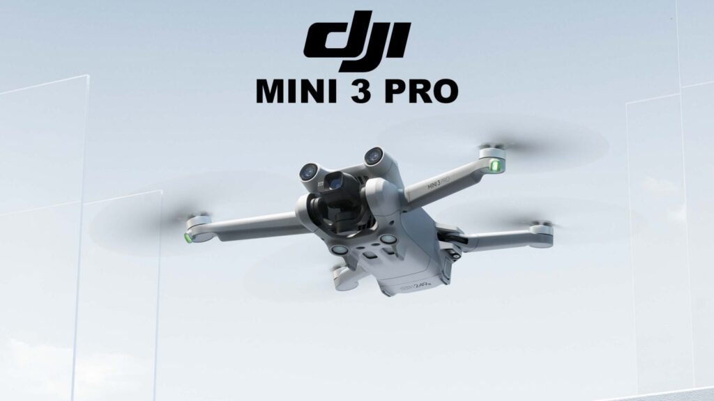
Are you thinking about buying the DJI Mini 3 Pro? You’re in the right place! This guide will walk you through everything you need to know about its amazing features, price, and what makes it a top choice in the world of drones. We’ll also talk about the best alternative—the Autel EVO Lite+—to help you decide which drone […]
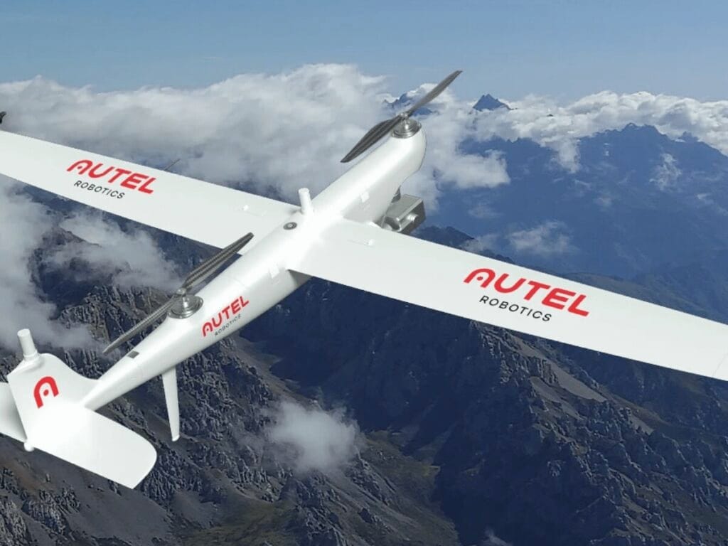
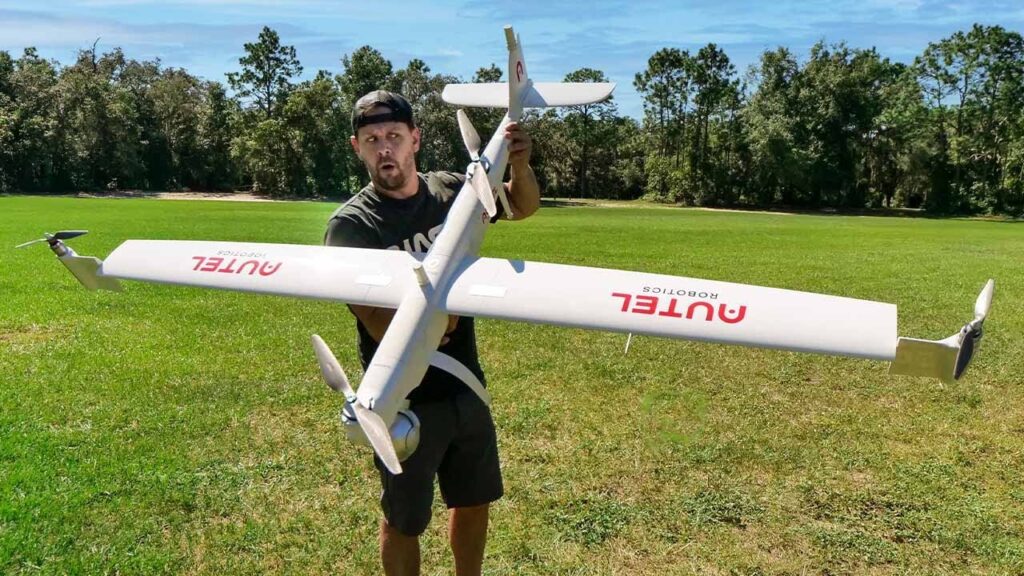
Top 9 Best Aerial Survey Drones & Mapping Welcome to XRTech Drone Shop! We’re your go-to place for finding the best drones for aerial survey and mapping. Our store offers top-quality aerial survey drones, including popular brands like DJI & Autel drones, to help you complete your projects quickly and accurately. Drones have become essential […]
Drone License in Dubai, UAE 2025 Drones are becoming more popular in Dubai, UAE 2025 for both personal and commercial use. People are using drones for photography, delivery services, and even surveying. As more people begin flying drones, the Dubai government has put regulations in place to ensure everyone’s safety. These rules require people to […]
Best Drones for Construction Site Monitoring and Inspection Construction sites are always busy, with many tasks happening at the same time. To make sure everything is going as planned, it’s important to keep a close eye on every detail. Monitoring and inspecting construction sites help avoid mistakes, ensure safety, and keep projects on track. Traditionally, […]