XRTech Group: Harnessing Satellite Imagery for Continuous Mine Monitoring
At XRTech Group, the mission is clear: to bring advanced Earth observation capabilities to industries that shape our world. One such industry is mining, where satellite imagery for mining has emerged as a transformative technology. Our satellite mining solutions provide unparalleled insights, enabling mining companies to explore, monitor, and manage operations more effectively and sustainably.
This blog dives deep into how mining satellite data and mineral mapping through satellite imagery empower mining operations today. Whether it’s tracking environmental changes or optimizing production, XRTech Group is at the forefront of making mining smarter and safer.
How Remote Sensing Empowers the Mining Industry
Remote sensing technology, which includes satellite and aerial data collection, plays a pivotal role in mineral mapping and continuous mine monitoring. Satellite mining data provide a wide-area view that can track changes in landforms, vegetation, and surface water bodies over time. These insights help mining companies assess ongoing environmental impacts and monitor mining infrastructure health.
Through mining satellite imagery, unauthorized mining activities and potential hazards are detected early, helping prevent accidents and environmental violations. The consistent flow of remote sensing data ensures that mining operations remain compliant with regulations and align with sustainable practices. As a result, remote sensing supports not only exploration but also operational safety and environmental responsibility in mining.
The Importance of Satellite Imagery in Mineral Mapping and Exploration
Mineral mapping depends heavily on satellite imagery for mining due to its ability to capture and analyze spectral signatures unique to different minerals and rocks. This spectral data is gathered through advanced optical and synthetic aperture radar sensors mounted on satellites. These sensors provide rich information on the chemical and physical properties of surface materials, enabling detailed mapping of mineral deposits.
At XRTech Group, the satellite mining technology offered delivers high-resolution, multispectral, and hyperspectral imagery that reveals subtle geological structures and mineral signatures. These images help geologists understand the spatial distribution of minerals and select promising sites for further investigation. The accuracy and scale of satellite mineral mapping help reduce the need for invasive and expensive ground surveys.
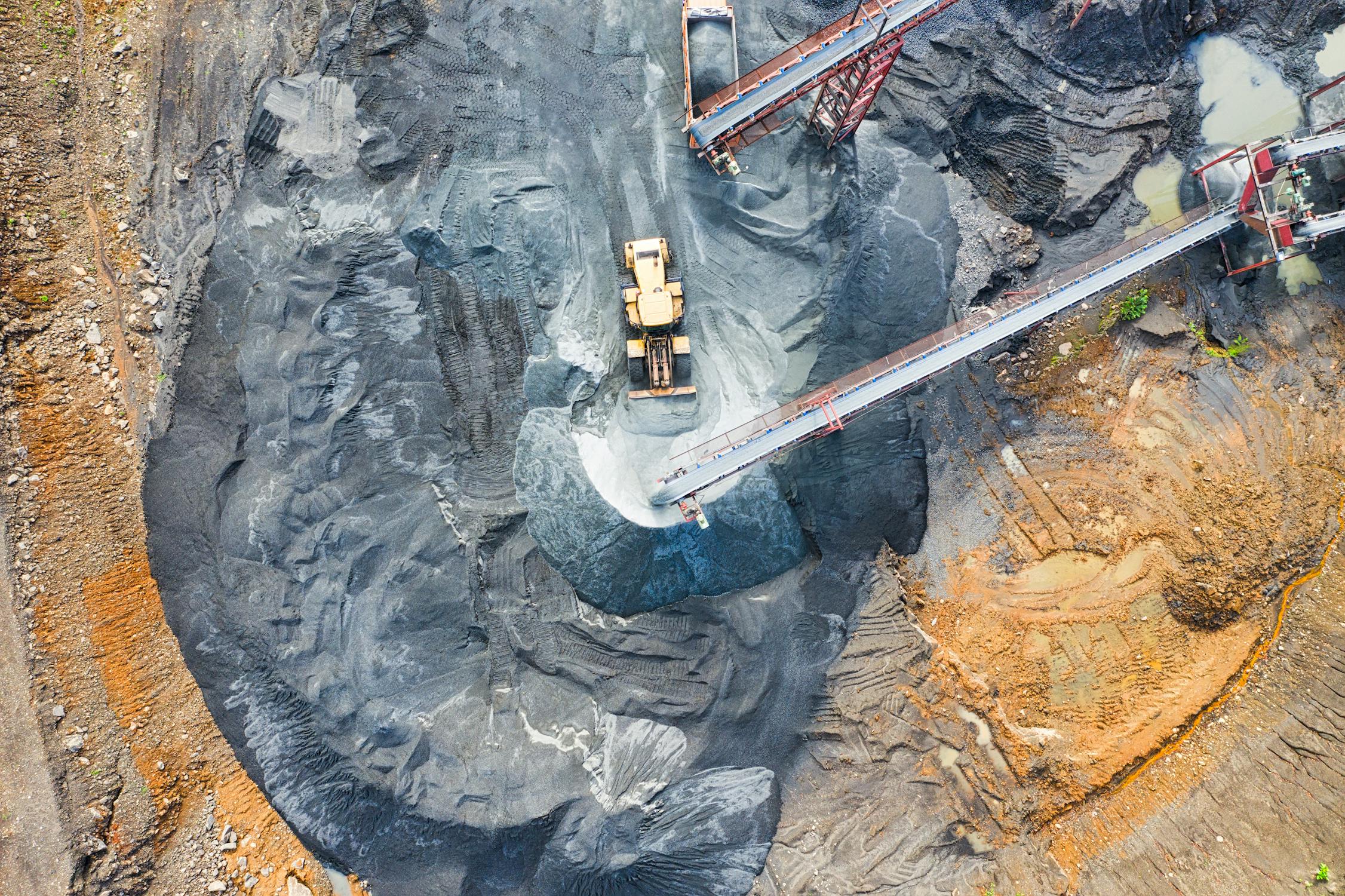
What Satellite Monitors in the Mine Area?
Satellite imagery for mining provides a powerful and consistent way to observe, track, and assess various elements of the mine area. Through XRTech Group’s advanced Earth observation capabilities, a mining site can be continuously and remotely monitored with precision and consistency, no matter how remote or challenging the terrain may be. Every pixel captured from above brings valuable insights that are essential for safety, sustainability, and productivity in the mining process.
Unlike traditional methods that depend heavily on ground visits and manual inspection, mining satellite data helps generate wide-scale views and in-depth analyses in near real-time. This technology not only enhances operational visibility but also supports long-term planning with historical data comparison and predictive modeling. Here’s what satellite imagery for mining can monitor around and within mine areas:
Mineral Mapping and Geological Structure Identification
Using spectral analysis, mining satellites help detect and distinguish different minerals and rock types based on their reflectance patterns. This enables geologists to identify promising mineral-rich zones and geological structures without physical digging. Mineral mapping with satellite imagery speeds up exploration and helps mining companies focus their resources on the most likely target zones.
By evaluating the unique spectral signatures of minerals, mining satellite imagery can spot potential deposits of gold, iron ore, copper, bauxite, and other valuable resources. This allows for quicker decision-making in exploration phases while minimizing ground disturbance.
Landform and Terrain Analysis
Satellite imagery for mining delivers detailed digital elevation models (DEMs) that help in understanding terrain and landforms across vast areas. This is useful for planning access roads, assessing slope stability, and preparing excavation strategies. By analyzing slope angles and surface characteristics, it becomes easier to prevent erosion and landslide risks in open-pit mining sites.
Topographic changes are continuously captured, helping to spot deformation in the mine structure early on. This capability supports safe design and development of haul roads, dumps, and stockpiles.
Water Body Detection and Tailings Pond Monitoring
Water management is a critical component in mining. Satellite imagery detects and monitors all water bodies around the mine site, including rivers, lakes, streams, and man-made water structures. This helps ensure water usage remains controlled and compliant with local regulations.
Tailings ponds, which store mining waste mixed with water, can be monitored for expansion, seepage, or overflow risks. Mining satellite data helps in identifying any breaches, waterlogging, or contamination spreading from tailings storage, which supports preventive maintenance and environmental protection.
Vegetation and Land Cover Monitoring
Satellite mining imagery enables detailed mapping and monitoring of vegetation health around and within mining zones. Monitoring vegetation changes allows for detection of deforestation, degradation, or illegal land use near mines. It also helps assess the ecological impact of mining over time.
XRTech Group’s solutions track regrowth in rehabilitated areas, supporting long-term sustainability reporting and compliance with environmental obligations. Changes in land cover are visualized over time to evaluate reclamation efforts and measure progress in green initiatives.
Infrastructure and Site Mapping
With high-resolution satellite imagery, every infrastructure element of the mining site can be mapped and monitored — from haul roads, in-pit roads, and processing facilities to buildings and equipment locations.
This level of mapping precision helps with logistics planning and safety audits. Satellite mining images allow for identification of road wear, congestion, and maintenance needs. Pit layouts and well pad boundaries can be updated frequently, without needing frequent physical visits to the site.
Crack Detection and Slope Stability Monitoring
Surface cracks, landslides, and slope movements are major safety concerns in both surface and underground mines. Mining satellite technology can detect subtle ground movement and surface deformation over time through interferometric synthetic aperture radar (InSAR) techniques.
These measurements help predict slope failures or subsidence before they pose a threat, ensuring mining personnel and assets are protected. By analyzing time-series satellite data, small shifts in the ground can be tracked and compared, improving response times to geohazards.
Change Detection and Unauthorized Activity Tracking
Frequent satellite passes over the same area allow for change detection by comparing images taken at different times. Any new developments — like unauthorized mining activity, illegal excavation, or unplanned construction — can be flagged.
Mining satellite monitoring protects assets by ensuring operations are carried out according to the approved plan. This capability supports enforcement and oversight, especially in large or remote areas where on-ground monitoring isn’t feasible all the time.
Erosion Monitoring and Surface Water Runoff Patterns
Erosion near mine slopes, tailings dams, or transport corridors can impact operational efficiency and cause environmental degradation. Satellite imagery for mining allows companies to assess erosion-prone areas based on rainfall, vegetation cover loss, and topographic changes.
Surface runoff patterns, especially after storms, can be tracked to help design better drainage systems and reduce soil loss. This leads to more effective water management and helps mining companies maintain site stability and reduce ecological disruption.
Air and Dust Dispersion Visibility
Although satellite imagery doesn’t directly measure air quality like sensors on the ground, it can be used to visualize dust plumes and atmospheric changes when combined with other satellite-based sensors. This helps mining operations track the impact of blasting, hauling, and excavation on nearby communities or ecosystems.
Mining satellite monitoring can support regulatory compliance and community engagement by providing visual data of airborne disturbances, improving transparency.
Wildlife and Habitat Observations
In areas with biodiversity sensitivity, satellite imagery supports wildlife corridor mapping and habitat monitoring. Mining companies can use this information to avoid disturbing protected areas and to design better conservation strategies.
Mining satellite data also helps assess how mining expansions affect surrounding habitats and allows for better coordination with environmental bodies for mitigation efforts.
Reclamation Progress and Post-Mining Land Use
Once mining operations cease, satellite imagery remains valuable for tracking land restoration and reclamation progress. Regular monitoring shows vegetation regrowth, soil stabilization, and reuse of the land over time.
With satellite mining insights, companies can provide accurate reports to regulatory bodies and communities, building trust and ensuring compliance. Rehabilitated areas can be evaluated for future development, agriculture, or eco-tourism, based on objective satellite-based evidence.
Exploring the Types of Geospatial Data in Satellite Mining
Satellite imagery for mining isn’t just about pretty pictures from space. It’s a complex collection of geospatial data types that together provide a full picture of mining operations and their surroundings.
Optical and Multispectral Satellite Images
These images capture reflected sunlight across various wavelengths. Through this, different minerals and rock types can be identified by their unique spectral signatures. This spectral information forms the basis of mineral mapping, allowing geologists to locate mineral deposits efficiently.
Synthetic Aperture Radar (SAR)
Radar-based satellites send radio waves that penetrate clouds and work day or night. SAR detects minute surface movements and changes, such as land deformation or subsidence, which are critical for ongoing mine safety.
Thermal Imaging
Thermal satellites measure heat emissions. Mining operations can use this data to monitor heat anomalies that might signal fires, equipment overheating, or chemical reactions in tailings ponds.
Elevation and Topographic Data
LiDAR and other elevation sensing satellites produce detailed 3D maps of terrain and mine structures. These maps assist with planning, volume calculations, and slope stability analysis.
Environmental Monitoring Data
Combining satellite imagery with environmental data helps track pollution, water quality, and ecosystem health near mining operations. This supports companies in meeting environmental standards and minimizing their footprint.
Features and Advances in Satellite Mining Technology by XRTech Group
XRTech Group leverages cutting-edge satellite imagery combined with advanced analytics to meet the diverse needs of the mining industry. Our mining satellite data platform provides seamless access to high-resolution images and sophisticated tools that facilitate detailed site mapping, environmental monitoring, and production optimization.
The features of our satellite mining services include:
- Water Bodies Detection: Satellite imagery for mining detects and monitors water bodies near mining sites, essential for managing water resources and controlling potential contamination.
- Haul Roads and In-Pit Roads Identification: The network of roads used for material transport is clearly mapped, enabling improved logistics and maintenance planning.
- Cracks and Erosion Detection: Surface changes that indicate erosion or structural damage are identified early to prevent larger failures.
- Well Pads Boundaries Mapping: Accurate delineation of well pads supports efficient site layout and compliance with land use regulations.
- Weed Detection and Classification: Vegetation analysis helps distinguish invasive species or weeds that may affect land reclamation efforts.
- Vegetation Monitoring and Land Mapping: Changes in vegetation health are tracked to assess environmental recovery or impact.
- Tailings Ponds Monitoring: Stability and changes in tailings storage facilities are regularly assessed to avoid environmental disasters.
- Mine Site Monitoring: Overall operational status and changes in mine sites are continuously observed to ensure efficiency and safety.
Benefits of Using Satellite Imagery for Mining Operations
Mining satellite data offers numerous advantages that improve overall mining workflows and decision-making:
- Resource Identification becomes faster and more accurate by pinpointing geological features linked with minerals, cutting down exploration times.
- Site Mapping benefits from high-resolution images that reveal topography and infrastructure details, supporting better mine design and planning.
- Environmental Monitoring provides ongoing data on vegetation changes and pollution sources, helping mining companies maintain sustainable practices.
- Safety Monitoring uses satellite data to identify hazards like unstable slopes or chemical spills, allowing preventative action before accidents occur.
- Production Monitoring tracks operational progress and resource extraction rates, aiding in optimizing workflows and forecasting outputs.
How XRTech Group Supports Advanced Mineral Exploration
Mineral exploration is the foundation of successful mining projects. Through satellite imagery for mining, XRTech Group delivers the tools that make exploration faster, smarter, and less invasive.
Our satellite mining solutions help identify key geological formations by analyzing spectral data, which highlight the presence of minerals such as gold, copper, and iron ore. This precision reduces the need for expensive and disruptive ground surveys.
By covering vast and often inaccessible regions from space, XRTech Group allows geologists to prioritize areas with the highest potential, conserving resources and time. This efficient targeting accelerates project timelines and improves success rates.
Advanced Analytics and Integration Capabilities
The power of satellite imagery for mining is amplified when combined with geospatial analytics and other data sources. XRTech Group offers platforms that integrate satellite images with GIS systems, drones, and ground sensors.
This integration creates a comprehensive digital twin of mining sites, providing stakeholders with a holistic view. Decisions are based on rich, layered data rather than isolated reports.
Advanced analytics also include machine learning models that detect subtle changes and trends, providing foresight into possible issues or opportunities.
Future Trends in Satellite Imagery for Mining
As satellite technology advances, new possibilities emerge for mining companies. The future includes higher resolution sensors capable of detecting smaller mineral deposits and changes on a finer scale. Machine learning and AI integration will automate the interpretation of satellite mining data, making it faster to generate insights.
Moreover, more satellites with increased revisit rates will provide near real-time monitoring, vital for dynamic mine environments. This will enable even better environmental management, regulatory compliance, and operational efficiency.
XRTech Group is committed to staying at the forefront of these advancements, continuously evolving its satellite mining offerings to deliver unparalleled value to the mining sector.
Conclusion: Satellite Imagery for Mining – A Game Changer for Mineral Mapping and Continuous Monitoring
Satellite imagery for mining has proven indispensable for modern mineral exploration, mine management, and environmental stewardship. Mining satellite data from XRTech Group offers a detailed, reliable, and ongoing source of information that helps companies make better decisions, reduce costs, and operate sustainably.
By using satellite mining technology, mining firms can map mineral deposits accurately, monitor environmental changes continuously, and maintain safety standards proactively. The impact of this technology goes beyond exploration—it transforms mining into a smarter, safer, and more sustainable industry.
For mining companies ready to harness the power of satellite imagery, XRTech Group offers customized solutions backed by expert support. Together, the future of mining looks more efficient and environmentally conscious.

