Satellite Imagery for Flooding in Sri Lanka Delivered in 3 Days During Cyclone Ditwah
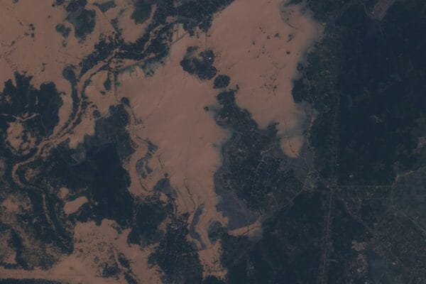
XRTech Group Case Study Satellite Imagery for Flooding in Sri Lanka Delivered in 72 Hours During Cyclone Ditwah 9 Sri Lanka flood zones. 4,100 km
XRTech Group Case Study Satellite Imagery for Flooding in Sri Lanka Delivered in 72 Hours During Cyclone Ditwah 9 Sri Lanka flood zones. 4,100 km
XRTech Group Case Study AI-Powered High Resolution Satellite Imagery for Gold Exploration in Africa How XRTech Group’s deep learning models analyzed remote sensing data to
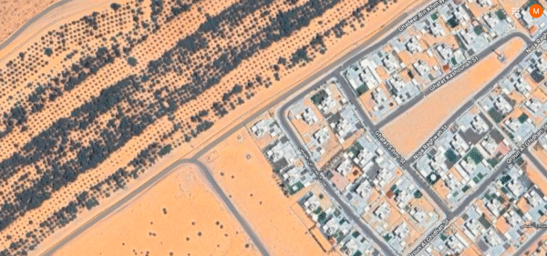
XRTech Group Case Study Flood-Ready Stereo Imagery for Smarter Planning in Abu Dhabi How high-resolution stereo satellite imagery delivered near-survey grade accuracy at scale, providing

The StreamlineChain Initiative, launched by Global Trade Solutions Inc., is a pioneering project aimed at revolutionizing supply chain management through the integration of cutting-edge technologies and data analytics.
The FeatherLight Surveillance Initiative, spearheaded by MetroSafe Security Solutions, is a groundbreaking project aimed at developing and deploying ultra-light security cameras for enhanced urban and remote surveillance.
The EcoDrone Mapping Initiative, spearheaded by Green Horizon Environmental Solutions, is a pioneering project set to deploy advanced drone technology for comprehensive environmental monitoring and conservation efforts.

The EarthWatch Satellite Imagery Analysis project, commissioned by GEMS, aims to leverage advanced satellite imagery for comprehensive environmental monitoring across various ecosystems.