Satellite View of Harry Reid International Airport, Las Vegas
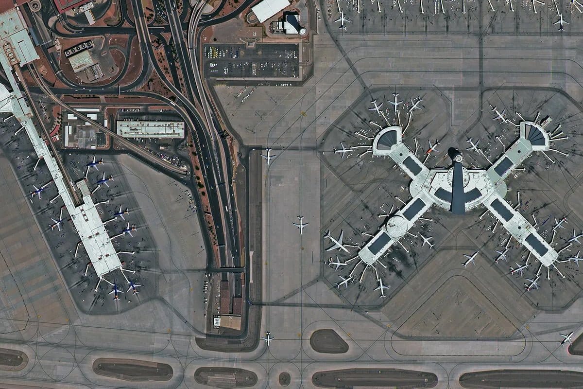
Satellite imagery of Harry Reid International Airport in Las Vegas at 30cm, showing the X-shaped concourse, parked aircraft and the apron.
This satellite view of Harry Reid International Airport, Las Vegas was captured from orbit, not by plane or drone. Click the aerial view to open it full size.
Aerial view of Harry Reid International Airport, Las Vegas from space
The four arms of the X-shaped concourse are surrounded by aircraft at their gates, with service roads, taxiway markings and ground vehicles all visible. To the left, a long terminal building and the curving access roads lead in from the city.
Airports are a standard benchmark for satellite image quality: aircraft, markings and vehicles only show cleanly in sharp, well-processed images.
What you can see in this aerial view
The X-shaped terminal concourse
Aircraft parked at gates
Taxiway markings and service roads
Terminal buildings and access roads
Who uses satellite imagery of places like this
Airport operators, defence and aviation analysts use 30cm satellite imagery for airport planning, apron monitoring and mapping.
Order archive images or new tasking, from 15cm HD and 30cm optical to all-weather SAR, delivered worldwide as GeoTIFF. Tell us your area and we send available images and a price, usually within 24 hours.