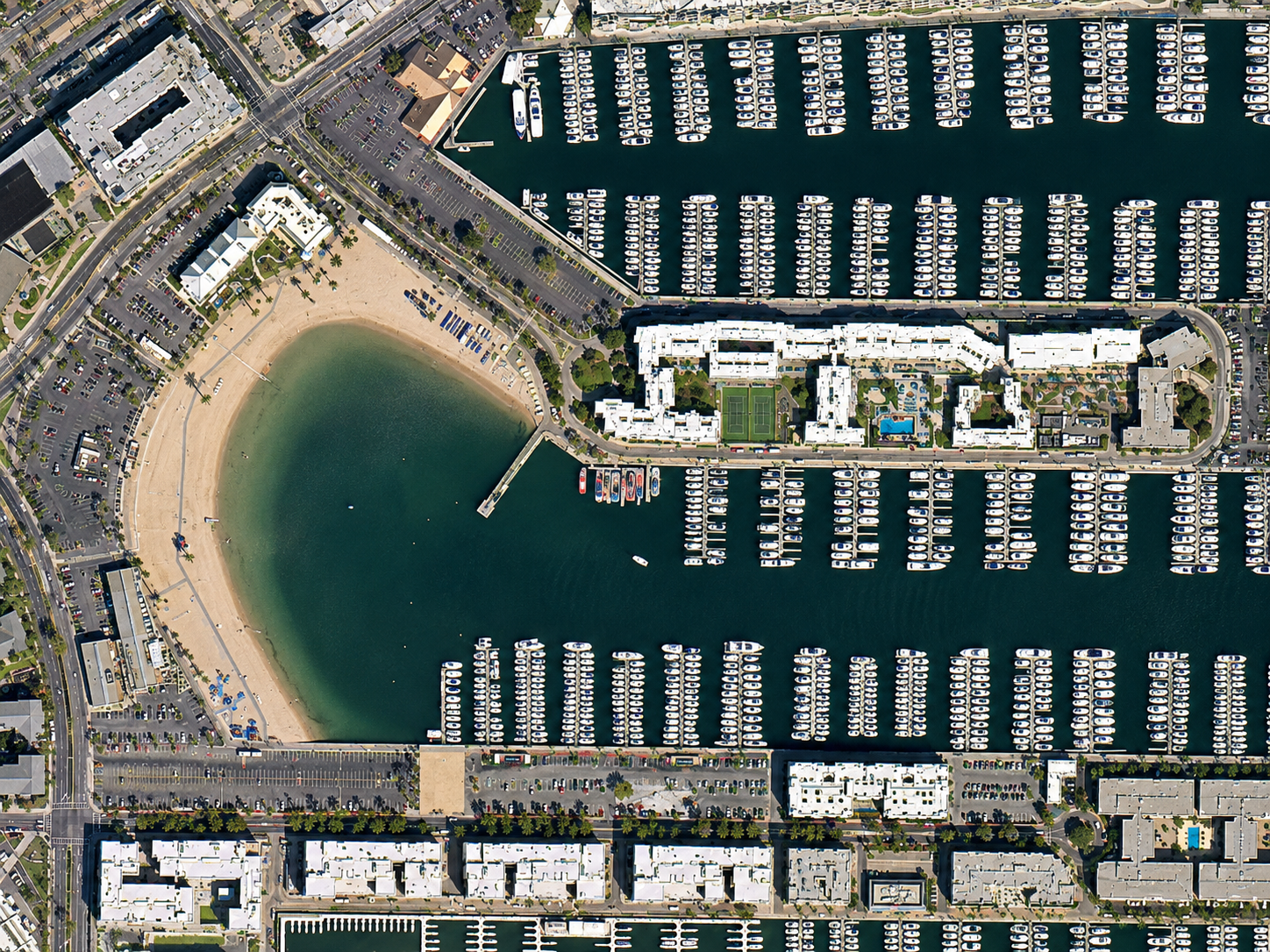
A TripleSat 80cm satellite image of Marina del Rey in California, with rows of docks, hundreds of moored boats and a sheltered beach.
This satellite view of Marina del Rey, California was captured from orbit, not by plane or drone. Click the aerial view to open it full size.
Aerial view of Marina del Rey, California from space
Marina del Rey is one of the largest man-made small craft harbours in North America. In this scene the regular rows of docks and boats fill the basins, while a curved sandy beach sits in a protected cove next to waterfront apartment blocks.
At 80cm, wide areas can be covered quickly and at a lower cost per square kilometre, while boats, buildings and roads are still easy to tell apart.
What you can see in this aerial view
Rows of docks and moored boats
A sheltered beach in a curved cove
Waterfront apartments and car parks
Streets and green spaces around the marina
Who uses satellite imagery of places like this
Port managers, insurers and planners use 80cm satellite imagery for marina mapping, coastal planning and insurance exposure checks.
Order archive images or new tasking, from 15cm HD and 30cm optical to all-weather SAR, delivered worldwide as GeoTIFF. Tell us your area and we send available images and a price, usually within 24 hours.