Satellite View of Las Vegas Strip, Nevada

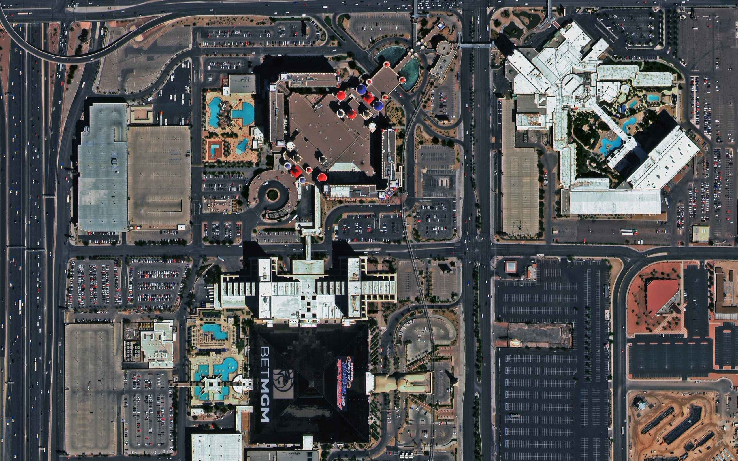
Satellite imagery of the south end of the Las Vegas Strip at 30cm, around the Luxor pyramid and the Excalibur resort, captured by SuperView Neo-1.

This satellite view of Las Vegas Strip, Nevada was captured from orbit, not by plane or drone. Click the aerial view to open it full size.

Aerial view of Las Vegas Strip, Nevada from space

The dark square of the Luxor pyramid sits at the bottom of the frame, with the turrets and red roofs of Excalibur above it and the white towers and pools of neighbouring resorts to the right. Las Vegas Boulevard runs along the left edge, lined with parking lots full of cars.

At 30cm every pool, rooftop unit and parked car is clear, which is why the Strip is a popular test scene for very high resolution satellites.

What you can see in this aerial view

  • The Luxor pyramid from directly above
  • Excalibur turrets and roofs
  • Resort pools and gardens
  • Las Vegas Boulevard, parking lots and cars

Who uses satellite imagery of places like this

Developers, insurers and planners use 30cm satellite imagery for real estate, insurance and urban planning work.

Need satellite imagery of your own site with the same level of detail? Buy high resolution satellite imagery of any area, or search the archive yourself in the XRTech satellite imagery portal.

Image specifications

Sensor
Optical, natural colour
Satellite
SuperView Neo-1
Resolution
30cm
Location
Las Vegas Strip, Las Vegas, Nevada, USA
Coordinates
36.095 N, 115.175 W
Scene
Resorts and city
Delivery formats
GeoTIFF, JPEG, KMZ
Licence
Commercial licence with every order

Get satellite imagery like this of your area

Order archive images or new tasking, from 15cm HD and 30cm optical to all-weather SAR, delivered worldwide as GeoTIFF. Tell us your area and we send available images and a price, usually within 24 hours.
More satellite images

Back to the satellite image gallery

Request Product Details