Satellite View of Oil Tank Farm at Night (SAR)

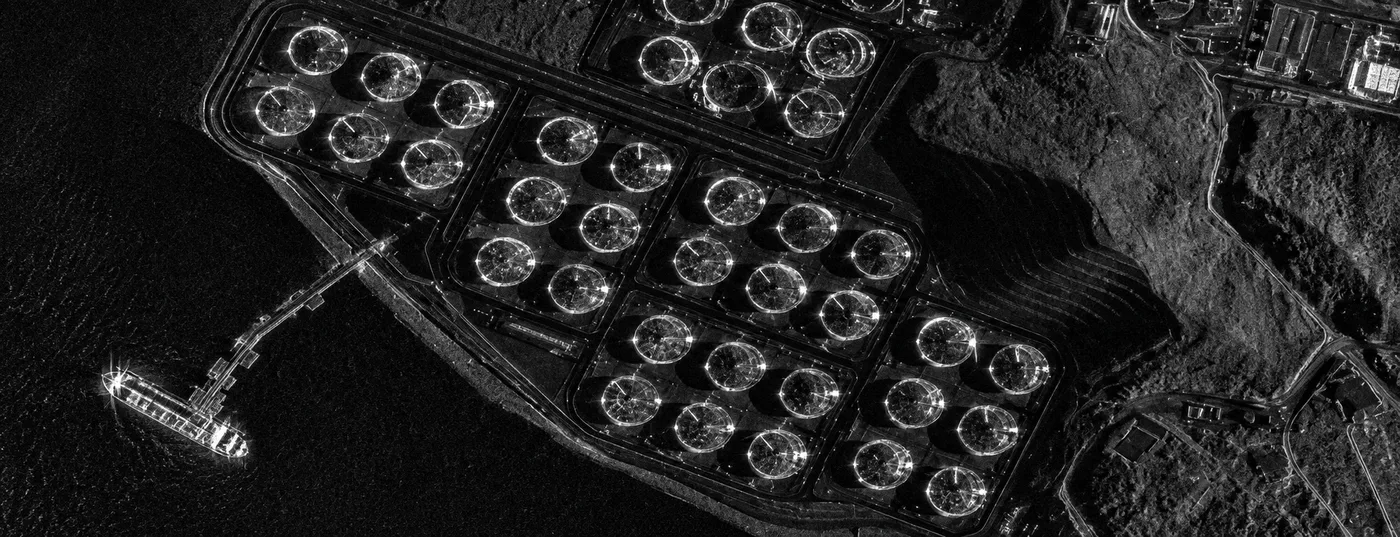
Satellite imagery of an oil tank farm captured at night by radar, with rows of round storage tanks and a tanker moored at the jetty.

This satellite view of Oil Tank Farm at Night (SAR) was captured from orbit, not by plane or drone. Click the aerial view to open it full size.

Aerial view of Oil Tank Farm at Night (SAR) from space

Radar does not need daylight, so this image was captured in darkness. The round storage tanks show as bright rings, the jetty runs out to sea and a tanker sits at the berth as a bright shape on the dark water.

Energy companies and emergency teams use night and all-weather SAR to check terminals, tanks and ships when optical satellites cannot see.

What you can see in this aerial view

  • Rows of round storage tanks
  • A jetty reaching out to sea
  • A tanker at the berth
  • Bunds and roads around the tanks

Who uses satellite imagery of places like this

Energy, port and emergency teams use SAR satellite imagery for oil and gas monitoring and emergency response.

Need satellite imagery of your own site with the same level of detail? Buy high resolution satellite imagery of any area, or search the archive yourself in the XRTech satellite imagery portal.

Image specifications

Sensor
Synthetic Aperture Radar (SAR)
Satellite
High resolution SAR satellite
Resolution
High resolution radar
Location
Coastal oil terminal
Scene
Tank farm and jetty
Delivery formats
GeoTIFF, JPEG, KMZ
Licence
Commercial licence with every order

Get satellite imagery like this of your area

Order archive images or new tasking, from 15cm HD and 30cm optical to all-weather SAR, delivered worldwide as GeoTIFF. Tell us your area and we send available images and a price, usually within 24 hours.
More satellite images

Back to the satellite image gallery

Request Product Details