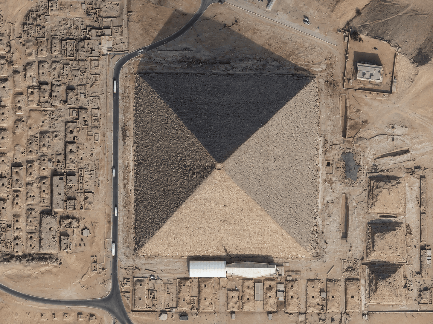
Satellite imagery of the Pyramids of Giza in Egypt, showing the pyramids, their shadows and the surrounding desert plateau.
This satellite view of Pyramids of Giza, Egypt was captured from orbit, not by plane or drone. Click the aerial view to open it full size.
Aerial view of Pyramids of Giza, Egypt from space
The pyramids are easy to recognise from above by their square bases and sharp shadows. Around them, the remains of smaller pyramids, tombs, roads and visitor areas are visible on the desert plateau.
Archaeologists and heritage teams use high resolution imagery to map sites, track change and plan conservation.
What you can see in this aerial view
Pyramid bases and shadows
Smaller pyramids and tombs
Roads and visitor areas
The desert plateau
Who uses satellite imagery of places like this
Heritage and tourism teams use satellite imagery for site mapping, conservation and visitor planning.
Order archive images or new tasking, from 15cm HD and 30cm optical to all-weather SAR, delivered worldwide as GeoTIFF. Tell us your area and we send available images and a price, usually within 24 hours.