Satellite View of King Abdullah Financial District, Riyadh (3D)
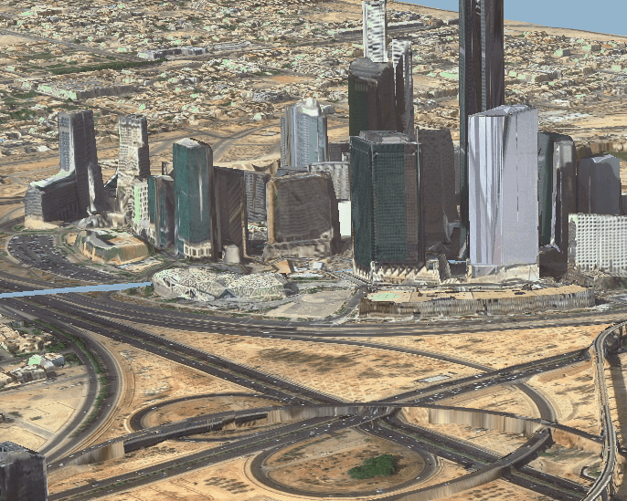
A 3D satellite view of the King Abdullah Financial District in Riyadh, with its cluster of towers rising above a highway interchange.
This satellite view of King Abdullah Financial District, Riyadh (3D) was captured from orbit, not by plane or drone. Click the aerial view to open it full size.
Aerial view of King Abdullah Financial District, Riyadh (3D) from space
Seen at an angle, the glass towers of the financial district stand out above the desert city, with a large highway interchange in the foreground. Views like this are made by combining high resolution satellite imagery with elevation data.
3D city views help planners, investors and engineers understand height, density and sight lines without a site visit.
What you can see in this aerial view
High-rise towers of the financial district
A large highway interchange
Desert land around the city edge
Roads and access ramps
Who uses satellite imagery of places like this
Developers and planners use satellite imagery with 3D city models for urban planning and real estate work.
Order archive images or new tasking, from 15cm HD and 30cm optical to all-weather SAR, delivered worldwide as GeoTIFF. Tell us your area and we send available images and a price, usually within 24 hours.