By Mustafa Jawaad, General Manager, XRTech Group
Quick answer: The best 3D city modeling software for urban planning is ArcGIS CityEngine for building a 3D city procedurally from GIS data, ArcGIS Urban for zoning and plan scenarios, and Autodesk Forma for fast massing with sun, wind and noise analysis. Infrastructure teams choose Autodesk InfraWorks or Bentley iTwin with Cesium for digital twins. SketchUp is the easiest to learn, Rhino with Grasshopper leads parametric urban design, Unreal Engine produces the most realistic 3D model visualizations, and Blender and QGIS let students and small teams create a 3D city for free.
Modelling a city is no longer a specialist task. Planners use 3D city models to test zoning before it is adopted, developers use them to win approvals, engineers use them to route roads and drainage, and cities run whole digital twins on them. The hard part is choosing the tool, because the market mixes GIS platforms, design apps, game engines and free open-source software that all claim to do the same job. At XRTech Group we supply the satellite imagery, elevation data and building models that feed these programs, so we see which tools teams actually use, where they get stuck, and what each one is genuinely good at. This guide compares the 10 most trusted, widely used options by user type, skill level, features, data support and price, so you can pick the right one with confidence.
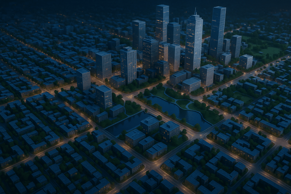
A 3D city model brings buildings, streets, terrain and green space into one scene that planners can measure, test and present.
The 10 Best 3D City Modeling Software at a Glance
Prices are typical published list prices per user and change by region and reseller, so confirm with the vendor before you budget.
Software
Best for
Skill level
Starting price
1. ArcGIS CityEngine (Esri)
Procedural city generation from GIS data, scenarios
Intermediate to advanced
About USD 2,000 per year; free trial
2. ArcGIS Urban (Esri)
Zoning, land use and plan scenarios on the web
Beginner to intermediate
Quote, needs ArcGIS Online or Enterprise
3. Autodesk Forma Site Design
Early massing with sun, wind, noise and carbon analysis
Beginner to intermediate
About USD 700 per year, or in the AEC Collection
4. Autodesk InfraWorks
Roads, bridges, drainage and infrastructure concepts
Intermediate
About USD 2,090 per year
5. Bentley iTwin, OpenCities Planner and Cesium
City-scale digital twins and reality meshes
Advanced, enterprise
Quote; Cesium ion has a free community plan
6. SketchUp (Trimble)
Quick massing and concept models
Beginner
Free web version; Go about USD 129, Pro about USD 399 per year
7. Rhino and Grasshopper
Parametric and generative urban design
Intermediate to advanced
About USD 995 one-time; USD 195 education
8. Blender
Free modeling and cinematic renders
Intermediate
Free and open source
9. Unreal Engine
Real-time, photoreal digital twin visualization
Advanced
Free under USD 1M yearly revenue, then about USD 1,850 per seat
10. QGIS
Free GIS-based 3D city views and analysis
Beginner to intermediate
Free and open source
Which 3D City Model Software Fits You? Pick by Persona
Start with your role and goal, not the feature list. These are the people we work with most often, and the tools that suit them:
Who you are
What you need
Best picks
City or regional planner
Test zoning and growth scenarios, share plans with councils and the public
ArcGIS Urban, ArcGIS CityEngine
GIS analyst
Turn footprints, heights and terrain into accurate 3D layers
ArcGIS CityEngine, QGIS
Architect or urban designer
Fast massing options and environmental checks
Autodesk Forma, Rhino with Grasshopper, SketchUp
Real estate developer
Feasibility, views, shadows and persuasive visuals for approvals
Autodesk Forma, Unreal Engine or Twinmotion
Civil and infrastructure engineer
Corridors, grading and drainage in real terrain
Autodesk InfraWorks, Bentley iTwin
Smart city or digital twin team
Stream large 3D data, sensors and live operations in one model
Bentley iTwin with Cesium, Unreal Engine, ArcGIS
Student or researcher
Learn modeling and GIS on a low budget
QGIS, Blender, SketchUp Free, education licences
Visualization studio
Film-quality fly-throughs and interactive scenes
Unreal Engine, Blender
The 10 Best 3D City Modeling Software, Reviewed
For each tool: what it is, its core functionality, who it suits, and the trade-offs we see in real projects.
1. ArcGIS CityEngine: best for building a 3D city procedurally
Esri's ArcGIS CityEngine is the reference tool for procedural modelling of cities. Instead of drawing buildings one by one, you write or apply rules (CGA, or the visual node editor) that turn GIS footprints, parcels and street networks into thousands of 3D buildings at once. Change a height limit or setback in the rule and the whole district updates, which is why CityEngine software is the go-to for comparing development scenarios.
- Core features: rule-based building and street generation, import of OpenStreetMap, shapefiles and terrain, scenario comparison, dashboards for floor area and density, and a library of ready-made rule packages.
- Output: scene layers for ArcGIS, plus FBX, OBJ, glTF and USD for Unreal Engine, Omniverse and other 3D tools.
- Best for: GIS teams and planners who need large, editable city models fast.
- Limits: the rule language takes time to learn, and it is a desktop app for Windows and Linux.
- Pricing: sold as an annual term licence of about USD 2,000 in the US, with a free trial and education access. Esri is moving the product to its user-type licensing, so check current options.
2. ArcGIS Urban: best for zoning and plan scenarios
ArcGIS Urban is a web app built for planning departments rather than 3D artists. It models zoning codes, land use and overlays as rules, then shows the buildable envelope and development capacity in 3D across a whole city. Planners can compare scenarios, track projects and publish plans for public feedback without any modeling skills. It works hand in hand with ArcGIS CityEngine for detailed design.
- Core features: zoning and land-use rules, capacity metrics (housing units, jobs, floor area), project tracking, scenario comparison and public engagement views.
- Best for: city and regional planners in organisations already on ArcGIS.
- Limits: not a free-form modeling tool, and it needs an ArcGIS Online or ArcGIS Enterprise organisation.
- Pricing: licensed through Esri, usually by quote.
3. Autodesk Forma Site Design: best for fast early-stage analysis
Autodesk Forma (formerly Spacemaker) is a cloud tool for site planning and concept design. You sketch or generate building masses on a real site, and it analyses sun hours, daylight, wind comfort, noise and operational and embodied carbon in near real time, so you can compare options before committing. Models move into Revit for detailed design.
- Core features: massing on real terrain and context, AI-assisted environmental analysis, terrain and earthworks tools, area and density metrics, and a Revit connection.
- Best for: architects, urban designers and developers testing many options quickly.
- Limits: focused on sites and districts rather than whole-city GIS modeling, and it runs in the browser only.
- Pricing: about USD 85 per month or USD 700 per year, and included in Autodesk's AEC Collection.
4. Autodesk InfraWorks: best for infrastructure in context
InfraWorks builds a 3D context model of an area from GIS, terrain and imagery, then lets engineers lay out roads, bridges, rail and drainage inside it. Its Model Builder can create a starting model of almost any location from public data in minutes, which makes it a practical way to create a 3D city context for infrastructure projects.
- Core features: Model Builder, conceptual road and bridge design, drainage and flood analysis, visual presentations, and links to Civil 3D and Revit.
- Best for: civil engineers and transport planners.
- Limits: Windows only, and building detail is basic compared with CityEngine.
- Pricing: about USD 2,090 per year, or within the AEC Collection.
5. Bentley iTwin, OpenCities Planner and Cesium: best for city-scale digital twins
Bentley Systems offers the most complete stack for infrastructure digital twins. iTwin Capture turns drone, aerial or street photos into textured reality meshes, OpenCities Planner shares plans and 3D city models with stakeholders on the web, and Cesium, which Bentley acquired, streams massive 3D models in the open 3D Tiles format to browsers, Unreal Engine and Unity.
- Core features: reality modeling, 3D Tiles streaming at global scale, engineering data alignment, IoT and sensor integration, and web sharing.
- Best for: city governments, utilities and large infrastructure owners running a digital twin.
- Limits: enterprise setup and budget, and you will need developers to get the most out of it.
- Pricing: by quote; Cesium ion has a free plan for personal and non-commercial work.
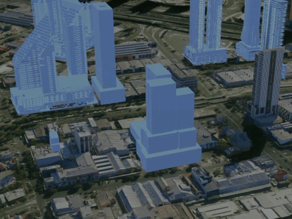
Building models placed over satellite imagery: the kind of 3D data a digital twin platform streams and analyses. See how we produce them on our 3D city models and digital twins page.
6. SketchUp: best for beginners and quick massing
SketchUp is the friendliest way to start building a 3D city scene. Its push-pull modeling is easy to learn in an afternoon, you can import a site location with terrain and satellite imagery, and the 3D Warehouse offers millions of free 3D models of furniture, trees and buildings.
- Core features: push-pull modeling, geo-location import, LayOut for drawings, a huge extension library and, in Studio, V-Ray rendering and point cloud tools.
- Best for: students, small practices and planners making concept and presentation models.
- Limits: slows down with very large city models and has no native GIS analysis.
- Pricing: free web version for personal use; Go about USD 129, Pro about USD 399 and Studio about USD 819 per year.
7. Rhino and Grasshopper: best for parametric urban design
Rhino is a precise 3D modeler, and Grasshopper, included free, is its visual programming tool. Together they let designers generate street grids, plots and building forms from parameters and test them against rules. Free plugins add urban analysis, such as Ladybug for sun and climate, and tools for importing OpenStreetMap and GIS data.
- Core features: NURBS and mesh modeling, visual scripting, thousands of plugins, and strong export to BIM, rendering and fabrication.
- Best for: computational designers, architecture schools and design-led planning teams.
- Limits: steep learning curve for Grasshopper, and GIS handling depends on plugins.
- Pricing: about USD 995 one-time for a commercial licence, USD 195 for education, with no subscription.
8. Blender: best free tool for 3D model visualizations
Blender is free, open-source 3D software used for modeling, animation and rendering. With add-ons such as BlenderGIS and Blosm, you can import OpenStreetMap buildings, terrain and map imagery, then texture and light a city for striking stills and fly-through videos.
- Core features: full modeling toolset, Cycles and Eevee renderers, geometry nodes for procedural layouts, and Python scripting.
- Best for: students, freelancers and visualization artists on a budget.
- Limits: not a GIS, so coordinates, zoning data and analysis need care or other tools.
- Pricing: free for any use; some add-ons are paid.
9. Unreal Engine: best for real-time, photoreal digital twins
Epic Games' Unreal Engine powers interactive, photoreal city experiences. With the free Cesium for Unreal plugin it can stream global terrain and 3D Tiles, and it imports models from CityEngine, Revit and Datasmith-supported tools. Many digital twin dashboards, public exhibitions and immersive planning reviews now run on it. Twinmotion, also from Epic, offers a simpler route to similar visuals.
- Core features: real-time ray tracing, large-world streaming, VR and touchscreen support, Blueprint visual scripting and live data connections.
- Best for: visualization teams, developers and smart-city projects that need interactive experiences.
- Limits: needs a powerful GPU and real development skills.
- Pricing: free for companies under USD 1 million in yearly revenue and for education; above that, about USD 1,850 per seat per year for non-game use.
10. QGIS: best free GIS for 3D city views
QGIS is the world's most popular free and open-source GIS. Its built-in 3D map view can extrude building footprints by height, drape imagery over elevation models and show point clouds, and plugins add CityJSON loading and web export of interactive 3D scenes.
- Core features: full GIS analysis, 3D map views, elevation and point cloud support, and a large plugin ecosystem.
- Best for: students, NGOs and small municipalities that need real GIS without licence costs.
- Limits: 3D styling and detailed building design are basic compared with dedicated tools.
- Pricing: free.
Feature Comparison: Data In, Models Out
Compatibility decides how well a tool fits your workflow. Here is how each one handles real-world data and exchange formats:
Software
Modeling approach
Real-world data it reads well
Common outputs
ArcGIS CityEngine
Procedural rules
GIS layers, OSM, terrain, imagery
Scene layers, FBX, OBJ, glTF, USD
ArcGIS Urban
Zoning and plan rules
ArcGIS layers, parcels, 3D buildings
Web scenes, reports
Autodesk Forma
Massing plus analysis
Built-in site context, terrain
Revit, IFC, analysis results
Autodesk InfraWorks
Context plus engineering design
GIS, DEMs, imagery, point clouds
Civil 3D, Revit, FBX
Bentley iTwin and Cesium
Reality meshes and streaming
Photos, point clouds, CAD, BIM, GIS
3D Tiles, iModels, OBJ
SketchUp
Manual push-pull
Geo-location, imagery, DWG
SKP, DWG, OBJ, FBX, IFC
Rhino and Grasshopper
Parametric and manual
CAD, OSM and GIS via plugins
3DM, DWG, IFC, OBJ, FBX
Blender
Manual and node-based
OSM, terrain and imagery via add-ons
glTF, FBX, OBJ, USD, renders
Unreal Engine
Real-time scene assembly
3D Tiles via Cesium, Datasmith, FBX
Interactive apps, video, VR
QGIS
Extrusion from attributes
Almost every GIS, raster and point cloud format
GeoPackage, web 3D scenes, images
How to Create a 3D City Model: A Typical Workflow
Whatever software you choose, building a 3D city follows the same basic steps:
- Define the purpose and detail: massing studies need simple block models (LOD1), while shadow, view and roof analysis need roof shapes (LOD2) or textured models.
- Collect base data: recent high-resolution satellite or aerial imagery, a terrain model (DTM) and surface model (DSM), building footprints and heights, roads and land parcels.
- Generate the buildings: extrude footprints in QGIS, apply rules in CityEngine, or use buildings already extracted from stereo imagery or lidar.
- Add texture and context: drape imagery on terrain, add facade textures, trees and street furniture.
- Analyse: test zoning, capacity, sun, wind or flood risk in ArcGIS Urban, Forma or InfraWorks.
- Visualize and share: publish as scene layers or 3D Tiles, or build an interactive experience in Unreal Engine.
Every Tool Needs Good 3D Data
The software is only half of a 3D city model. Its accuracy depends on the data you put in: how recent the imagery is, how precise the heights are, and whether buildings match reality. Free sources such as OpenStreetMap often lack heights or are out of date, which is the main reason projects stall.
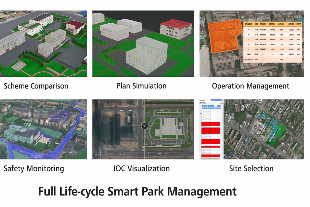
White building models support planning tasks from scheme comparison and plan simulation to operations, safety monitoring and site selection.
XRTech Group produces ready-to-use 3D city data from high-resolution stereo satellite imagery: building models, digital elevation models, and orthophoto maps, for any city worldwide and without flying a plane. We deliver in the formats these tools read, including glTF, FBX, OBJ, 3D Tiles, I3S, SHP and GeoJSON. Learn how the source imagery works on our stereo satellite imagery page.
Get 3D City Data Ready for Your Software
Tell us your city, the level of detail you need and the software you use. We will send a sample and a quote for building models, terrain and imagery that drop straight into CityEngine, ArcGIS Urban, InfraWorks, Cesium, Unreal Engine or QGIS.
Frequently Asked Questions
What is the best 3D city modeling software?
For most urban planning teams, ArcGIS CityEngine is the strongest all-round choice because it builds whole cities from GIS data and updates them by rule. Pair it with ArcGIS Urban for zoning, or choose Autodesk Forma if you mainly test site massing and environmental performance.
Is ArcGIS CityEngine free?
No, but there is a free trial, and students and universities can get access through Esri education programmes. Commercial use needs a paid licence.
What is the difference between ArcGIS CityEngine and ArcGIS Urban?
CityEngine is a desktop tool for creating detailed 3D buildings and streets with procedural rules. ArcGIS Urban is a web app for planners to manage zoning, plans and projects and compare scenarios. Many cities use both together.
How can I create a 3D city model for free?
Use QGIS to extrude building footprints by height over a terrain model, or Blender with the BlenderGIS add-on to import OpenStreetMap buildings. The SketchUp web version and the Cesium ion free plan also work for personal projects.
What is the difference between a 3D city model and a digital twin?
A 3D city model is a geometric copy of buildings, terrain and streets. A digital twin connects that model to live and historical data, such as sensors, traffic or energy use, so it can be monitored and simulated over time.
What level of detail (LOD) do urban planners need?
LOD1 block models are enough for massing, density and skyline studies. LOD2 models with roof shapes are better for solar potential, shadows and views. Textured or LOD3 models are mainly for presentation and street-level design.
Which 3D city software is easiest for beginners?
SketchUp is the easiest to learn, followed by ArcGIS Urban for planners and Autodesk Forma for designers. Both of the latter guide you with templates rather than asking you to model from scratch.
Where can I get accurate 3D building data for my city?
Options include national mapping agencies, lidar surveys, OpenStreetMap and commercial providers. Satellite stereo imagery is the fastest way to cover a whole city with consistent, recent heights, which is how XRTech Group builds its 3D city models.
Sources
- Esri: ArcGIS CityEngine and ArcGIS Urban
- Autodesk: Forma Site Design and InfraWorks
- Cesium: Cesium joins Bentley Systems
- Trimble: SketchUp plans and pricing
- Robert McNeel and Associates: Rhino and Grasshopper
- Blender Foundation: Blender
- Epic Games: Unreal Engine licensing
- QGIS: QGIS project

Mustafa Jawaad
General Manager, XRTech Group
Mustafa helps governments and critical industries get satellite and UAV data in days rather than weeks, from archive search and new satellite tasking to processed maps, so teams can plan infrastructure faster and with less risk. Connect on LinkedIn.