Satellite View of Mountain Terrain (LT-1 L-band SAR)
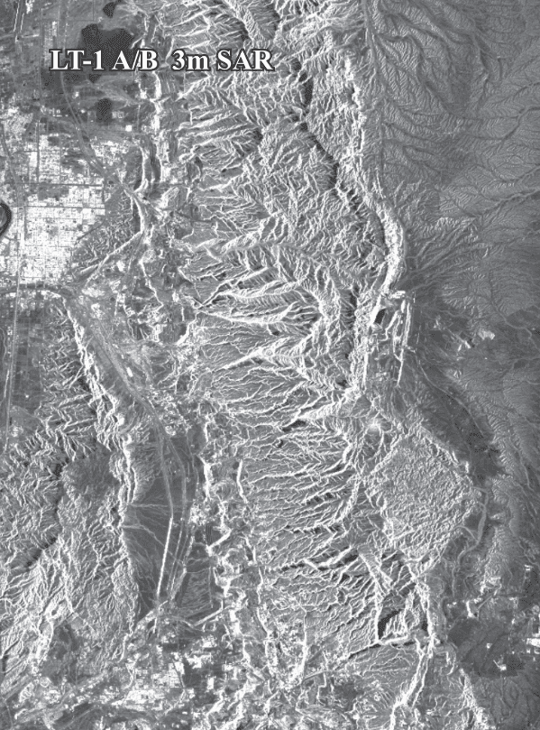
LT-1 L-band SAR satellite imagery at 3m of rugged mountain terrain, with sharp ridges, valleys and a town at the edge of the scene.
This satellite view of Mountain Terrain (LT-1 L-band SAR) was captured from orbit, not by plane or drone. Click the aerial view to open it full size.
Aerial view of Mountain Terrain (LT-1 L-band SAR) from space
Mountain slopes facing the radar look bright and slopes facing away look dark, which gives the terrain a strong 3D texture. LT-1 is an L-band pair built for interferometry and ground movement mapping.
L-band penetrates vegetation better than shorter wavelengths, so it is used for landslides, subsidence and forest mapping.
What you can see in this aerial view
Sharp ridges and valleys
Bright and dark slopes
Drainage channels
A town at the edge of the scene
Who uses satellite imagery of places like this
Geologists and engineers use L-band SAR imagery for landslide, subsidence and terrain mapping.
Order archive images or new tasking, from 15cm HD and 30cm optical to all-weather SAR, delivered worldwide as GeoTIFF. Tell us your area and we send available images and a price, usually within 24 hours.