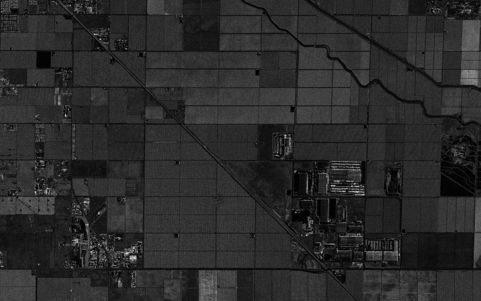
SAR satellite imagery of farmland processed as an EEC (Enhanced Ellipsoid Corrected) product, with field boundaries, canals and farm buildings.
This satellite view of Farmland, SAR EEC Product was captured from orbit, not by plane or drone. Click the aerial view to open it full size.
Aerial view of Farmland, SAR EEC Product from space
Each field shows a different shade of grey because crops, soil moisture and ploughing change how much radar signal returns to the satellite. Straight canals and roads divide the land and small farm buildings show as bright points.
EEC processing places the radar image on the map with geocoding and ellipsoid correction, so it can be loaded straight into GIS.
What you can see in this aerial view
Fields in different shades of grey
Straight canals and roads
Bright farm buildings
A long diagonal channel
Who uses satellite imagery of places like this
Agriculture and water teams use SAR imagery for crop monitoring, soil moisture and flood mapping, even under cloud.
Order archive images or new tasking, from 15cm HD and 30cm optical to all-weather SAR, delivered worldwide as GeoTIFF. Tell us your area and we send available images and a price, usually within 24 hours.