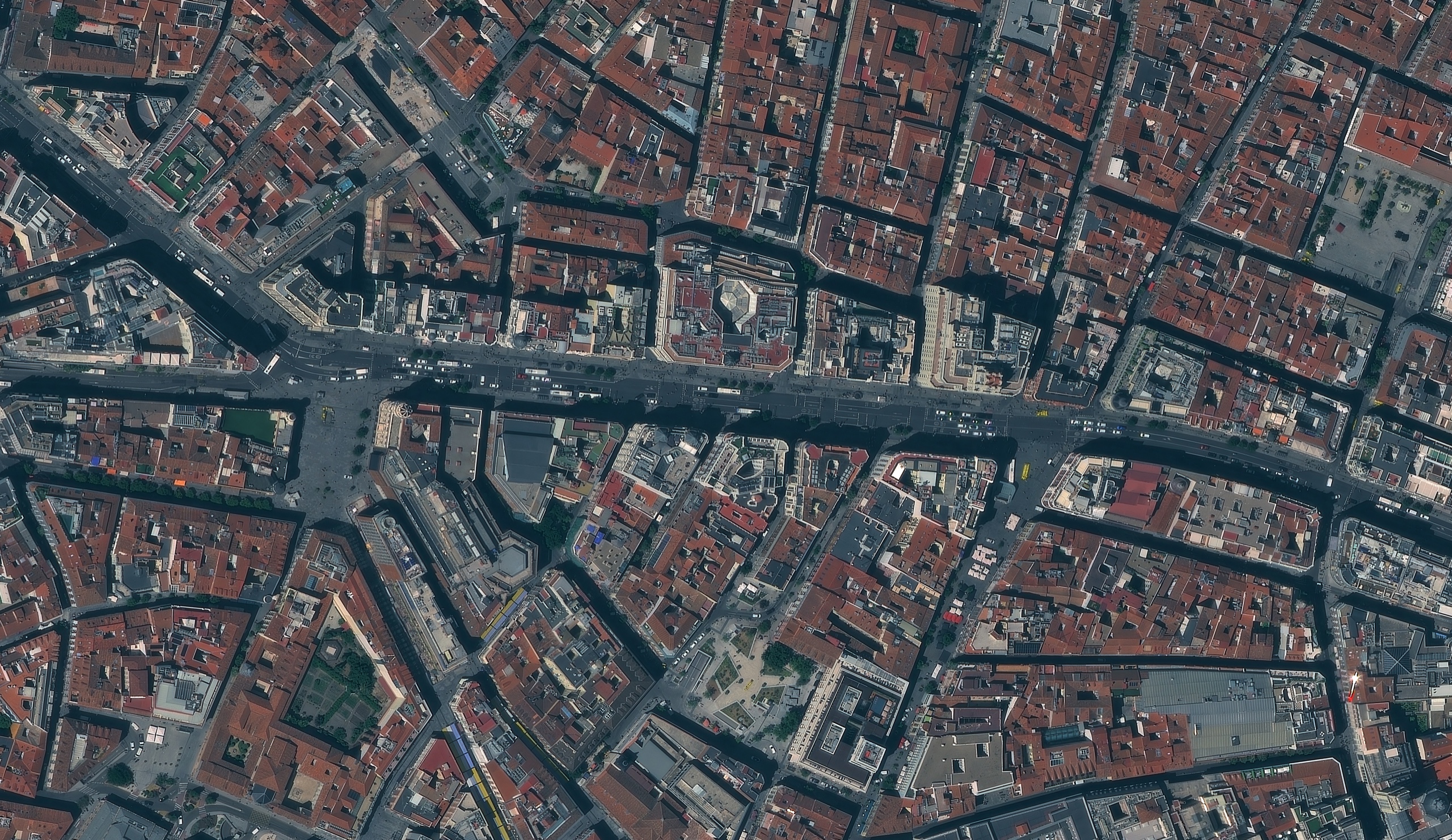
A sub-metre optical satellite image of central Madrid, showing the dense grid of red tile roofs, inner courtyards and busy streets.
This satellite view of Madrid, Spain was captured from orbit, not by plane or drone. Click the aerial view to open it full size.
Aerial view of Madrid, Spain from space
Historic European centres are some of the hardest places to map: buildings share walls, courtyards are small and streets are narrow. At this resolution each courtyard, roof terrace and crossing is clear, and individual cars and buses can be counted on the main avenues.
Imagery like this supports city mapping, heritage records, rooftop solar studies and traffic analysis, and it can be ordered as a georeferenced GeoTIFF ready for GIS.
What you can see in this aerial view
Red clay tile roofs and inner courtyards
Main avenues with cars and buses
Plazas and pedestrian streets
Roof terraces and rooftop equipment
Who uses satellite imagery of places like this
Municipalities and engineers use it for urban planning, and insurers use it to check roofs and property details for insurance work.
Order archive images or new tasking, from 15cm HD and 30cm optical to all-weather SAR, delivered worldwide as GeoTIFF. Tell us your area and we send available images and a price, usually within 24 hours.