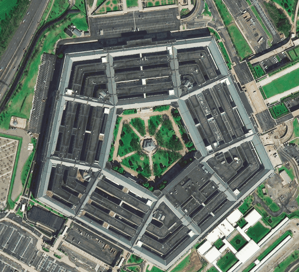
SuperView-2 satellite imagery of the Pentagon in Virginia, USA, at 0.4m resolution, from a 9-band multispectral sensor.
This satellite view of The Pentagon, USA was captured from orbit, not by plane or drone. Click the aerial view to open it full size.
Aerial view of The Pentagon, USA from space
The five rings of the building, the central courtyard with its trees and paths, the roof structure and the surrounding car parks are all clear.
SuperView-2 collects 9 spectral bands, including red edge, NIR1 and NIR2, so the same data supports vegetation and material analysis as well as sharp visual mapping.
Order archive images or new tasking, from 15cm HD and 30cm optical to all-weather SAR, delivered worldwide as GeoTIFF. Tell us your area and we send available images and a price, usually within 24 hours.