Optical Satellite Imagery Acquisition Modes: A Complete Guide by XRTech Group
In the modern geospatial world, satellite imagery has evolved far beyond simple pictures of the Earth. Today, high-resolution optical imagery provides critical insights for industries, ranging from agriculture and urban planning to mining and disaster management. At XRTech Group, our partnership with China Siwei offers access to a powerful constellation of over 130 satellites, delivering precise, reliable, and ready-to-use data for projects worldwide.
Understanding optical satellite imagery acquisition modes and their spectral capabilities is essential for selecting the right data for your mission. This guide explains each mode, the types of imagery available, and how XRTech ensures unmatched accuracy, speed, and versatility.
What is Optical Satellite Imagery?

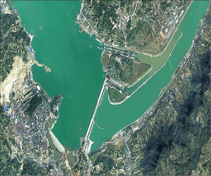
Optical satellite imagery captures light reflected from the Earth’s surface, including the visible, near-infrared, and short-wave infrared spectrum. Unlike radar or LiDAR sensors, optical satellites work like a high-resolution camera in space. The resulting images are used for mapping, monitoring, and analyzing land cover, vegetation, urban areas, and natural resources.
Multispectral and hyperspectral imagery also fall under optical satellite data. While multispectral sensors capture light in several discrete bands such as red, green, blue, and near-infrared, hyperspectral sensors record hundreds of narrow spectral bands to detect the chemical composition of the ground or vegetation. This makes optical imagery a versatile tool for precision agriculture, mineral mapping, environmental monitoring, and urban planning.
1. Optical Satellite Imagery Acquisition Modes
Modern satellites are agile and flexible, enabling different acquisition modes to suit diverse projects. XRTech Group offers access to all these modes, allowing clients to collect the exact type of imagery they need for high-resolution analysis.
Mono Acquisition
Mono acquisition is the most standard method, where a satellite captures a single image of a target area during its orbital pass. This mode is ideal for:
General land-use monitoring
Historical change detection
Crop health tracking
Large-area surveillance
While mono imagery provides high-resolution two-dimensional data, it does not include height information. However, it is cost-effective and sufficient for most mapping and monitoring applications.
Stereo and Tri-Stereo Acquisition
For projects requiring high-precision elevation data, stereo and tri-stereo acquisitions are crucial.
Stereo Mode: The satellite captures two images from different angles—usually forward and backward or left and right. This “binocular vision” allows the creation of Digital Elevation Models (DEMs) and Digital Surface Models (DSMs), enabling precise measurement of terrain height and urban structures.
Tri-Stereo Mode: Here, the satellite captures three images of the same location—forward, nadir (straight-down), and backward. This mode is particularly useful for dense urban areas or rugged terrain, as it reduces data gaps caused by shadows, steep slopes, or “urban canyons.”
Stereo and tri-stereo acquisition are essential for:
Urban planning and building footprint extraction
Infrastructure monitoring for highways, pipelines, and bridges
High-accuracy mapping for engineering projects
Strip Mapping: Long and Multi-Strip
Strip mapping is designed for continuous coverage of linear features and large regions.
Long Strip Mapping: Captures a continuous swath along the satellite’s orbital path. It is perfect for linear infrastructure projects such as:
Pipelines
Roads and railways
Borders and corridors
Multi-Strip Mapping: Multiple parallel passes are used to cover large areas at very high resolution. This method is suitable for:
Regional environmental studies
Large-scale urban development monitoring
Forest management and land use classification
Target Collection (Point Targets)
Agile satellites, like SuperView-2, can tilt quickly to capture multiple point targets in a single pass. XRTech Group satellites can:
Capture up to 30 targets per pass
Collect up to 240 targets per day
This makes target collection ideal for monitoring dispersed assets such as:
Mines and mineral exploration sites
Telecommunication towers
Remote infrastructure and transportation networks
Corridor Acquisition
Unlike older satellites that scan only along the orbital path, corridor acquisition allows satellites to scan in any direction, following roads, rivers, or coastlines. This provides:
Flexible, project-specific coverage
Efficient monitoring of linear features
Reduced gaps in urban or complex terrain
Corridor acquisition is especially valuable for:
Highway and rail planning
Coastal monitoring
Disaster response mapping
2. The Spectral Spectrum: Panchromatic, Multispectral, and Hyperspectral
Optical imagery is also categorized by spectral bands, which determine the type of information that can be extracted.
Panchromatic (PAN)
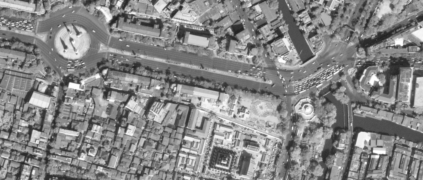
Black-and-white imagery capturing a single broad band of light
Provides the highest spatial resolution, with details as fine as 0.3 meters per pixel
Ideal for:
Detailed structural analysis
Urban mapping
High-resolution 2D visualization
Multispectral Imagery
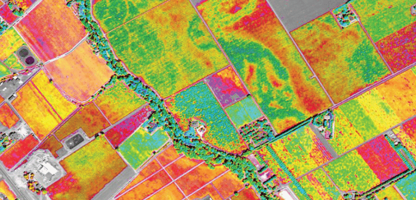
Captures multiple bands of light, typically including red, green, blue, and near-infrared
Some satellites, like GF-6 and SuperView-2, also include specialized bands like Red Edge, which are critical for precision agriculture
Applications include:
Crop stress detection and disease monitoring
Vegetation health mapping
Water quality analysis
Hyperspectral Imagery

Captures hundreds of narrow spectral bands, covering 400 to 2500 nanometers
Provides a chemical fingerprint of the Earth’s surface
Used for:
Mineral exploration, such as gold, copper, and lithium
Environmental monitoring
Identifying subtle changes in vegetation or soil chemistry
XRTech’s Khaza’in platform leverages hyperspectral data to replace expensive field surveys and enable faster decision-making
3. The XRTech Constellation
XRTech Group’s partnership with China Siwei ensures access to a diverse fleet of satellites optimized for different resolutions and revisit frequencies.
SuperView Neo-1: A flagship 0.3-meter VHR satellite offering daily revisits for intelligence and high-precision mapping
SuperView-2 (GFDM): An agile 0.4-meter sensor with eight multispectral bands, ideal for environmental monitoring and complex target collection
GF-7: Provides 0.65-meter stereo mapping with a laser altimeter, achieving superior vertical accuracy for rugged terrain
GF-4: A geosynchronous satellite offering 20-second revisit times, perfect for monitoring large regions in near real-time
These satellites allow XRTech to deliver imagery that meets engineering-grade standards, supports digital twins, and enables AI-driven analysis.
4. Accuracy Specifications and Technical Features
XRTech imagery is designed for precision and reliability, making it suitable for demanding applications.
Horizontal Accuracy: Geolocation at nadir ranges from 5–8 meters CE90 (SuperView-1) to 10 meters CE90 (SuperView-2)
Vertical Accuracy: Standard DEMs provide ±3 meters RMSE, while GF-7 offers ≤0.5 meters in plains and ≤1 meter in rough terrain
Off-Nadir Angle Adjustments: Users can request specific viewing angles (e.g., ONA ≤ 10°) to minimize building lean and maximize 3D modeling accuracy
Flexible Processing: Data comes ready for GIS, CAD, and AI platforms
5. Global Applications of Optical Satellite Imagery
XRTech Group imagery serves multiple industries and operational needs.
Agriculture:
Yield estimation with over 85% accuracy
Crop classification exceeding 90% accuracy
Detection of stress, disease, and irrigation issues
Mining and Energy:
Real-time monitoring of tailings dams and pipelines using InSAR and optical imagery
Identification of mineral deposits with hyperspectral analysis
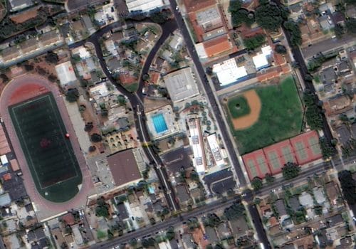
Urban Planning and Infrastructure:
Mapping city growth and urban changes
Creating 3D models for planning and engineering
Disaster Management:
Rapid flood mapping and evacuation modeling within 24 hours
Damage assessment after storms, earthquakes, or industrial accidents
Environmental Monitoring:
Tracking deforestation, coastal erosion, and water pollution
Monitoring wetlands, forests, and agricultural landscapes
The XRTech Advantage: Speed, Flexibility, and Global Reach
Choosing XRTech Group offers unmatched benefits for geospatial projects:
Fast Delivery: Earth observation imagery delivered in under seven days and custom DEMs in under 21 days
Cloud-Based Access: Siwei Earth system allows one-click access and processing of up to 50 terabytes of data daily
Global Reach Without Bottlenecks: As a non-U.S. provider, XRTech avoids export license delays common in other platforms
Comprehensive Sensor Suite: Access to panchromatic, multispectral, hyperspectral bands, and VHR imaging for specialized tasks
Accuracy You Can Trust: Engineering-grade vertical and horizontal precision ensures reliable measurements for urban planning, infrastructure monitoring, and natural resource management
Conclusion
Optical satellite imagery is no longer a simple tool for observation. It has become a powerful engine for insight, enabling precise mapping, monitoring, and decision-making across industries. Understanding the acquisition modes, spectral capabilities, and technical specifications of optical satellites allows organizations to select the right data for every mission.
Through its partnership with China Siwei, XRTech Group delivers high-resolution optical imagery with unmatched speed, accuracy, and flexibility. Whether your project requires mono, stereo, tri-stereo, strip mapping, target collection, or corridor acquisition, XRTech provides the data and tools needed to visualize, analyze, and act on Earth observation data with confidence.
With precision imagery, advanced spectral bands, and global coverage, XRTech enables organizations to turn satellite data into actionable insights, supporting everything from precision agriculture to urban planning, mining, and disaster response.
Key Takeaways:
Optical satellite imagery captures visible, near-infrared, and short-wave infrared light
Mono, stereo, tri-stereo, strip mapping, target collection, and corridor acquisition offer flexibility for different project needs
Panchromatic, multispectral, and hyperspectral imagery provide detailed structural and chemical insights
XRTech’s satellite constellation delivers high-resolution, accurate, and ready-to-use imagery
Applications include agriculture, mining, urban planning, disaster management, and environmental monitoring
Engineering-grade horizontal and vertical accuracy supports critical decision-making
XRTech offers speed, flexibility, global access, and comprehensive spectral data to meet complex geospatial requirements

