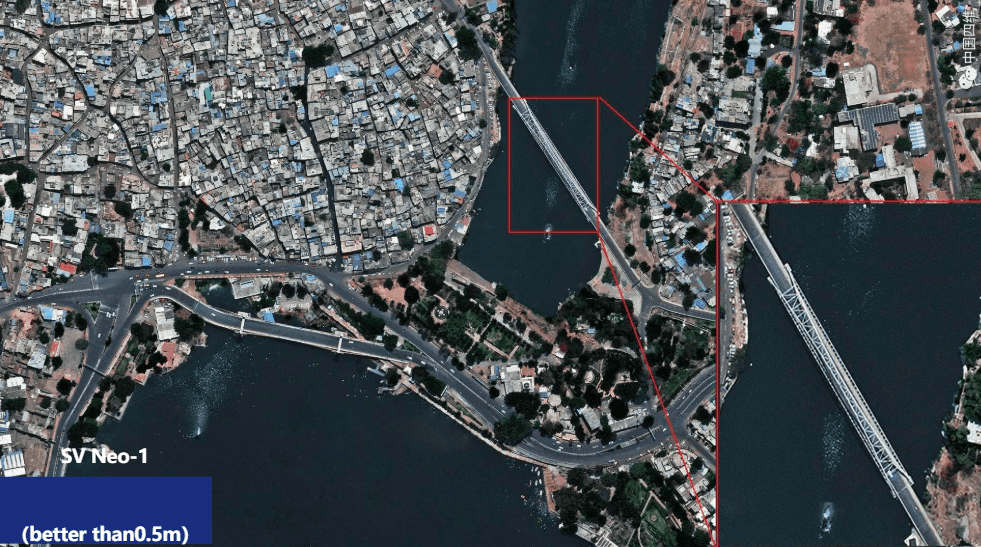
Super resolution satellite imagery is standard satellite data that has been computationally processed to produce a sharper, more detailed image than the satellite physically captures. XRTech Group’s highest native capture is 25 to 30 cm from SuperView Neo-1. Super resolution processing takes that same data and delivers it at 15 cm HD. Each pixel now covers a smaller area on the ground, and features that were hard to make out at 30 cm become clear.
This is not digital zoom. It recovers real detail that exists in the raw signal but is not visible at native resolution. Think of it as pulling more information out of the same photo rather than just blowing it up.
Quick Answer: Super resolution satellite imagery is processed to a finer resolution than the satellite natively captures. XRTech delivers up to 15 cm HD from its 25 to 30 cm native capture. At 15 cm you can identify vehicles, road markings, building materials and small structures. It is worth ordering when native 30 cm imagery is not detailed enough for your project.
What Does Super Resolution Actually Mean?
Every satellite pixel covers a fixed area on the ground. At 30 cm, one pixel equals one 30 x 30 cm square. You can see a car parked on a street. You cannot tell what type of vehicle it is or read the markings around it.
At 15 cm HD, each pixel covers a 15 x 15 cm square. Now you can distinguish a car from a van, see lane markings, and identify whether a loading bay is occupied.
Super resolution achieves this by analyzing patterns and slight variations across multiple captures of the same scene, then reconstructing detail that the native pixel size was too large to show individually. The key rule: enhancement up to 2x native resolution recovers real information. Some providers advertise 5x or 10x super resolution. At those factors, the software is generating content from training data, not from the actual scene. Do not use those products for engineering, inspection, or any application where accuracy matters.
Super Resolution vs High Resolution vs Medium Resolution
| Tier | Resolution | What you can identify |
|---|---|---|
| Super Resolution HD | 15 cm | Vehicles, lane markings, rooftop materials, small structures |
| Super High Resolution | 25 to 30 cm | Vehicles, buildings, road types, infrastructure |
| Very High Resolution | 31 to 50 cm | Buildings, roads, land cover types |
| High Resolution | 51 cm to 1 m | Urban blocks, field boundaries |
| Medium Resolution | 1 m to 10 m | Regional land use, crop types, forests |
The jump from 30 cm to 15 cm is the difference between knowing a vehicle is there and knowing what type it is. For urban work, infrastructure inspection, and anything requiring small feature detail, that gap matters. For flood mapping, deforestation monitoring, or regional agriculture, medium resolution at $1/km² does the same job at a fraction of the cost. Buy satellite imagery now!
What Is the Purpose of Super Resolution?
Satellites cannot physically capture at 15 cm because a smaller pixel collects less light, which creates noise. Manufacturers balance pixel size against image quality, which is why even the best commercial satellites top out at 25 to 30 cm natively.
Super resolution solves that trade-off using software. The result is 15 cm visual clarity without the noise you would get from a physically smaller pixel.
In practical terms, 15 cm HD lets you:
- Tell vehicle types apart, not just spot vehicles
- See road lane markings, pedestrian crossings and street furniture
- Assess rooftop and surface materials on buildings
- Identify individual solar panels and their orientation
- Monitor construction progress at the structural detail level
- Detect surface defects on roads and infrastructure
Is Super Resolution Worth It?
It depends on what you are trying to identify.
Order super resolution HD when:
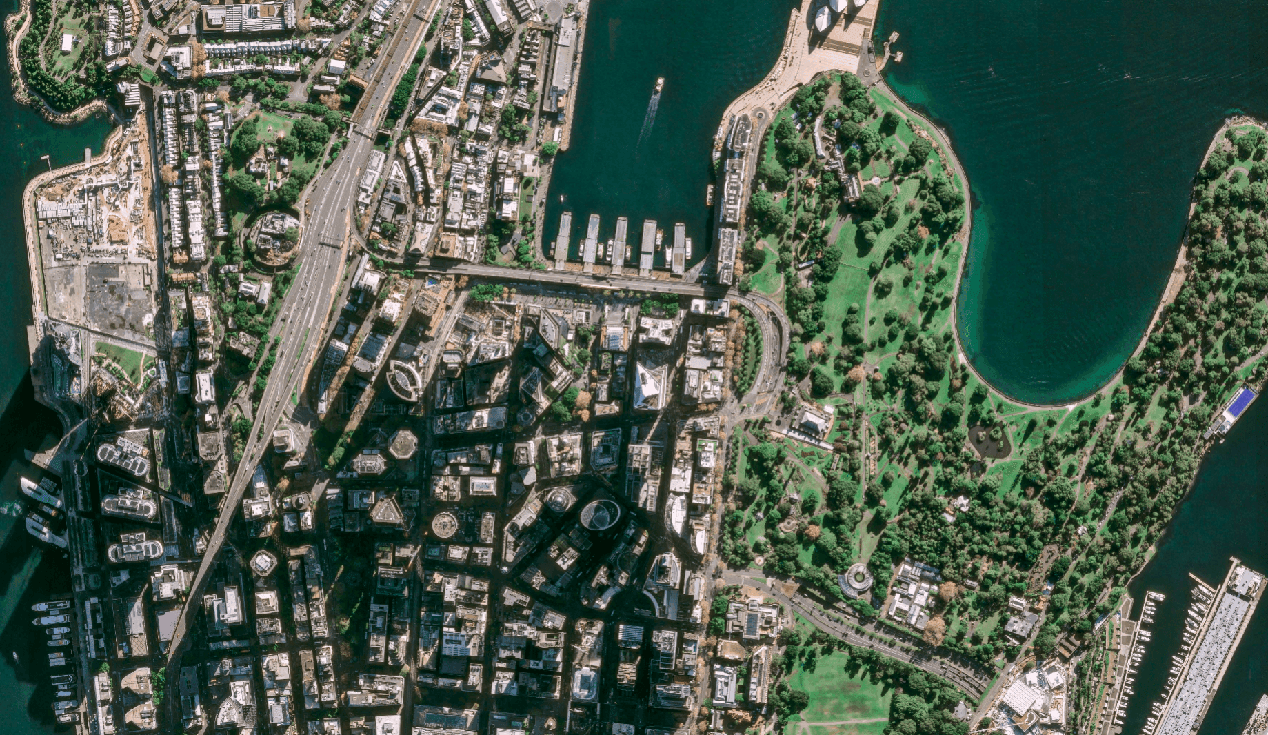
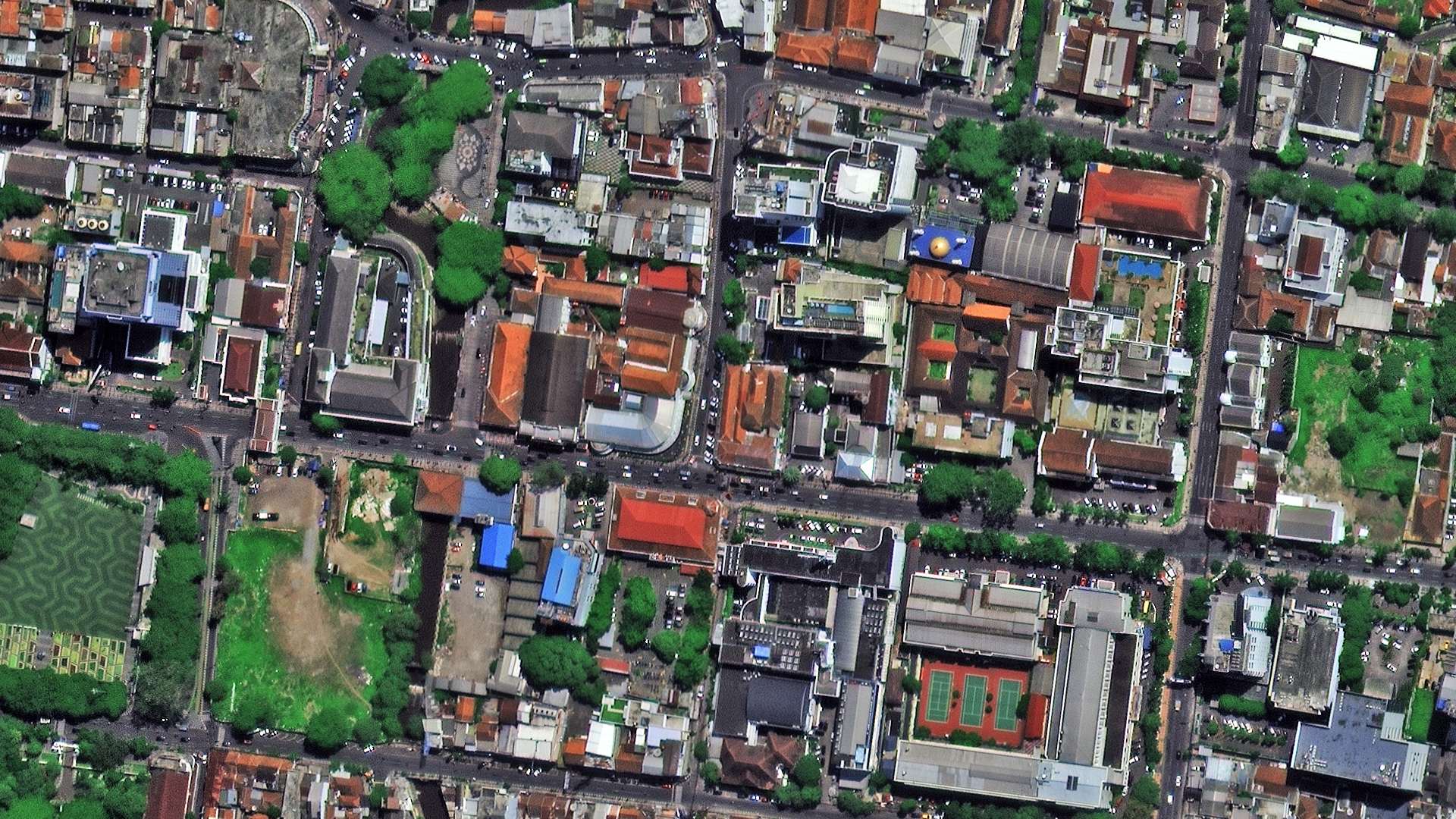
Your target features are smaller than 60 cm across and native 30 cm imagery does not resolve them clearly. This covers most urban inspection, property mapping, and infrastructure monitoring work. XRTech Group’s AbuDhabi 15 cm HD basemap is a good example: Abu Dhabi’s dense development means small features matter, and the 15 cm product resolves them where the 30 cm archive does not.
Stick with native SHR at 30 cm when:
Your features are larger than 60 cm, or you are mapping a large area where the cost difference between SHR and HD is significant. For most non-urban projects, 30 cm is more than enough.
Use medium resolution when:
You need regional coverage for environmental monitoring, crop mapping, or flood extent work. Medium resolution at $1/km² gives you the same analytical output at a much lower cost.
Is It Better to Have Super Resolution On or Off?
On, for urban, infrastructure, and inspection applications where 15 cm detail changes what you can see and measure.
Off, for anything regional or environmental where the extra detail does not affect the result and the cost difference is not justified.
One important point: if a provider is offering more than 2x enhancement from native resolution (for example, 15 cm from a native 1 m sensor), the output is not based on real scene information. It is computer-generated content. That is fine for visual presentation but not for any project requiring accurate, verified data.
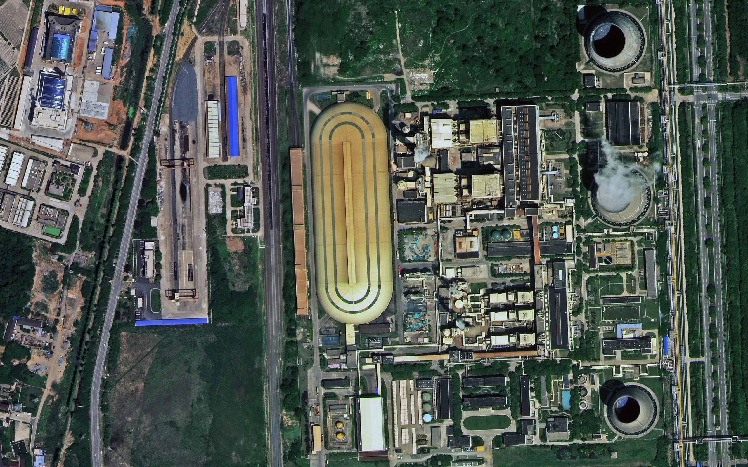
Applications of Super Resolution Satellite Imagery
Urban planning. Verify building setbacks, monitor construction against approved plans, and check encroachment without sending a field team.
Infrastructure inspection. Assess road surfaces, bridge decks, pipeline corridors and power line routes at a detail level that was previously only achievable by aircraft or drone.
Property and insurance. Identify roof damage, assess building condition, and verify as-built structures against permits at sub-30 cm resolution.
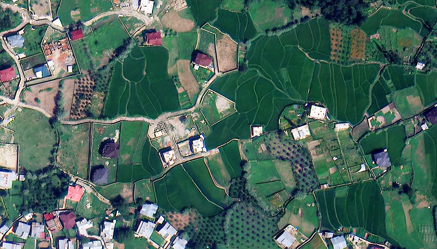
Precision agriculture. Map crop stress, irrigation coverage and pest damage at the row level rather than the field level.
Disaster response. Assess structural damage after earthquakes, floods or storms quickly enough to direct emergency resources to the right locations.
Satellite Imagery Pricing
| Product | Resolution | Price from |
|---|---|---|
| Medium resolution | 2 m | $1/km² |
| High resolution | 51 to 80 cm | $5/km² |
| Very high resolution | 31 to 50 cm | $13/km² |
| Super high resolution | 25 to 30 cm | $20/km² |
| Super resolution HD | 15 cm | Custom quote |
| New tasking (SHR) | 25 to 30 cm | $8/km² |
Super resolution HD pricing depends on area coverage and whether a basemap already exists for your location. XRTech Group’s AbuDhabi 15 cm HD basemap is available now. Contact us with your area of interest for a quote.
Frequently Asked Questions
What is super resolution satellite imagery?
Super resolution satellite imagery is imagery processed to a finer resolution than the satellite sensor physically captures. XRTech Group natively captures at 25 to 30 cm from SuperView Neo-1 and delivers super resolution at 15 cm HD, where each pixel covers a 15 x 15 cm area on the ground.
What is the difference between super resolution and high resolution satellite imagery?
High resolution is a resolution tier, typically 51 cm to 1 m, where you can see buildings and roads but not small features. Super resolution is a processing technique that takes native 25 to 30 cm imagery and enhances it to 15 cm. They describe different things: one is what the sensor captures, the other is what processing delivers from that capture.
Is super resolution satellite imagery worth it?
Yes, when your project requires identifying features smaller than 60 cm or when native 30 cm archive imagery is not detailed enough for your application. No, when you are mapping large regional areas where medium resolution does the same job cheaper.
Is it better to have super resolution on or off?
On for urban inspection, infrastructure monitoring and precision mapping. Off for regional environmental work where the cost premium is not matched by analytical benefit. Avoid super resolution products that claim more than 2x enhancement from the native sensor resolution, as those generate content rather than recovering real detail.
What can 15 cm HD satellite imagery identify that 30 cm cannot?
At 15 cm you can distinguish vehicle types, read road lane markings, assess rooftop and surface materials, identify individual solar panels, and detect structural surface conditions. At 30 cm, vehicles appear as shapes and road markings are indistinct.
What is the 15 cm HD basemap from XRTech Group?
The 15 cm HD basemap is a pre-processed, orthorectified tile set covering urban areas at super resolution. XRTech Group’s AbuDhabi 15 cm HD product is a current example, covering Abu Dhabi’s metro area at 15 cm resolution for planning, inspection and infrastructure use.
Can super resolution replace drone surveys?
For large areas, yes. A drone achieves higher resolution than satellite super resolution but covers a fraction of the area per day. For projects above a few hundred km², 15 cm HD satellite imagery is faster and cheaper. For small sites where 2 to 5 cm resolution is needed, drone surveys are still the better tool.
What resolution do I need for my project?
Start with your smallest target feature. Under 60 cm: use 15 cm HD. Between 60 cm and 1.5 m: use 25 to 30 cm SHR. Between 1.5 m and 5 m: use VHR at 31 to 50 cm. Larger than 5 m or regional scale: medium resolution is sufficient.
10 Key Points
- Super resolution processes native 25 to 30 cm satellite data to deliver 15 cm HD output.
- Each pixel at 15 cm covers a 15 x 15 cm area on the ground, half the area of a 30 cm pixel.
- Up to 2x enhancement recovers real detail from the captured signal. Beyond that, content is generated, not observed.
- 15 cm HD lets you identify vehicle types, lane markings, rooftop materials, and surface conditions.
- XRTech Group’s AbuDhabi 15 cm HD basemap is an available super resolution product for that metro area.
- Super resolution is worth the cost for urban inspection, infrastructure monitoring and precision agriculture.
- For regional mapping and environmental monitoring, medium resolution at $1/km² delivers the same result cheaper.
- Super resolution does not penetrate cloud cover. Use SAR for all-weather coverage.
- All XRTech super resolution products are LEVEL2A orthorectified and geometrically accurate.
- Providers advertising 5x or 10x super resolution are generating synthetic content, not recovering real scene detail.
Order Super Resolution Satellite Imagery
XRTech Group delivers 15 cm HD super resolution and native 25 to 30 cm SHR imagery from 130+ satellites. Archive SHR starts at $20/km² with 48-hour delivery. Request a free sample tile before ordering.
Contact: admin@xrtechgroup.com | +971 58 885 3151