By Mustafa Jawaad, General Manager, XRTech Group
Quick answer: To see your house on Google Earth, open earth.google.com or the Google Earth app, type your full address into the search bar and press Enter. Google Earth flies to your home and shows it from above in satellite view, often in 3D. Drag the yellow Pegman onto the street in front of your house for a ground-level Street View, and open Historical imagery to see older pictures of your home. The view is not live: the image of your house is a recorded photo that is usually months to a few years old.
Google Earth is the easiest free way to look at your own home from the sky, and most people can find their house in under a minute. What confuses people is everything around it: why the picture is old, why the roof looks blurry, where the 3D view went, and whether a "live" view exists at all. This guide covers every way to see your house on Google Earth and Google Maps, on a computer, Android phone and iPhone, plus how to check how old the image is and what to do when it is not good enough.
How to See Your House on Google Earth (Computer)
Google Earth runs in Chrome, Edge, Firefox and Safari with nothing to install. These steps work on Windows, Mac and Chromebook:
- Open Google Earth: go to earth.google.com/web in your browser.
- Search your address: click the search box at the top left, type your street address with city and postcode or ZIP code, then press Enter.
- Pick the right result: Google Earth flies to the location and drops a pin on your house.
- Zoom in: scroll with your mouse, pinch on a trackpad, or use the + button at the bottom right until your roof, yard and driveway fill the screen.
- Look around: drag to move, hold Shift and drag to tilt and rotate, and click the compass to point north again.
Tip: if your address is not found, search your street name or a nearby landmark, then pan to your home. You can also paste GPS coordinates (for example 25.2048, 55.2708) straight into the search box. If you only see a flat map with no photo, switch the base map from Map to Satellite.
How to See Your House on the Google Earth App (Android and iPhone)
- Install the free Google Earth app from Google Play or the App Store and open it.
- Tap the search icon (magnifying glass) and type your home address.
- Tap your address in the results. The app flies to your house.
- Pinch open to zoom in on the roof and garden. Drag two fingers up or down to tilt the view, and twist two fingers to rotate.
- Tap the compass to reset the view to north.
Prefer Google Maps? Open the Maps app, search your address, tap the Layers button and choose Satellite. It uses the same satellite and aerial photos as Google Earth, so your house looks the same in both. Our guide to Google Maps satellite view covers that layer in more detail.
How to Get a Street View of Your House
Satellite view shows your roof. Street View shows the front of your house as you would see it from the road, in 360° photos taken by Google's camera cars, trekkers and contributors. Google's Street View library now holds more than 280 billion images across over 100 countries and territories, so most homes on public roads are covered.
Street View in Google Earth
- Find your house in Google Earth as above.
- Grab the Pegman (the small yellow figure at the bottom right) and drag it over the map. Roads with Street View turn blue.
- Drop Pegman on the blue line in front of your house.
- Drag the picture to turn around, and click the arrows on the road to move along the street.
- To leave, click Back or the X at the top.
- On the Google Earth app, tap the Pegman or Street View button instead, then tap any blue line near your home.
Street View in Google Maps on a computer
- Open Google Maps and search your address.
- Click the photo thumbnail labelled with a 360° icon in the side panel, or drag Pegman from the bottom right onto the blue line outside your house.
- Point your cursor in the direction you want to go and click to move. Scroll or use + and - to zoom.
- Click the compass at the bottom right to face north.
Street View in the Google Maps app
- Open Google Maps on your Android phone, iPhone or iPad.
- Search your address, or touch and hold your house on the map to drop a pin.
- Tap the thumbnail with the Street View icon at the bottom of the screen.
- Swipe to look around, or tap More and turn on Tilt to look to steer with your phone. Tap the arrows to move, and pinch to zoom.
- Tap the split-screen arrows to see a small map under the photo, which helps you jump to the right house.
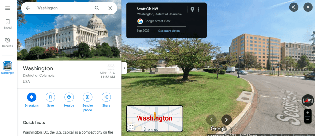
Street View in Google Maps shows the capture month at the top left. Click See more dates to step back through older drive-bys of the same street.
How to See Your House in 3D
In many cities and suburbs, Google Earth wraps its aerial photos over 3D models of buildings and trees, so you can fly around your home and see the walls, not just the roof. 3D coverage is best in large towns. In rural areas you will usually see a flat 2D image instead.
- Google Earth web: tilt with Shift and drag, or switch between 2D and 3D with the button at the bottom right. If buildings look flat, open Map Style and make sure 3D buildings are turned on.
- Google Earth app: drag two fingers up the screen to tilt into 3D.
- Google Maps app (Immersive View): where it is available, open Street View and tap Aerial at the bottom left to switch to a 3D bird's eye view, then tap Street to go back. Immersive View is built from different imagery, so a house that is blurred in Street View may not be blurred there.
How to See Old Images of Your House (Historical Imagery)
Want to see your house before the extension went on, or the street before your home was built? Google Earth keeps older satellite and aerial photos, and in some places the archive goes back about 80 years. Coverage varies: busy cities have dozens of dates, while rural homes may have only a few.
Google Earth on the web and mobile
- Find your house and make sure the base map is set to Satellite (historical imagery does not work on the Map style).
- Click or tap the Historical imagery button (clock icon) in the toolbar.
- A timeline appears. Click a year, or use Previous and Next to step through each capture. Dots on the timeline mark available years, and smaller dots mark extra months.
- Choose Timelapse to play the changes as a short animation.
- Click the newest date to return to the current image. 3D buildings switch off while historical imagery is on.
Google Earth Pro (free desktop app)
- Download Google Earth Pro for Windows, Mac or Linux. It is free.
- Search your address in the Search panel on the left.
- Click the clock icon in the top toolbar, or go to View > Historical Imagery.
- Drag the time slider at the top left to move between dates.
- Read the exact Imagery Date in the status bar at the bottom of the window.
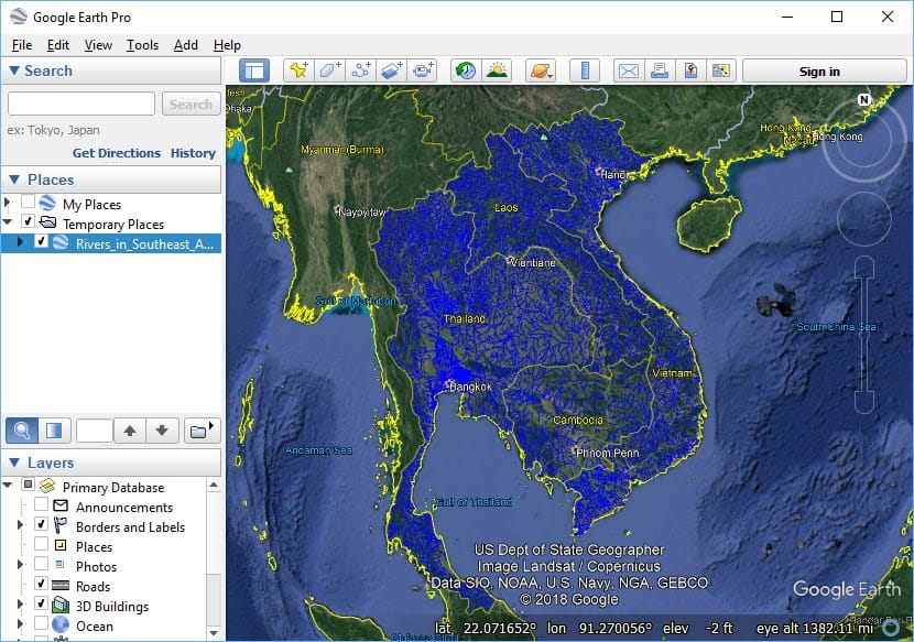
Google Earth Pro shows historical imagery through the clock icon in the toolbar, and the imagery date of the current view in the status bar.
Older Street View photos of your house
Street View keeps old drive-bys too, and Google Earth now shows historical Street View as well as Google Maps. On a computer, open Street View outside your house and click See more dates in the top left box, then scroll the thumbnails at the bottom. In the Maps app, tap Layers, then Street View, tap a blue line, then See more dates and pick an image from the carousel. Not every street has older dates.
Can You See a Live View of Your House on Google Earth?
No. Google Earth and Google Maps never show a live or real-time view of your house. Every picture is a still photo captured on one day by a satellite or an aircraft, then processed and stitched into the map, sometimes months later. Google says it updates imagery on no fixed schedule. In practice:
- Big cities are often refreshed every one to three years.
- Suburbs and small towns may wait several years.
- Rural and remote homes can show the same image for five years or more.
- Street View is refreshed separately, on its own driving schedule.
The best way to know how current your view is: read the Imagery Date in Google Earth Pro, check the newest date on the Historical imagery timeline, or look at the capture month in Street View. Any website offering a free "live satellite view of your house" is showing these same recorded images or a weather satellite feed that cannot resolve a single building. We explain the real options for recent pictures in can I see a live satellite view of my house.
Google Earth vs Google Maps vs Street View: Which Shows Your House Best?
Each free tool shows your home differently. Use this table to pick the right one:
Tool
What you see of your house
How current
Cost
Google Earth (web and app)
Roof and plot from above, 3D in many cities
Months to several years old
Free
Google Earth historical imagery
Older aerial and satellite photos of the same spot
Past dates, up to decades back
Free
Google Earth Pro
Same imagery, plus exact image dates, measuring and printing
Same as Google Earth
Free download
Google Maps Satellite
Top-down photo of your home, with directions and place info
Same source as Google Earth
Free
Street View
Front of your house from the road, in 360°
Shown on screen, usually one to several years old
Free
Commercial 30 cm satellite image
Sharp top-down image with a known capture date and time
Days old from archive, or a new capture to order
Paid, priced per km²
Why Your House Looks Blurry, Old or Missing on Google Earth
If you cannot find your house, or it looks like a smudge, one of these is usually the cause:
- New build: the image was taken before your home was built, so you see an empty plot or a building site.
- Low-resolution source: rural areas are often covered by satellite photos of around 1 m or coarser per pixel, so a house is only a few pixels wide.
- Slow connection: sharp tiles load last. Wait a few seconds or reload.
- Too much zoom: past the native resolution, Google Earth just enlarges pixels, so zoom out one step.
- Blurred on purpose: some sensitive sites are degraded, and homes whose owners asked for privacy are blurred in Street View.
- Clouds or shadows: a cloudy or low-sun capture can hide part of your property.
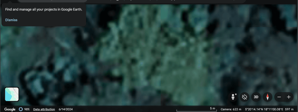
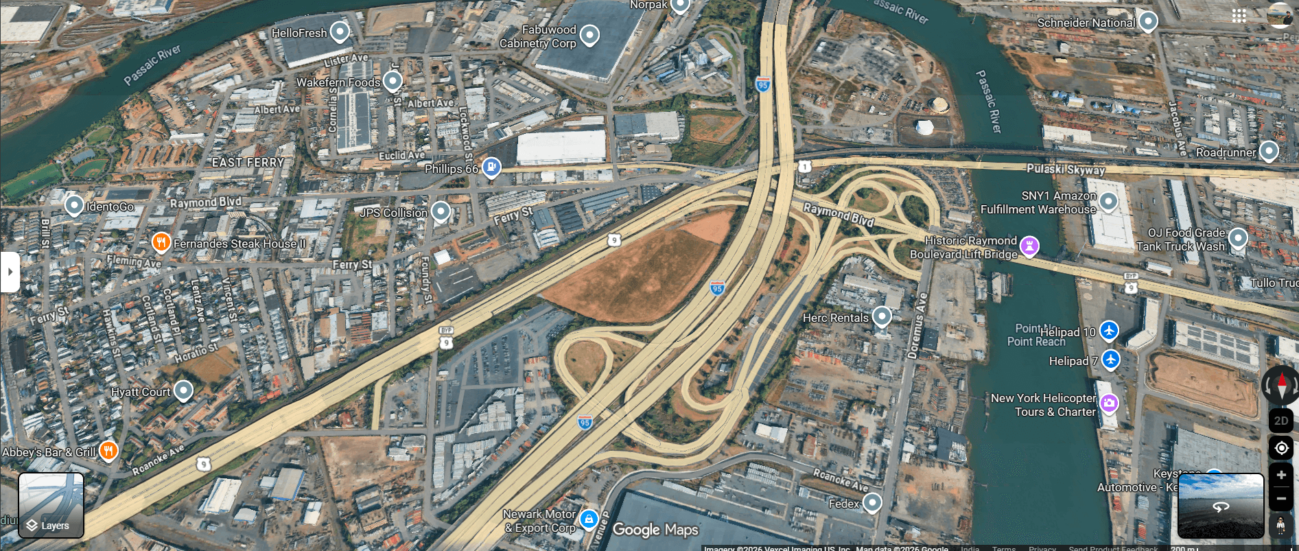
A low-resolution tile in Google Earth. Zooming further only enlarges the pixels, it does not add detail. More fixes in why is Google Earth so blurry.
How to Blur Your House or Report Outdated Imagery
You can ask Google to blur your home in Street View. Think before you do it: once a blur is published, Google cannot remove it, so it stays for future visitors and owners too.
- Open Google Maps and go to Street View in front of your house.
- Click Report a problem at the bottom right (on the app, tap More, then Report a problem).
- Select that you want your home blurred, move the red box over your house, and add your email.
- Click Submit. Google reviews the request and may email you for details.
The blur covers Street View only. Your roof still shows in the satellite and 3D views, and Immersive View uses separate imagery. If your satellite view is badly out of date, use Google's outdated imagery form, linked from the Street View help page. It helps Google decide where to fly next, but Google does not commit to a date.
When Google Earth Is Not Enough: A Recent, Dated Image of Your House
Google Earth is perfect for a quick look. It falls short when you need to know exactly when the picture was taken, or need detail sharp enough for a roof check, a boundary question, an insurance claim or a property abroad you cannot visit. That is where a commercial satellite image of your house helps.
Recent archive images at 30 cm start from around USD 20 per km², with a 25 km² minimum order. A brand-new capture over your address (satellite tasking) starts from about USD 30 per km², with a 100 km² minimum. Need something free first? Try the options in where to get high-quality satellite images for free.
Buy a Sharper, Dated Satellite Image of Your House
Google Earth shows you a free map layer of unknown age. XRTech Group gives you a 30 cm satellite image of your exact address with the capture date and time on record, from an archive of more than 130 satellites or a new capture ordered for you. Compare the difference below, then search your address or ask our team for a free quote.
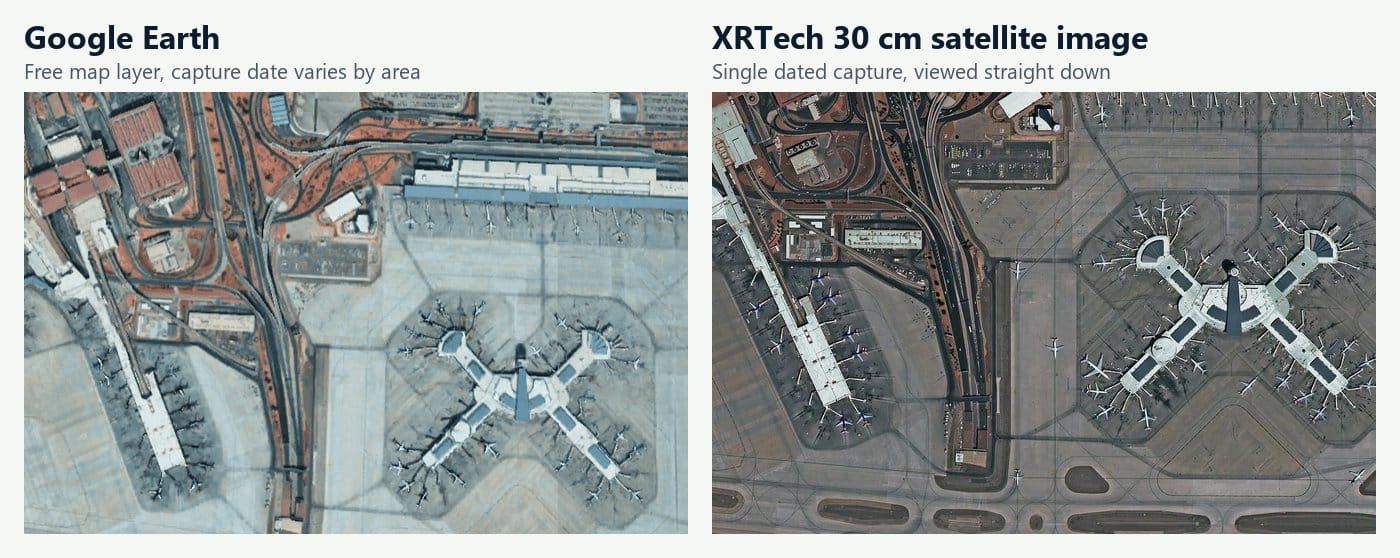
Same airport, two sources: the free Google Earth layer (left) and an XRTech 30 cm satellite image (right), where aircraft, gates and road markings are clearly visible.
Frequently Asked Questions
How do I see my house on Google Earth for free?
Open earth.google.com in a browser or the free Google Earth app, type your address in the search bar and press Enter. Google Earth flies to your house. Zoom in to see the roof, tilt for 3D, and drag Pegman onto the road for Street View. No account or payment is needed.
Can I see a live view of my house on Google Earth?
No. Google Earth shows recorded satellite and aerial photos, not a live feed. The newest image of your home is usually months to a few years old. For a view of your house right now, use a home security camera or a drone. For a recent dated image from space, order a commercial satellite image.
How old is the Google Earth image of my house?
It depends on where you live. Cities are often updated every one to three years, rural areas much less often. To check, open your house in Google Earth Pro and read the Imagery Date in the status bar, or open Historical imagery in Google Earth and look at the newest date on the timeline.
How do I see a street view of my house?
In Google Maps or Google Earth, search your address, then drag the yellow Pegman onto the blue line in front of your home. On a phone, tap the Street View thumbnail after searching. The capture date appears on screen.
How can I see old pictures of my house on Google Earth?
Turn on Historical imagery (the clock icon) in Google Earth on the web, app or Google Earth Pro, then move through the timeline. For older street-level photos, open Street View and click See more dates.
Why can't I see my house on Google Earth?
Your house may be newer than the imagery, the area may only have low-resolution coverage, or the sharp tiles may not have loaded yet. Check the image date, try Historical imagery for a sharper date, and reload on a faster connection.
Can I get Google Earth to update the image of my house?
You can't order an update. You can send feedback through Google's outdated imagery form, which helps them prioritise areas, but there is no promised date. If you need a new image on a set date, a commercial satellite capture is the reliable route.
Can I remove my house from Google Earth?
You can't remove it from satellite or 3D views, but you can ask Google to blur it in Street View using Report a problem. The blur is permanent and can't be undone.
Is Google Earth or Google Maps better for seeing my house?
They use the same satellite imagery. Google Earth is better for 3D views, historical imagery and checking image dates. Google Maps is better for quick Street View, directions and Immersive View on your phone.
Sources
- Google Earth Help: See what places look like from the ground
- Google Earth: Historical imagery and Use Street View in Google Earth
- Google Earth Help: How images are collected
- Google Maps Help: Use Street View in Google Maps
- Google Maps Help: Request blurring of your home in Street View
- Google: Google Earth timeline and historical Street View

Mustafa Jawaad
General Manager, XRTech Group
Mustafa helps governments and critical industries get satellite and UAV data in days rather than weeks, from archive search and new satellite tasking to processed maps, so teams can plan infrastructure faster and with less risk. Connect on LinkedIn.