2. Maxar Technologies (now Maxar Intelligence): A Leader in High-Resolution Earth Intelligence
Maxar Technologies is a well-known satellite company that provides very clear pictures from space. They give information about Earth using both regular light (optical) and radar (SAR) data. This company is a main satellite data provider for governments and businesses around the world. They help in making maps, creating 3D models of Earth, and gathering important information.
Key Satellite Services & Data:
- Optical Satellite Imagery: Very high-resolution images from satellites like WorldView.
- Synthetic Aperture Radar (SAR) Imagery: Data collected in all weather conditions, day or night.
- 3D Terrain and City Models: Detailed models of landscapes and urban areas.
- Imagery Basemaps: Foundational map products used for various applications.
Best For:
This provider is best for defense and intelligence, urban planning, mapping, and large-scale infrastructure monitoring. Their clear satellite imagery is used for critical decision-making.
Pricing:
Pricing for Maxar Technologies‘ products is usually given directly to customers after they explain their specific needs. This means a direct contact is often required to get a quote.
3. Planet Labs PBC: Daily Views of Earth
Planet Labs PBC is a satellite company that takes daily pictures of almost the entire Earth. They do this using a very large group of small satellites, sometimes called “Doves.” This daily imaging helps people to see changes happening quickly on our planet. They offer frequent updates and information for many different uses, making them a key satellite imagery provider for ongoing monitoring.
Key Satellite Services & Data:
- Daily Planet Monitoring: New images of large areas every day.
- High-Resolution Tasking: More detailed images for specific areas when requested.
- Planetary Variables: Data products that are made from their imagery, like information about plant health.
- Historical Archives: A large collection of old pictures to see changes over time.
Best For:
Planet Labs is best for agriculture (watching crops), mapping, environmental monitoring (like deforestation), and tracking changes over time. Their frequent satellite data is very useful for these dynamic applications.
Pricing:
Planet Labs offers different plans and pricing models, often based on the area covered, resolution, and how often data is needed. Specific quotes are usually provided based on project requirements, which is common among satellite data providers.
4. Airbus Defence and Space: European Excellence in Earth Observation
Airbus Defence and Space is a very large European Satellite company that is important in the space industry. They offer many space-based services, including high-resolution optical satellite imagery and radar data from their own satellites. They are known for their reliable services and important contributions to Earth observation missions. Their work helps with watching the climate, protecting the environment, and managing disasters, making them a significant satellite company.
Key Satellite Services & Data:
- Pléiades Neo Imagery: Very high-resolution optical images for detailed mapping.
- SPOT Satellite Imagery: Wide-area optical images for land monitoring.
- TerraSAR-X and TanDEM-X Data: High-resolution SAR data for all-weather, day-and-night imaging.
- Elevation Models (DEMs): Digital models that show the height of the Earth’s surface.
Best For:
Airbus Defence and Space is best for detailed mapping, urban development, defense, and environmental studies. Their strong history and wide range of satellite data make them a trusted satellite imagery provider for large-scale and critical projects.
Pricing:
As a major industry player, Airbus Defence and Space usually provides tailored pricing after a customer requests a quote for their specific project needs. This ensures that the cost reflects the resolution, area, and type of satellite services required.
5. ICEYE: All-Weather Radar Satellite Imaging
ICEYE is a Finnish company that is a leader in radar satellites, also known as Synthetic Aperture Radar (SAR) technology. Their satellites can take pictures day and night, even through clouds, smoke, or haze. This makes them very useful for watching floods, helping during disasters, and seeing changes in areas where it is often cloudy. They are known for providing fast and reliable all-weather satellite imagery.
Key Satellite Services & Data:
- SAR Imagery: High-resolution radar images regardless of light or weather.
- Flood and Disaster Monitoring: Quick assessment of affected areas during emergencies.
- Maritime Domain Awareness: Tracking ships and ice conditions.
Best For:
ICEYE is best for disaster management, maritime safety, and monitoring areas that are frequently covered by clouds. Their unique SAR capabilities make them a vital satellite data provider for situations where traditional optical imagery is not enough.
Pricing:
ICEYE‘s pricing for their specialized SAR data and solutions is typically based on specific project requirements and is provided upon direct inquiry, as their satellite services are often customized.
6. Capella Space: High-Resolution SAR from the U.S.
Capella Space is a U.S. company that also uses advanced SAR satellites to get very clear pictures. Their technology allows for clear images even when it’s dark or cloudy. They focus on giving quick access to radar satellite data, which is important for projects that need timely information, no matter the conditions. This makes them a key satellite imagery provider in the radar segment.
Key Satellite Services & Data:
- High-Resolution SAR Imagery: Detailed images of specific locations.
- Frequent Revisit Capabilities: Ability to image the same spot multiple times a day.
- Change Detection: Tools to spot differences over time using their imagery.
Best For:
Capella Space is best for defense, intelligence, infrastructure monitoring, and environmental observation, especially where consistent monitoring is needed despite weather challenges. They are a strong satellite data provider for critical missions.
Pricing:
Pricing for Capella Space services is usually customized based on the resolution, area of interest, and frequency of data collection. Customers are encouraged to contact them directly for detailed quotes that match their specific satellite imagery needs.
7. BlackSky: Real-Time Space-Based Intelligence
BlackSky is a company that provides information from space in real-time. They are very good at giving quick pictures from satellites and using smart computer programs to understand what is happening on Earth. They help businesses and governments watch global changes as they happen. Their focus on speed and AI-driven insights makes them a strong satellite imagery provider for situations that need fast answers.
Key Satellite Services & Data:
- Rapid Revisit Imagery: Quick turnaround for new images.
- AI-Powered Analytics: Smart analysis of imagery to find important information.
- Global Monitoring: Continuous observation of key areas around the world.
Best For:
BlackSky is best for defense, intelligence, financial market monitoring, and supply chain tracking, where timely awareness of global events is crucial. They are a leading satellite data provider for actionable intelligence.
Pricing:
BlackSky‘s pricing models are often subscription-based or depend on the scope of monitoring services and imagery access. Detailed pricing is typically provided upon request to best match customer requirements for their satellite services.
8. EOS Data Analytics (EOSDA): Agriculture and Forestry Insights from Space
This company uses satellite data specifically for farming, checking forests, and other environmental uses. They offer online tools that help people watch their fields and check conditions, using both free and paid satellite imagery. They are a growing satellite data provider, especially for those in agricultural and forestry sectors.
Key Satellite Services & Data:
- EOSDA LandViewer: A platform to search, preview, and download global satellite imagery.
- EOSDA Crop Monitoring: Tools for precision farming, crop health, and yield prediction.
- EOSDA Forest Monitoring: Solutions for tracking forest health and changes.
Best For:
EOSDA is best for agriculture, forestry, environmental protection, and climate monitoring, providing focused Remote sensing solutions.
Pricing:
EOSDA offers various plans, including free options for basic access and paid tiers for more advanced features and commercial satellite data. Specific pricing can be found on their website or by contacting their sales team.
9. Satellogic: Making Space Data More Accessible
Satellogic is a satellite company that wants to make it easier and cheaper for more people to get real-time satellite data. They are building a large group of small satellites that can take pictures often. They aim to make space-based services available to more businesses and groups, helping to democratize access to valuable satellite imagery.
Key Satellite Services & Data:
- High-Frequency Imagery: Rapid updates for monitoring large areas.
- Sub-meter Resolution: Detailed optical images.
- Custom Tasking: Requesting new images of specific locations.
Best For:
Satellogic is best for agriculture, energy, finance, and government intelligence, where frequent and affordable satellite data is needed to track assets and changes.
Pricing:
Satellogic offers flexible pricing models, often based on subscriptions or custom bundles, making their satellite services accessible for various budgets. Contacting them directly is recommended for specific pricing details.
10. Pixxel: Pioneering Hyperspectral Satellite Imagery
Pixxel is an Indian satellite company that is building satellites that take hyperspectral images. These images can see many more colors and details than regular pictures. This advanced ability helps in finding out what different things are made of on Earth, which is very useful for discovering new materials or understanding pollution. They are pushing the limits of Remote sensing capabilities.
Key Satellite Services & Data:
- Hyperspectral Imagery: Detailed spectral information for advanced material analysis.
- Data Analytics Platform: Tools to gain insights from hyperspectral data.
Best For:
Pixxel is best for environmental monitoring, agriculture (precise crop analysis), mineral exploration, and understanding changes in ecosystems, where detailed material composition is important for geospatial solutions.
Pricing:
Pricing for Pixxel‘s hyperspectral satellite data and analysis services is typically provided through customized quotes, as these are specialized satellite services for specific project needs.
11. GHGSat: Monitoring Emissions from Space
This satellite company uses its own special satellites to measure gases like methane in the air, especially from industrial places. This helps companies and countries keep track of pollution and meet environmental rules. They offer unique satellite services that are very important for environmental monitoring and climate action.
Key Satellite Services & Data:
- Methane Emission Monitoring: Detecting and measuring methane leaks from industrial sites.
- CO2 and Other Gas Monitoring: Tracking other greenhouse gases from space.
- Detailed Reports: Providing actionable insights based on emission data.
- Custom Analytics: Tailored analysis for specific emission sources.
Best For:
GHGSat is best for energy companies, environmental regulators, and organizations focused on climate change. Their specialized satellite data helps in finding and fixing pollution sources, making them a unique satellite data provider.
Pricing:
Pricing for GHGSat‘s services is typically based on the monitoring scope, frequency, and specific requirements of the client. Detailed quotes are provided upon request.
12. SkyWatch: A Marketplace for Earth Observation Data
SkyWatch is a company that provides a simple way for others to get Earth observation data. Their EarthCache platform connects users to many different satellite data providers, making it simpler to buy and use satellite data for their projects. They act like a bridge, making it easier to access a wide range of satellite services without having to go to many different companies.
Key Satellite Services & Data:
- EarthCache Platform: A one-stop shop to browse and buy satellite imagery from various sources.
- Automated Data Acquisition: Streamlined process for ordering new satellite data collections.
- API Access: Programmatic access for developers to integrate imagery into their applications.
- Diverse Sensor Types: Access to optical, SAR, and other data types.
Best For:
SkyWatch is best for developers, businesses, and researchers who need an easy and efficient way to find, order, and integrate satellite imagery from multiple sources without dealing with many different vendors. They are ideal for projects requiring flexible satellite data provider options.
Pricing:
SkyWatch‘s pricing is usually based on the specific imagery products chosen from their marketplace, with transparent pricing provided within the EarthCache platform. This allows for clear budgeting for diverse satellite data needs.
13. SI Imaging Services (SIIS): Precision Imagery from South Korea
SI Imaging Services (SIIS) is a key satellite imagery provider based in South Korea. They offer high-resolution optical and SAR (radar) imagery from their KOMPSAT series of satellites. These images are very detailed and are used for making maps, checking land use, and for security reasons. They play an important role in providing precise satellite data for global customers.
Key Satellite Services & Data:
- KOMPSAT-3/3A Optical Imagery: High-resolution optical images for detailed mapping.
- KOMPSAT-5 SAR Imagery: All-weather radar data for continuous monitoring.
- Digital Elevation Models (DEMs): Products derived from their imagery to show terrain elevation.
- Value-Added Products: Custom solutions for specific applications.
Best For:
SIIS is best for mapping and surveying, urban planning, disaster monitoring, and defense applications. Their reliable and high-quality satellite imagery makes them a strong choice for projects needing detailed views of Earth.
Pricing:
Pricing for SIIS‘s satellite imagery and derived products is typically provided through direct inquiries or through their network of distributors. The cost is based on resolution, area, and collection type.
14. TCarta: Ocean and Coastal Satellite Data Provider
TCarta is a specialized satellite imagery provider that focuses on mapping the ocean floor and coastal areas. They use satellite data to create important information for marine environments. This includes details about water depth, what the seafloor is made of, and the quality of the water. They are a unique satellite services provider for anyone working in or near the ocean.
Key Satellite Services & Data:
- Satellite-Derived Bathymetry (SDB): Mapping ocean depths using satellite images.
- Seafloor Classification: Identifying different types of materials on the ocean floor.
- Marine Basemaps: Foundational maps for maritime navigation and planning.
- Water Quality Analysis: Monitoring pollutants and other water conditions from space.
Best For:
TCarta is best for maritime security, offshore energy, coastal zone management, environmental protection of marine areas, and nautical charting. Their specialized Remote sensing products are vital for ocean industries.
Pricing:
TCarta provides quotes for their specialized hydrospatial products and services based on the specific project area and data requirements. Direct contact is advised for accurate pricing.
15. Satellite Imaging Corporation: Comprehensive Geospatial Solutions
Satellite Imaging Corporation (SIC) offers a wide range of satellite imagery products and services. They provide very high-resolution images, create 3D models, and perform detailed mapping. They work with many different industries to meet their geospatial needs. This company is a versatile satellite imagery company, capable of providing customized solutions from raw data to advanced products.
Key Satellite Services & Data:
- Very High-Resolution Satellite Imagery: Images with sub-meter detail.
- Digital Elevation Models (DEMs): Used for terrain analysis and 3D modeling.
- Digital Orthophoto Maps (DOMs): Geometrically corrected aerial or satellite images.
- Custom Mapping Products: Tailored maps for specific projects.
Best For:
Satellite Imaging Corporation is best for engineering, construction, urban planning, oil & gas, mining, and telecommunications. Their ability to deliver diverse geospatial solutions makes them a strong partner for complex projects requiring precise data.
Pricing:
Pricing for Satellite Imaging Corporation‘s extensive range of products and services is provided upon request, as solutions are typically customized to meet specific client requirements.
16. LiveEO: Infrastructure Monitoring from Space
LiveEO is a satellite imagery provider that uses high-resolution satellite data along with smart AI programs to provide insights for watching large structures like railways, pipelines, and power lines. They help businesses keep their important assets safe and monitored by detecting changes or potential issues from space. This makes them a critical partner for large-scale infrastructure management using Remote sensing.
Key Satellite Services & Data:
- Vegetation Management: Monitoring vegetation encroachment on infrastructure.
- Ground Deformation Monitoring: Detecting ground movement that could affect assets.
- Anomaly Detection: Automatically finding unusual activity or damage.
- Infrastructure Mapping: Creating detailed maps of large networks.
Best For:
LiveEO is best for railway operators, utility companies, pipeline operators, and foresters. Their specialized satellite services help in preventative maintenance and risk reduction across vast infrastructure networks.
Pricing:
LiveEO offers subscription-based models for their monitoring services. Specific pricing is determined by the size of the infrastructure network to be monitored and the level of detail required. Quotes are provided upon direct contact.
17. Muon Space: Climate Intelligence from Orbit
Muon Space is a new satellite company that creates and operates groups of satellites to gather Earth information, especially for watching climate changes. They focus on understanding our planet’s environment better by collecting detailed data related to weather, climate, and atmospheric conditions. They are advancing the use of Remote sensing for environmental science.
Key Satellite Services & Data:
- Atmospheric Data: Measuring temperature, humidity, and other atmospheric properties.
- Climate Monitoring: Tracking long-term climate trends and changes.
- Weather Forecasting Data: Contributing to more accurate weather predictions.
- Environmental Sensing: Gathering data relevant to ecological systems.
Best For:
Muon Space is best for climate scientists, environmental researchers, weather forecasting agencies, and organizations focused on sustainability. Their specialized satellite data supports critical climate modeling and environmental protection efforts.
Pricing:
As a specialized provider in climate intelligence, Muon Space typically offers tailored solutions, and pricing is provided on a project-by-project basis after discussion of specific data needs.
18. Astro Digital: Fast Access to Earth Imagery
Astro Digital is a satellite company that makes it fast and easy to get and analyze satellite imagery. They work in different areas, with a focus on agriculture to help farmers with crop health and yield predictions. They aim to provide readily available satellite data for various commercial and scientific applications, making Earth observation more accessible.
Key Satellite Services & Data:
- Optical Satellite Imagery: High-resolution images for diverse applications.
- On-demand Tasking: Requesting new image collections for specific areas.
- Cloud-based Platform: Easy access and analysis of imagery.
- Geospatial Analytics: Tools to derive insights from their data.
Best For:
Astro Digital is best for agriculture, land management, urban development, and environmental monitoring. Their focus on quick access and user-friendly platforms makes them a good choice for those who need efficient satellite imagery solutions.
Pricing:
Pricing for Astro Digital‘s imagery and services is typically based on subscriptions or data volumes, with details provided upon direct inquiry to suit customer needs.
19. SpaceKnow: Economic Insights from Space
SpaceKnow is a unique satellite imagery provider that uses satellite imagery to watch economic activity around the world. They can see things like how busy factories are, how many cars are in parking lots, or how much material is stored at a port. This gives unique insights for market intelligence and financial analysis. They turn raw satellite data into valuable business information.
Key Satellite Services & Data:
- Economic Activity Monitoring: Tracking industrial production, trade, and consumer behavior.
- Supply Chain Monitoring: Observing global logistics and inventory levels.
- Construction Monitoring: Tracking new developments and progress.
- AI-Driven Analysis: Automated insights from large volumes of imagery.
Best For:
SpaceKnow is best for financial institutions, hedge funds, commodity traders, and businesses looking for independent, real-time insights into global economic trends. Their specialized satellite services offer a new perspective on market dynamics.
Pricing:
Pricing for SpaceKnow‘s economic intelligence products is typically subscription-based, with costs varying depending on the scope of monitoring and the specific datasets required. Quotes are provided directly by their sales team.
20. Latitudo 40: Urban Intelligence with Satellite Imagery
Latitudo 40 is a satellite imagery provider that uses AI (Artificial Intelligence) to turn satellite imagery into useful information for cities and real estate. They help assess risks like heat islands and floods in urban areas, providing valuable geospatial solutions for urban planning and resilience. Their work helps cities become smarter and more sustainable.
Key Satellite Services & Data:
- Urban Heat Island Mapping: Identifying areas with higher temperatures in cities.
- Flood Risk Assessment: Analyzing potential flood impacts on urban infrastructure.
- Land Change Detection: Monitoring urban growth and changes in land use.
- Green Infrastructure Analysis: Assessing green spaces for urban sustainability.
Best For:
Latitudo 40 is best for urban planners, real estate developers, city governments, and environmental agencies focused on smart city initiatives and climate resilience. Their services provide actionable insights from satellite data for urban environments.
Pricing:
Pricing for Latitudo 40‘s urban intelligence solutions is usually tailored to specific projects and city scales. Direct contact is recommended to obtain a detailed quote for their specialized satellite services.
21. Descartes Labs: AI-Powered Geospatial Analysis
Descartes Labs applies artificial intelligence and machine learning to analyze satellite imagery for insights across various sectors, including agriculture, energy, and government. They turn raw satellite data into actionable intelligence, helping businesses and organizations make data-driven decisions. They are an advanced satellite data provider specializing in analytical solutions.
Key Satellite Services & Data:
- Global Data Platform: Access to a vast archive of satellite imagery.
- AI/ML Models: Proprietary algorithms for automated feature extraction and change detection.
- Agricultural Analytics: Crop yield forecasting, field monitoring.
- Supply Chain Insights: Tracking global commodity movements.
Best For:
Descartes Labs is best for commodity traders, agricultural businesses, financial institutions, and government agencies needing to extract complex insights from large-scale satellite imagery. Their advanced analytics make them a powerful Remote sensing partner.
Pricing:
Pricing for Descartes Labs‘ platform access and analytical solutions is typically subscription-based, with variations depending on the scope of data access and the complexity of the analytics required. Quotes are provided directly.
22. Spire Global: Data for Weather, Maritime, and Aviation
Spire Global operates a large constellation of small satellites that gather data for weather forecasting, maritime activities, and aviation. While their primary focus is not solely on traditional satellite imagery for land, their satellites do collect Earth observation data that provides valuable insights for global monitoring. They are a significant satellite data provider for a variety of critical global services.
Key Satellite Services & Data:
- Weather Data: Atmospheric profiles for improved weather forecasts.
- Maritime Data (AIS): Tracking ship positions and movements globally.
- Aviation Data (ADS-B): Monitoring aircraft movements for air traffic management.
- Earth Observation Data: Some capabilities for land and ocean insights from space.
Best For:
Spire Global is best for shipping companies, airlines, weather agencies, and governments needing global, real-time data for logistics, safety, and environmental monitoring. Their broad range of satellite services supports diverse applications.
Pricing:
Pricing for Spire Global‘s data solutions is typically subscription-based, tailored to the specific data streams and volume required by the client. Direct contact is recommended for detailed pricing information.
23. Umbra: Very High-Resolution SAR from the U.S.
Umbra is a U.S. satellite company specializing in very high-resolution Synthetic Aperture Radar (SAR) imagery. They are building a constellation of satellites designed to deliver some of the clearest commercial radar images available. This allows for detailed observation of Earth’s surface regardless of cloud cover or time of day, making them a powerful satellite imagery provider for demanding applications.
Key Satellite Services & Data:
- Sub-meter Resolution SAR Imagery: Exceptionally detailed radar images.
- Global Coverage: Ability to image any location worldwide.
- Frequent Revisit: Supporting persistent monitoring.
- All-Weather Imaging: Unaffected by clouds or darkness.
Best For:
Umbra is best for defense, intelligence, critical infrastructure monitoring, and environmental change detection where extremely precise and reliable SAR satellite data is required.
Pricing:
Pricing for Umbra‘s advanced SAR imagery is typically customized based on resolution, area, and tasking priority. Direct inquiry is necessary to obtain a detailed quote for their specialized satellite services.
24. Synspective: Japanese SAR Satellite Data Provider
Synspective is a Japanese satellite company that develops and operates small SAR (Synthetic Aperture Radar) satellites. Their goal is to provide timely and frequent SAR satellite imagery for various applications, including disaster preparedness and urban development. They are focused on creating solutions that use radar data to address real-world challenges, making them an important satellite data provider from Asia.
Key Satellite Services & Data:
- SAR Constellation: Small SAR satellites for flexible data collection.
- Disaster Management Solutions: Rapid assessment of damage from floods or earthquakes.
- Ground Deformation Monitoring: Tracking subtle changes in land surface.
- Urban Development Monitoring: Observing changes in city landscapes.
Best For:
Synspective is best for disaster response teams, infrastructure companies, and urban planners. Their SAR satellite imagery offers continuous monitoring capabilities in any conditions, supporting critical operations.
Pricing:
Pricing for Synspective‘s SAR data and solutions is provided on a project-specific basis, reflecting the customization and scope of the satellite services required. Direct contact is recommended for detailed information.
25. SkyFi: Earth Observation, Made Easy
SkyFi is a modern satellite company that makes satellite imagery more accessible and affordable for users across the globe. Their platform connects users directly to a wide range of Earth observation data, simplifying the way people request and receive imagery from space. As one of the fastest-growing satellite imagery providers, SkyFi focuses on ease of use, transparency, and fast delivery—making high-quality space-based data available to anyone, from individuals to large enterprises.
Key Satellite Services & Data:
Global Image Marketplace: Easy-to-use platform to browse, request, and download satellite images.
Multi-Sensor Access: Access to high-resolution optical, SAR, infrared, and hyperspectral imagery from various satellite partners.
Tasking & Archive Options: Users can choose between archived imagery or request fresh satellite tasking.
Mobile App for Imagery Access: One of the only satellite services with a mobile app, allowing real-time image requests from your phone.
Best For:
SkyFi is ideal for urban planners, agriculture professionals, real estate developers, media companies, students, and researchers. Whether you’re monitoring crops, tracking wildfires, or planning a new construction project, SkyFi makes satellite data easy to obtain and apply—no technical expertise needed.
Pricing:
SkyFi offers transparent and pay-per-use pricing. Archive images start at around $10 USD, and new tasking costs vary based on the sensor, resolution, and area size. Prices are shown up front before checkout, and custom quotes are available for larger or more complex needs.
For the latest pricing or bulk access to satellite services, visit their official platform or reach out through their contact form.
26. Apollo Mapping: Global Satellite Imagery Broker for All Industries
Apollo Mapping is a U.S.-based satellite imagery provider specializing in offering high-resolution satellite imagery from multiple commercial satellite companies. As a global satellite company aggregator, Apollo Mapping connects clients with data from top satellite operators including Maxar, Airbus, Planet, and more.
Key Satellite Services & Data:
Multi-Satellite Access: Offers data from over 30 commercial satellites worldwide.
High to Medium Resolution Imagery: Ranges from 30 cm to 10 m resolution for varied applications.
Archive Search and New Tasking: Clients can access existing imagery or request fresh satellite captures.
Digital Elevation Models (DEM): Accurate 3D terrain modeling for engineering and mapping.
Geospatial Analytics & Custom Maps: Value-added services for specific use cases.
Best For:
Engineers, urban planners, mining and oil companies, environmental researchers, and military consultants seeking flexible satellite data sourcing. Apollo Mapping serves clients who want a one-stop source for imagery from diverse constellations.
Pricing:
Apollo Mapping’s pricing depends on:
Quotes are provided on request, and they specialize in custom pricing models for large and small projects alike.
27. European Space Imaging (EUSI): Premium Satellite Imagery Provider in Europe
European Space Imaging (EUSI) is one of the top satellite imagery providers in Europe, offering very high-resolution satellite data from the Maxar constellation. Based in Munich, Germany, EUSI is a trusted satellite company for clients across government, defense, agriculture, and environmental sectors.
Key Satellite Services & Data:
Direct Access to Maxar Satellites: Includes WorldView-1, WorldView-2, WorldView-3, and GeoEye-1 for up to 30 cm resolution.
European Ground Station: Allows rapid tasking and delivery across Europe and nearby regions.
Near Real-Time Tasking: Flexible collection options with reduced latency for urgent imaging needs.
Stereo and Tri-Stereo Imaging: Enables advanced 3D terrain modeling and change detection.
Maritime & Border Monitoring: Specialized services for EU security and defense applications.
Best For:
Government agencies, EU-funded research projects, agriculture monitoring programs, urban planners, and defense analysts. EUSI is ideal for those requiring reliable, ultra-high-resolution satellite services with fast delivery in Europe and the Middle East.
Pricing:
Pricing is determined by:
Resolution (up to 30 cm)
Tasking priority (Standard, Priority, Emergency)
Image type (Archive or New Collection)
Stereo/Tri-Stereo needs
Clients can request custom quotes based on area of interest and delivery urgency. EUSI specializes in tailored imagery solutions for large-scale European and international projects.
28. Satpalda: Leading Indian Satellite Imagery Provider and Geospatial Company
Satpalda Geospatial Services is one of India’s trusted satellite imagery providers, offering high-resolution satellite data, mapping, and geospatial intelligence to industries worldwide. As an ISO-certified satellite company, Satpalda delivers satellite services that support urban development, infrastructure, agriculture, and defense.
Key Satellite Services & Data:
Multi-Sensor Satellite Imagery Access: Includes data from Maxar (WorldView, GeoEye), Airbus (Pleiades, SPOT), PlanetScope, KOMPSAT, and more.
High-Resolution Imagery: Up to 30 cm resolution for accurate analysis and visualization.
Digital Elevation Models (DEM): 3D elevation data for infrastructure, mining, and hydrology applications.
Thematic Mapping & GIS Services: Land use/land cover (LULC), NDVI, flood risk, and more.
Change Detection & Urban Growth Monitoring: For government and commercial use.
Best For:
Urban planners, infrastructure consultants, environmental analysts, telecom providers, and disaster response agencies. Satpalda is also ideal for educational and research institutions needing localized satellite imagery and geospatial analysis in South Asia, Africa, and the Middle East.
Pricing:
Pricing depends on:
Resolution & sensor type (e.g., 30 cm, 50 cm, 1 m, etc.)
Archive vs. new collection
Area coverage and licensing terms
Additional value-added processing (DEM, change detection, etc.)
Clients can request customized quotes directly from Satpalda based on their project scope and industry requirements. Flexible pricing is available for both small and enterprise-level orders.
29. EarthDaily Analytics: AI-Powered Satellite Imagery Provider for Daily Earth Monitoring
EarthDaily Analytics is a Canada-based satellite company focused on delivering advanced, analytics-ready satellite data for daily monitoring of Earth. As one of the most forward-thinking satellite imagery providers, EarthDaily combines multi-spectral satellite services with AI and machine learning to serve industries like agriculture, sustainability, ESG compliance, and disaster monitoring.
Key Satellite Services & Data:
EarthDaily Constellation (Launching Soon): Will provide global, daily imagery with 22 spectral bands at up to 5-meter resolution.
Optical + Thermal Sensors: Enable detailed insights into vegetation health, water stress, and environmental changes.
Analytics-Ready Data (ARD): Pre-processed and radiometrically corrected imagery ideal for AI modeling and decision support.
Historical & Archive Imagery: Access to pre-launch data via partnerships (e.g., Deimos-1, Landsat, Sentinel).
API-Based Delivery: Seamless integration into enterprise platforms, dashboards, and agriculture systems.
Best For:
Agritech companies, ESG reporting teams, insurers, food security agencies, climate risk analysts, and financial services firms. EarthDaily is ideal for anyone needing daily, global, cloud-minimized satellite services with actionable analytics.
Pricing:
EarthDaily uses a subscription-based and usage-based model:
Daily Monitoring Plans: Tiered pricing based on AOI size and update frequency.
Custom Tasking: For precision agriculture or seasonal monitoring.
API Access: For large-scale analytics or third-party integration.
Pricing is tailored per industry use case. Custom quotes are available for enterprise users and researchers with scalable data requirements.
29. Copernicus Data Space Ecosystem: Free and Open Earth Observation from Europe’s Leading Satellite Program
The Copernicus Data Space Ecosystem is part of the European Union’s flagship Earth Observation satellite program, Copernicus. Operated in collaboration with the European Space Agency (ESA), it delivers massive volumes of free, open-access satellite imagery and geospatial data collected from the Sentinel satellites. As one of the most significant satellite imagery providers globally, Copernicus supports environmental monitoring, disaster response, and climate change research.
Key Satellite Services & Data:
Sentinel-1 (SAR Radar): All-weather radar imaging for land and ocean monitoring.
Sentinel-2 (Optical): High-resolution multi-spectral imagery (10m–60m) for vegetation, soil, and water cover.
Sentinel-3: Ocean and land surface temperature and color monitoring.
Sentinel-5P: Air quality and atmospheric gas detection.
On-Demand Processing: Access to pre-processed Level-1 and Level-2 products.
API Integration: Supports developers and platforms needing direct satellite data integration.
Best For:
Environmental researchers, government agencies, universities, NGOs, and tech startups building Earth analytics tools. The Copernicus ecosystem is especially useful for land use monitoring, agriculture, forestry, marine surveillance, and disaster response in Europe and globally.
Pricing:
Free and Open Access: All Sentinel data and related services are offered completely free of charge under the EU’s open data policy.
Cloud Access and APIs: Also available at no cost, making Copernicus one of the most accessible satellite services in the world.
Processing Tools: Free online processing via platforms like CREODIAS, CODE-DE, and ONDA DIAS.
30. Geoimage Australia: Premium Satellite Imagery Solutions for the Asia-Pacific Region
Geoimage is a trusted Australian satellite company specializing in the provision and analysis of high-resolution satellite imagery for commercial and government clients. With over 30 years of experience, Geoimage partners with leading global satellite imagery providers to deliver tailored solutions for industries such as mining, agriculture, energy, infrastructure, and environmental monitoring across Australia, New Zealand, and the wider Asia-Pacific region.
Key Satellite Services & Data:
Satellite Imagery Sales: Access to data from WorldView, Pléiades, SPOT, GeoEye, PlanetScope, and Sentinel.
Image Processing & Analysis: Includes orthorectification, mosaicking, DEM generation, and spectral analysis.
Remote Sensing Services: Customized for land use classification, vegetation health monitoring, mineral exploration, and infrastructure mapping.
Change Detection: Timely updates on land development, water bodies, and deforestation.
Data Integration: GIS-ready formats for easy integration with ArcGIS, QGIS, and enterprise systems.
Best For:
Mining companies, agriculture enterprises, government departments, civil engineering firms, and environmental consultants that require accurate, up-to-date satellite data for decision-making and project planning.
Pricing:
Custom Quotes: Pricing varies based on spatial resolution, area of interest, licensing terms, and processing level.
Volume Discounts: Available for recurring or large-area tasking.
Consultation Required: Geoimage offers tailored quotes based on your project specifications. Contact is recommended for detailed pricing and solution scoping.
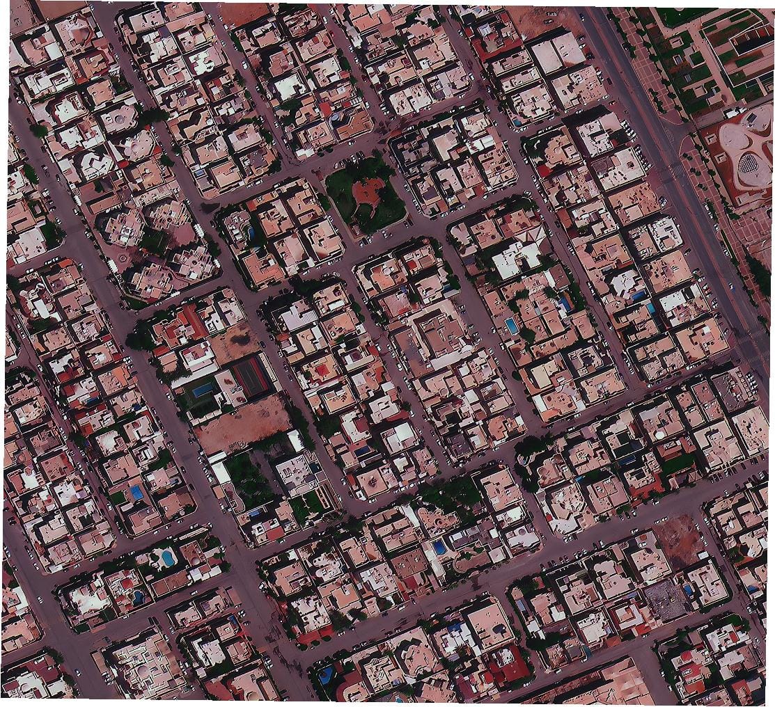
What is Satellite Imagery & What are Satellite Imagery Providers?
Satellite imagery is a type of photograph taken from space using Earth observation satellites. These images capture detailed visuals of the Earth’s surface, including land, water, buildings, forests, or weather systems. They are used in agriculture, environmental monitoring, city planning, defense, disaster response, and more.
A satellite imagery provider is a company or agency that collects, processes, and distributes this imagery. Some providers own satellites, while others partner with satellite companies to deliver data and services. Examples include XRTech Group, Maxar, Airbus, Planet, Synspective, and SkyWatch.
These providers deliver high-resolution data to help governments, researchers, businesses, and individuals make informed decisions based on what’s happening on the ground—from space.
Why Do We Need Satellite Imagery and GIS Data in 2026?
In 2026, satellite imagery and GIS (Geographic Information Systems) data are more important than ever. Here’s why:
Climate Change Monitoring: Frequent updates from satellites help track melting glaciers, rising sea levels, and deforestation in real time.
Urban Growth: As cities expand, planners use satellite data to manage space, build smart infrastructure, and reduce overcrowding.
Agriculture: Farmers rely on vegetation indices and soil data from satellites to increase crop yields and reduce waste.
Disaster Response: After floods, earthquakes, or fires, emergency teams use recent satellite images to assess damage and plan rescue efforts.
Security and Surveillance: Governments and defense agencies use high-resolution satellite data to monitor borders, protect critical infrastructure, and track illegal activities.
GIS data adds powerful layers to satellite imagery, allowing you to map, analyze, and visualize complex patterns on Earth. Together, they help solve real-world problems with location-based intelligence.
What to Consider When Choosing a Satellite Imagery Provider
Choosing the right satellite imagery provider depends on your project goals, timeline, and budget. Here are key factors to keep in mind in 2026:
1. Resolution of Imagery
2. Revisit Frequency
How often can the satellite capture new images of your area?
If you need frequent monitoring (daily or weekly), choose a provider with a strong satellite constellation.
3. Data Access & Format
Do you need raw imagery or processed, GIS-ready formats like GeoTIFF?
Some providers also offer APIs for automated data integration.
4. Delivery Speed
5. Global Coverage
6. Custom Services
Look for value-added services like change detection, terrain modeling, NDVI analysis, and AI-based classification.
7. Pricing & Licensing
Understand the cost per km², minimum order size, and licensing terms.
Some providers offer flexible pricing for NGOs, researchers, or startups.
By evaluating these factors, you can choose a satellite imagery provider that offers the right balance of cost, quality, and service for your needs.
Final Thought
The world of satellite imagery providers is always growing and changing. From large, well-known companies to new, specialized ones, each plays a part in helping us understand our planet better. Whether you need very detailed pictures for a specific project or wide-area monitoring, there is a satellite company or satellite data provider that can help.
XRTech Group stands out with its wide range of high-resolution imagery, quick data delivery, and smart analysis tools. Our commitment to quality and customer happiness makes us a strong partner for any project needing advanced geospatial solutions. Our transparent pricing also makes it easy for you to plan your project without hidden costs.
Choosing the right satellite imagery company means looking at your specific needs, the type of data you require, and how often you need updates. The companies listed above, including XRTech Group, represent the best in the field for 2026, offering diverse capabilities in Remote sensing and GIS data provider services. The continuous advancements in satellite technology mean that even more powerful and accessible solutions will become available in the future, further helping us understand and manage our world.
For more information on how satellite imagery and geospatial solutions can benefit your work, or to get a custom quote for your specific needs, please contact XRTech Group today. Our experts are ready to discuss how our satellite services can help you achieve your goals in 2026 and beyond.