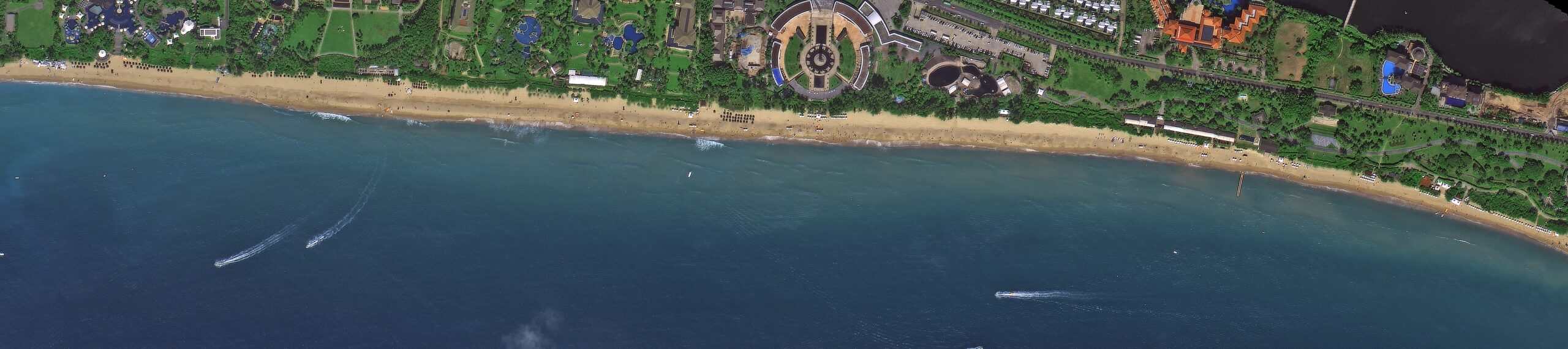
A SuperView optical satellite image of Yalong Bay in Sanya, Hainan, with its long curved beach, resorts and boats in the bay.
This satellite view of Yalong Bay, Sanya was captured from orbit, not by plane or drone. Click the aerial view to open it full size.
Aerial view of Yalong Bay, Sanya from space
The bay's crescent of white sand runs across the full width of the image, backed by hotel grounds, pools and gardens. Small boats leave wakes in the clear blue water, and changes in water colour show where the seabed drops away.
Coastal images like this support tourism planning, beach erosion studies and marine monitoring, and they show how well the sensor handles water clarity.
Order archive images or new tasking, from 15cm HD and 30cm optical to all-weather SAR, delivered worldwide as GeoTIFF. Tell us your area and we send available images and a price, usually within 24 hours.