Quick answer: A crown fire is a wildfire that burns through the crowns (canopy) of trees, spreading from treetop to treetop instead of along the forest floor. Most crown fires start as surface fires that climb into the canopy through ladder fuels such as low branches and small trees. Crown fires are the fastest and most intense type of forest fire: they often spread at 20 to 100 metres per minute, produce flames two to three times taller than the trees, and throw embers hundreds of metres ahead. Once a crown fire is running, crews cannot attack its head directly.
3 typesPassive, active and independent crown fire20 to 100 m/minTypical spread of active crown firesOver 3.4 mFlame length where head attack stops working1 km+Ember spotting ahead of the fire
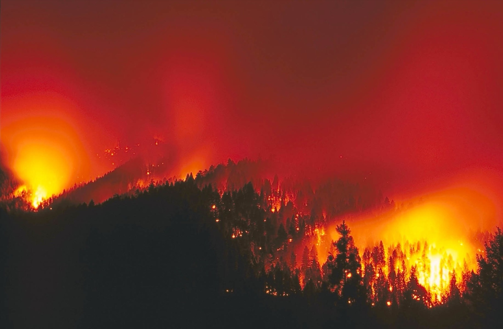
An active crown fire runs through the canopy of a conifer forest. Photo: USDA Forest Service, public domain.
What Is a Crown Fire? Definition and Meaning
In fire science, the crown is the upper part of a tree: its branches and foliage. A crown fire is any fire that burns in that layer. Fire behaviour scientists define it by fuel layer, not by size, so a single burning tree and a fire racing across thousands of hectares of treetops are both crown fires. Crown fires are most common in conifer forests such as pine, spruce and fir, where resinous needles and connected crowns carry flame easily.
The terms crown fire, crown forest fire and crown wildfire mean the same thing. "Crown of fire" is an informal phrase people use for the same event: a fire that has climbed into, and is burning across, the tops of the trees.
Crown Fire vs Surface Fire vs Ground Fire
Wildfires burn in three fuel layers. A single fire can burn in all three at once.
Surface fire
Crown fire
Ground fire
Fuel
Litter, grass, shrubs, logs
Needles, leaves and small branches in the canopy
Roots, peat, duff, organic soil
Typical spread
Under 10 m/min under a forest canopy
20 to 100 m/min, faster in strong wind
Centimetres to metres per day
Flames
Usually under 3 m
Often 2 to 3 times tree height
Few or no flames, smouldering
Control
Hand crews and engines can attack directly
Head of the fire cannot be attacked; crews work the flanks
Hard to find, needs digging or flooding
Damage
Low to moderate, many trees survive
Usually kills most trees in the stand
Kills roots, can burn for weeks
Types of Crown Fire: Passive, Active and Independent
Fire scientists group crown fires into three types based on how much the canopy depends on the fire below it.
Type
What happens
How dangerous
Passive crown fire (torching)
Single trees or small groups catch fire from the surface fire and burn up like torches, but flames do not carry from crown to crown
High: throws embers and can switch to active crowning
Active crown fire
A solid wall of flame burns through the canopy and the surface fuels together, each feeding the other
Very high: the fast, intense runs seen on the news
Independent crown fire
Flame spreads through the canopy ahead of, or without, the surface fire, driven by strong wind and steep slopes
Extreme, but rare and short-lived
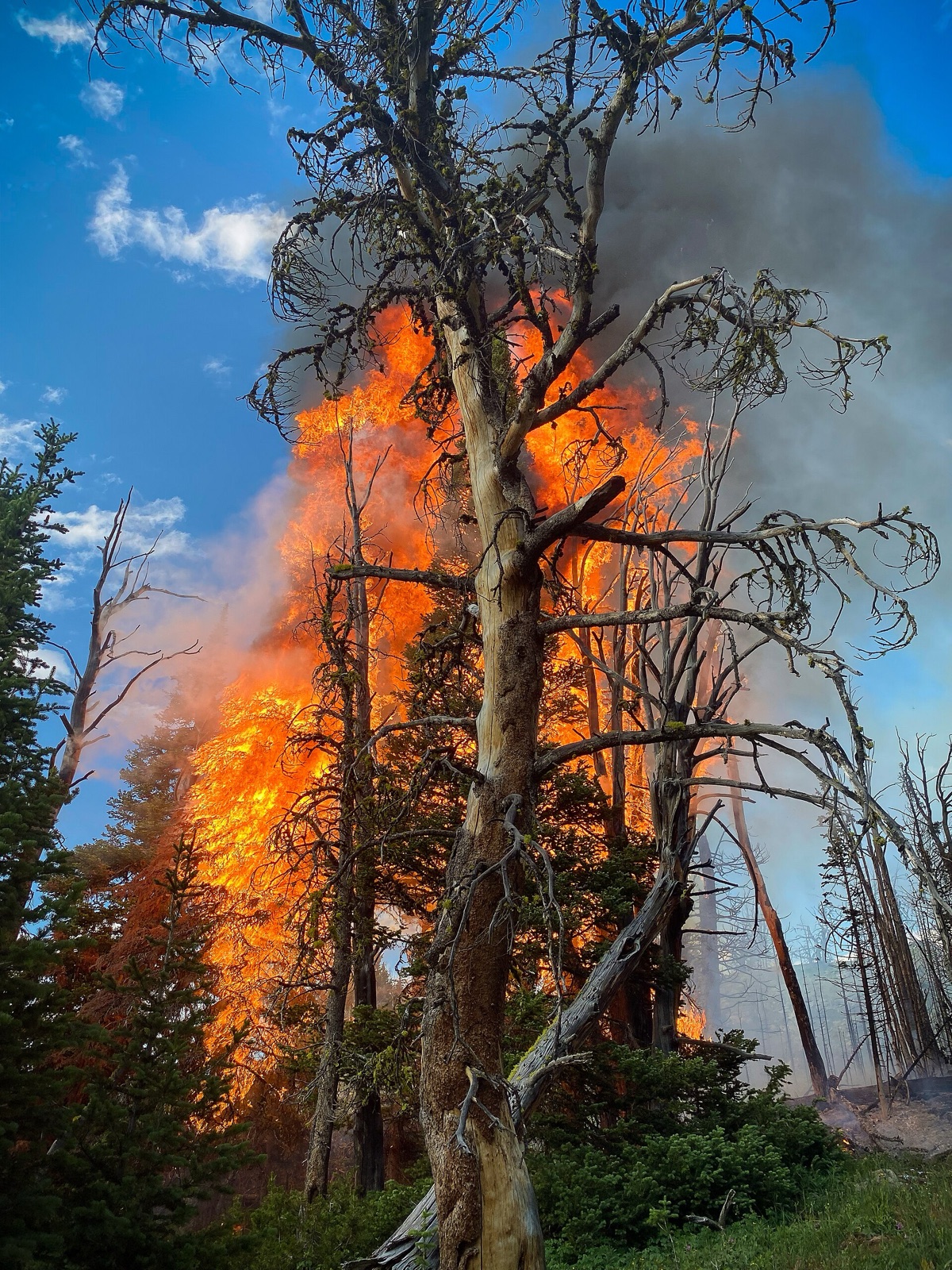
Torching: a passive crown fire, where single trees ignite from the surface fire. Photo: USDA Forest Service, public domain.
How a Surface Fire Becomes a Crown Fire
01Surface fireBurns litter and shrubs on the forest floor02Ladder fuelsLow branches and small trees carry flame upward03TorchingSingle crowns ignite: a passive crown fire04Active crown runFlame spreads crown to crown with wind and slope05SpottingEmbers start new fires far ahead of the front
Three canopy measurements decide whether that climb happens and whether the fire keeps running:
- Canopy base height: the distance from the ground to the lowest live branches. The lower it is, the smaller the surface fire needed to ignite the crowns.
- Foliar moisture content: how much water is in the needles. Drier foliage ignites more easily; many conifers have a seasonal dip in needle moisture in spring.
- Canopy bulk density: how much fine fuel is packed into the canopy. Dense, closed canopies let flame jump from crown to crown; open stands starve an active crown fire.
Van Wagner’s crown fire model, the basis of most operational systems, uses exactly these: a surface fire must reach a critical intensity set by canopy base height and foliar moisture to ignite the crowns, and the fire must spread fast enough for the canopy density to sustain an active crown fire. For example, a canopy bulk density of 0.1 kg/m³ needs a spread rate of about 30 metres per minute to keep an active crown fire going.
How Fast Does a Crown Fire Spread?
Active crown fires typically spread at 20 to 100 metres per minute, about 1 to 6 km per hour, and wind-driven runs in conifer forests can go faster for short periods. Rothermel’s widely used crown fire model estimates crown fire spread at about 3.3 times the rate of a standard surface fire in timber. In the steepest, windiest conditions, the gap is larger.
Surface fire under a canopyUnder 10 m/minPassive crown fire (torching)10 to 20 m/minActive crown fire20 to 100 m/minWalking personAbout 80 m/min
Chart: typical spread ranges on a 0 to 100 m/min scale. An active crown fire can outpace a person walking, and on steep slopes it can outpace a person running uphill.
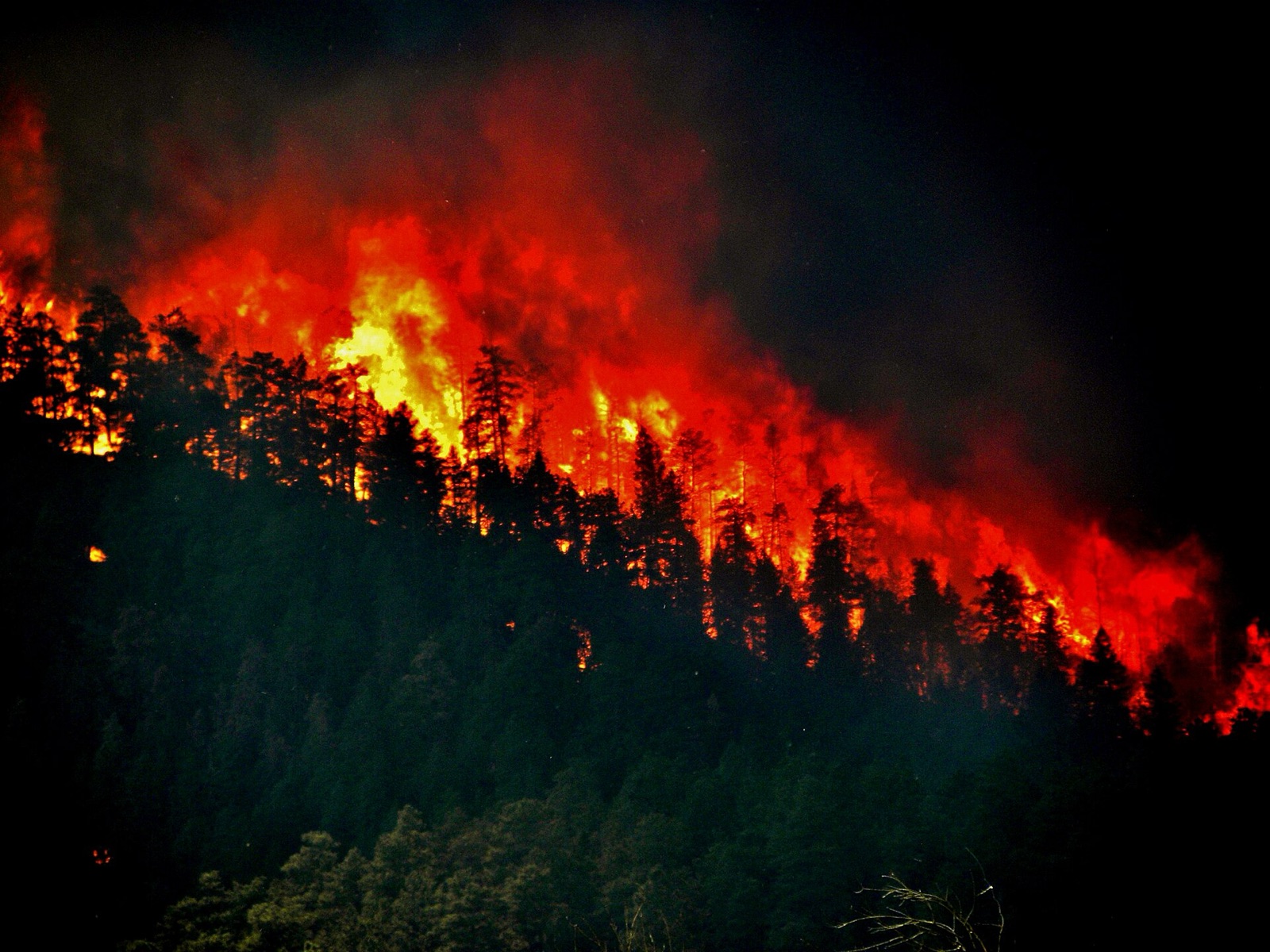
Groups of trees burning together on a slope as the fire moves into the crowns. Photo: USDA, public domain.
Why Crown Fires Are So Dangerous
- Speed: a run of several kilometres can happen in under an hour, cutting off roads and escape routes.
- Intensity: active crown fires release far more heat per metre of fire front than surface fires, with flames well above the treetops and temperatures that can exceed 1,000°C.
- Spotting: burning embers lofted by the convection column start new fires hundreds of metres ahead, sometimes more than a kilometre, and much farther in extreme events. Roads, rivers and firebreaks do not stop them.
- No direct attack: hand tools, engines and even aircraft cannot stop the head of an active crown fire, so crews work the flanks and wait for wind, terrain or fuels to change.
- Total stand loss: most trees in an active crown fire die, which raises erosion, flooding and landslide risk on burned slopes afterwards.
US wildland fire crews use flame length to judge what they can do. This is the standard guide from the National Wildfire Coordinating Group:
Under 1.2 mHand crewsDirect attack at the head and flanks with hand tools1.2 to 2.4 mEngines and dozersToo intense for hand crews; equipment can hold the line2.4 to 3.4 mSerious problemsTorching and spotting; control at the head is unlikelyOver 3.4 mCrown fireCrowning, spotting and major runs; head attack is ineffective
What Causes Crown Fires?
Factor
Why it pushes fire into the crowns
Warning sign
Strong wind
Tilts flames into the canopy, drives crown to crown spread and lofts embers
Gusty winds, red flag warnings
Steep slope
Preheats fuel uphill, so fire runs upslope much faster
Chimneys, narrow canyons, south-facing slopes in the north
Ladder fuels
Shrubs, small trees and low branches carry flame upward
Dense young trees under a mature canopy
Low canopy base height
A smaller surface fire can reach the crowns
Branches close to the ground
Dense canopy
High canopy bulk density sustains active crowning
Closed, unthinned conifer stands
Drought, heat and low humidity
Dries foliage and surface fuels, raising fire intensity
Long dry spells, humidity below about 20%
Heavy surface fuel
Dead needles, branches and logs feed a hotter surface fire
Thick litter, beetle-killed or storm-damaged trees
Fire agencies combine these into daily danger ratings, such as the Canadian Fire Weather Index and the US National Fire Danger Rating System, to flag days when crown fires are likely.
Which Forests Burn as Crown Fires?
Dense conifer forests, including spruce, pine, fir and larch, carry most crown fires because their needles are resinous, their crowns touch and many keep dead branches low on the trunk. Broadleaf trees such as aspen and birch hold more moisture in summer and often slow a fire down, though they can burn in early spring before leaf-out, in severe drought, or where conifers are mixed in. Eucalyptus forests in Australia also crown readily, and their bark produces long-distance embers.
How to Prevent Crown Fires
Method
What it does
Effect on crown fire
Thinning
Removes some trees to open the canopy
Lowers canopy bulk density, so active crowning is harder
Pruning
Removes low branches
Raises canopy base height, so surface fire cannot reach the crowns
Surface fuel reduction
Clears litter, shrubs and fallen wood
Keeps surface fires small and low
Prescribed burning
Burns surface fuel under mild, controlled conditions
Reduces fuel and ladder fuels over large areas
Fuel breaks
Wide strips with thinned, low fuel
Gives crews a safe place to stop a fire dropping to the surface
Early detection
Finds fires while they are still small surface fires
Stops them before they reach the canopy
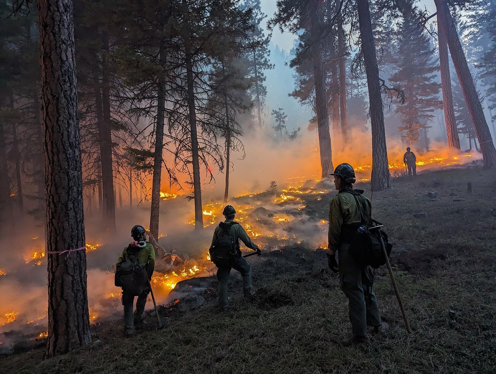
A prescribed burn removes surface fuel under mild conditions, so a later wildfire stays on the ground. Photo: USDA Forest Service, public domain.
How to protect a home from a crown fire
Most homes are lost to embers and small fires close to the house, not to the main flame front. FireSmart Canada and the US Firewise programme use home ignition zones:
0 to 1.5 mImmediate zoneNothing that burns: gravel or bare soil, clean roof and gutters, no mulch or woodpiles1.5 to 10 mIntermediate zoneSpaced, pruned plants, mowed grass, trees well apart, no ladder fuels10 to 30 mExtended zoneThinned trees with crowns apart, low branches pruned, surface fuel removed
Can Satellites Detect and Map Crown Fires?
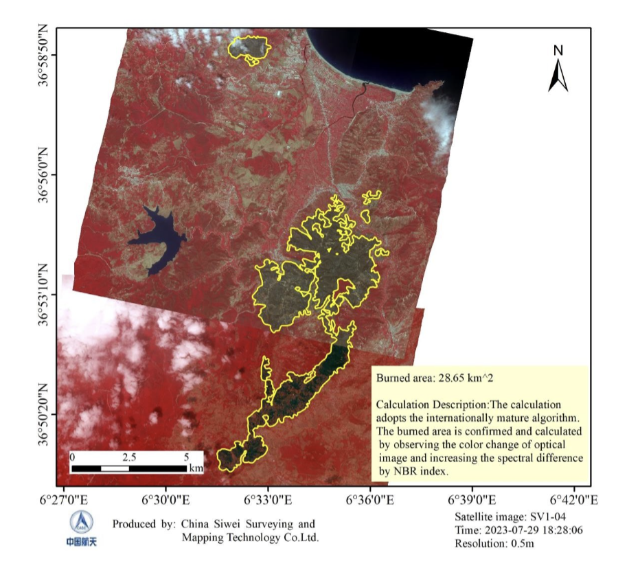
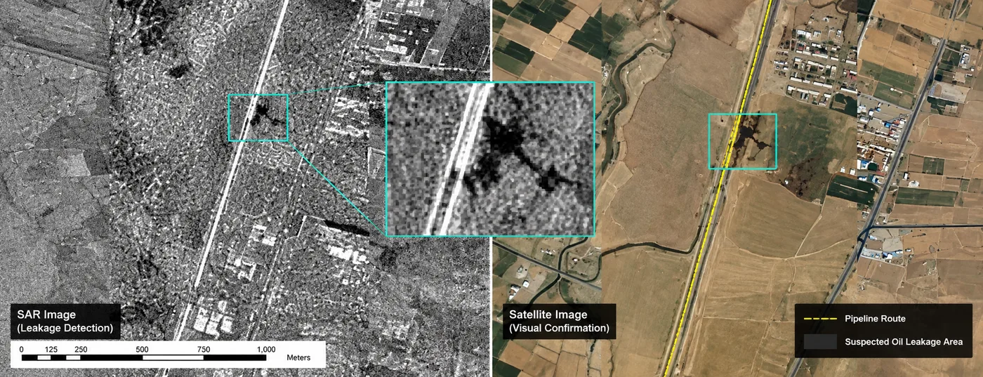
Yes, at every stage. Before the season, satellites map where crown fires are likely; during a fire, they track the front; afterwards, they show where the canopy burned. XRTech Group delivers all three through wildfire detection and forest fire monitoring.
Stage
What satellite data shows
Satellite data used
Before: crown fire risk
Canopy height and density, conifer cover, ladder fuel structure, slope and needle dryness
Stereo imagery for canopy height models (<a href="https://xrtechgroup.com/digital-surface-model-dsm/">DSM</a> minus DTM), land cover, NDVI and NDMI, <a href="https://xrtechgroup.com/digital-elevation-model-dem-services/">DEM</a>
During: detection and spread
Hotspots within minutes, the fire front and spot fires, smoke direction
GF-4 geostationary thermal every 20 seconds, optical tasking, <a href="https://xrtechgroup.com/sar-satellite-imagery-data/">SAR</a> through smoke
After: crown fire severity
Where the canopy was consumed (high dNBR) versus surface-only burns, regrowth over time
NBR and dNBR from before and after imagery, sub-metre imagery for damage
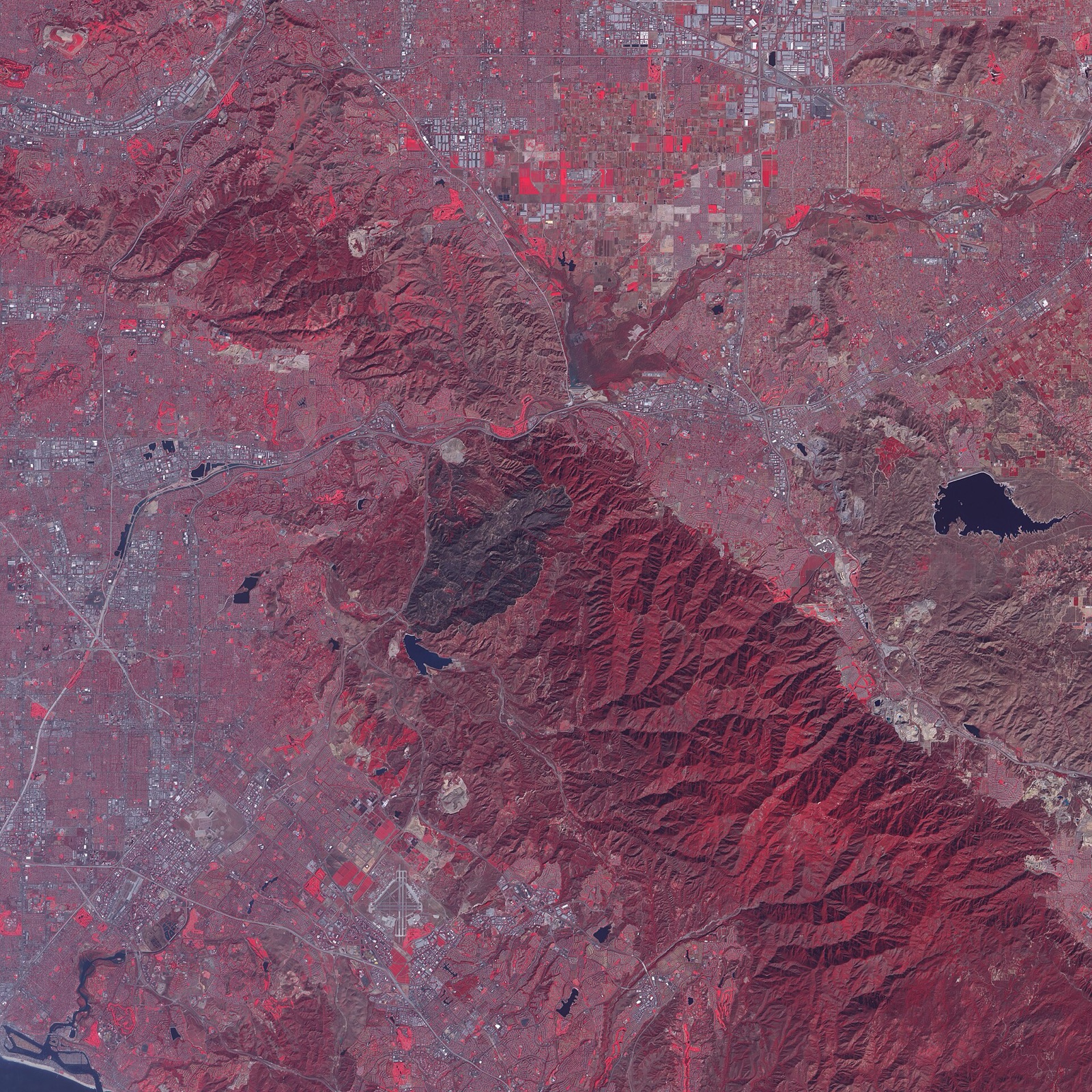
From space, crown fire areas show up as the darkest burn scars, where the whole canopy was consumed. Image: NASA Earth Observatory, Landsat, public domain.
Crown fire areas stand out after the fire because the whole canopy is gone: dNBR values are highest there, while surface fires leave green crowns above blackened ground. This split matters for recovery planning, insurance and carbon accounting. See vegetation indices for how NBR and NDMI work.
Will a Forest Grow Back After a Crown Fire?
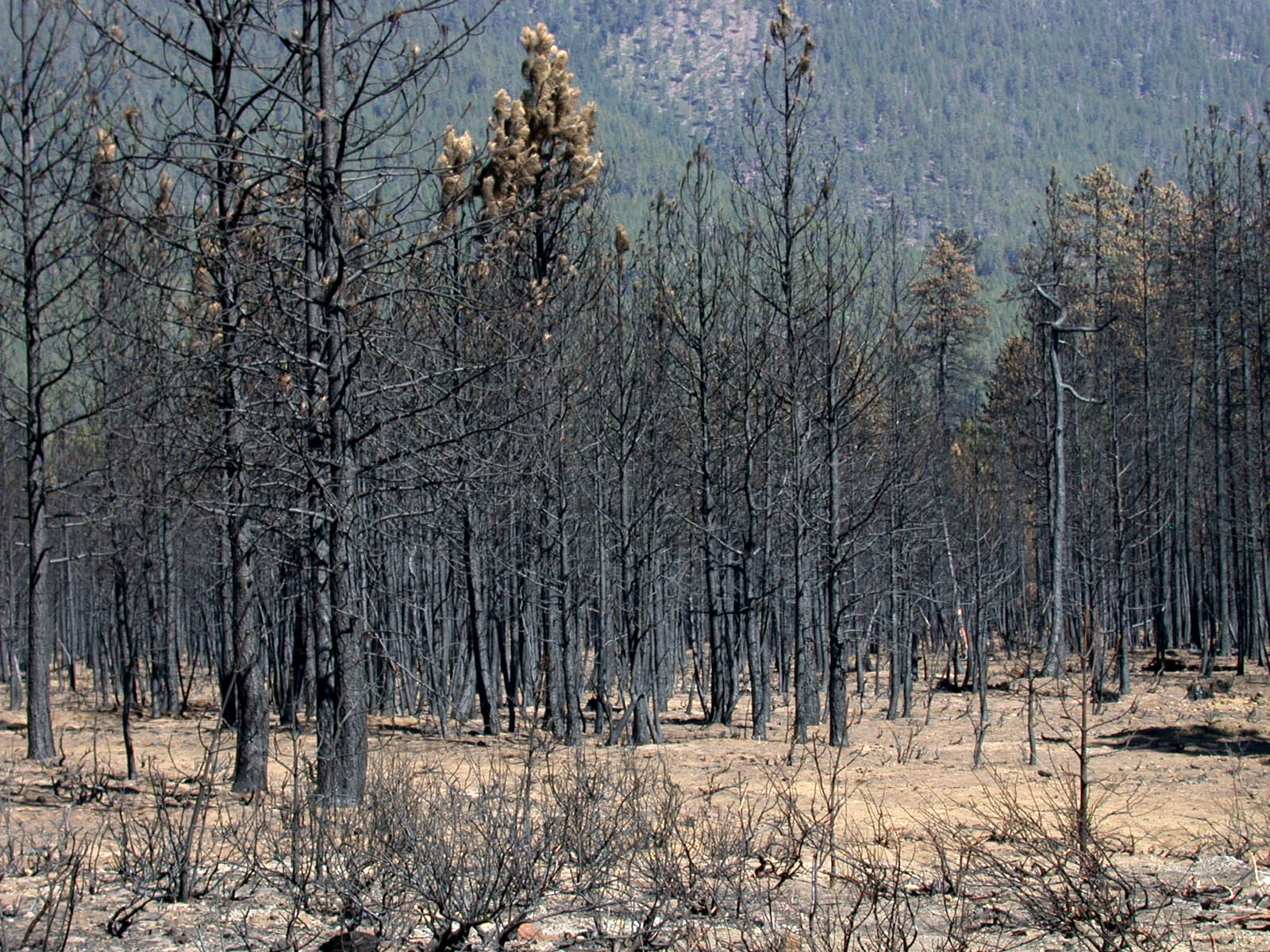
After an active crown fire: the canopy is consumed and nearly every tree in the stand is killed. Photo: USDA Forest Service, public domain.
Often, but it can take decades. Fire-adapted conifers such as lodgepole pine and jack pine have serotinous cones that open in the heat and reseed the burn, so crown fire is a natural part of their cycle. Very severe fires, repeated fires within a few years, or the loss of nearby seed trees can stop a forest from returning and leave shrubland or grassland instead. In those areas, replanting and erosion control are needed, and satellite time series show whether regrowth is on track.
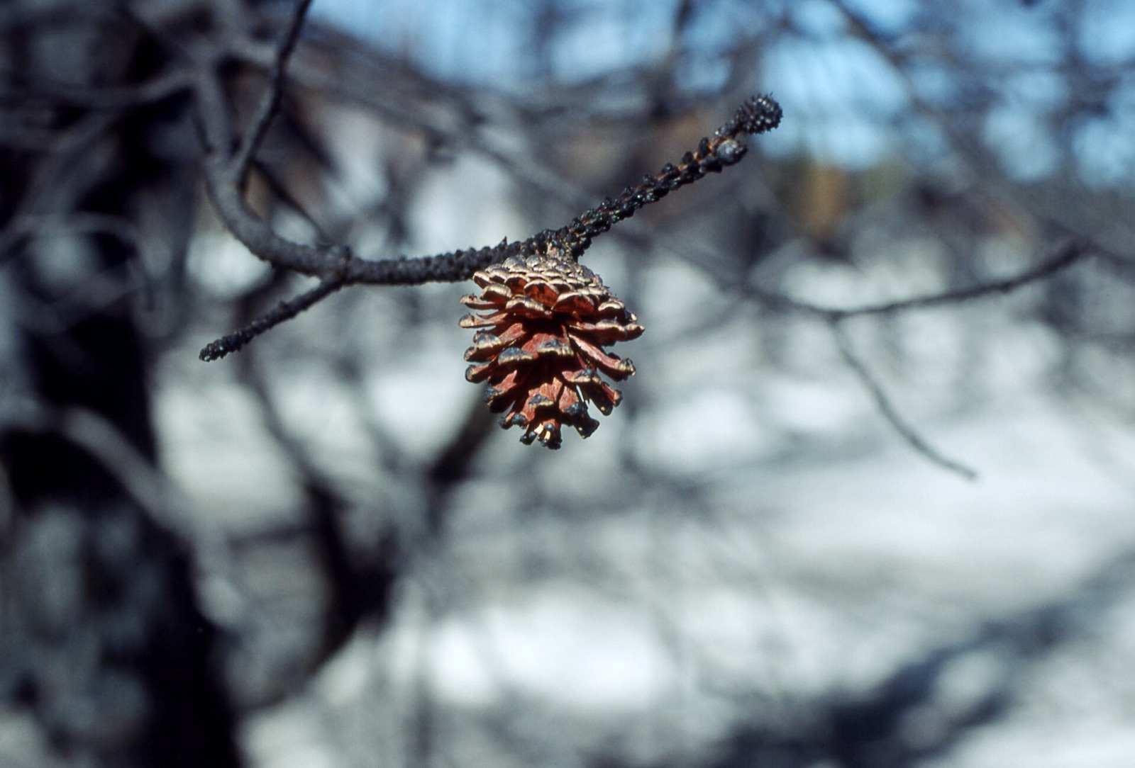
Serotinous lodgepole pine cones open in the heat of a crown fire and reseed the burn. Photo: public domain.
How XRTech Group Helps With Crown Fire Risk and Response
XRTech Group is a satellite imagery and geospatial analytics provider with access to more than 130 optical, thermal, hyperspectral and SAR satellites. For crown fires it delivers:
- Crown fire risk maps: canopy height and density from stereo satellite imagery, conifer and fuel type mapping, NDVI and NDMI dryness and slope, so thinning and fuel breaks go where crowning is most likely.
- Minute-scale detection: GF-4 geostationary thermal alerts every 20 seconds, to catch fires before they reach the canopy.
- Fire front tracking: sub-metre to 16m optical imagery plus SAR through smoke, with emergency satellite imagery within 24 hours.
- Crown fire severity: dNBR maps separating canopy loss from surface burns, with burned area in hectares.
- Recovery monitoring: regrowth tracked month by month to guide replanting.
Map Crown Fire Risk and Severity for Your Forest
Send your forest boundary or fire location. XRTech Group replies with the satellite data, analysis and price per km² for risk mapping, active fire monitoring or post-fire severity.
Frequently Asked Questions
What is a crown fire?
A crown fire is a wildfire that burns through the crowns, or canopy, of trees and spreads from treetop to treetop. It usually starts as a surface fire that climbs into the canopy through ladder fuels. Crown fires are the fastest, most intense and most dangerous type of forest fire.
What does "crown of fire" mean?
"Crown of fire" is an informal way of describing a crown fire: a wildfire burning across the tops of the trees. Fire agencies use the terms crown fire, crown forest fire or crown wildfire.
What is the difference between a passive and an active crown fire?
In a passive crown fire, single trees or small groups torch, but flames do not carry from crown to crown. In an active crown fire, a continuous wall of flame burns through the canopy and the surface fuels together. An independent crown fire spreads through the canopy without the surface fire, and is rare.
How fast does a crown fire spread?
Active crown fires typically spread at 20 to 100 metres per minute, about 1 to 6 km per hour, and can run faster in strong wind on steep slopes. Surface fires under a forest canopy usually spread at under 10 metres per minute.
Can a person outrun a crown fire?
Not reliably. An active crown fire can move faster than a person walks, faster still uphill, and heat, smoke and embers make the forest deadly well before the flames arrive. The only safe choice is to leave early by the routes authorities recommend.
Can a crown fire jump a road, river or firebreak?
Yes. Embers from a crown fire can land hundreds of metres ahead, sometimes more than a kilometre, and start new fires on the far side of roads, rivers and cleared strips. Firebreaks still help crews by slowing the fire and giving them a place to work.
Why can’t water bombers put out a crown fire?
The fire is too hot and too high. Much of the water or retardant evaporates or blows off course, and little gets through a thick canopy. Aircraft still protect homes and slow the flanks, but they rarely stop the head of an active crown fire.
What are ladder fuels?
Ladder fuels are shrubs, small trees and low branches that let a surface fire climb into the tree crowns. Pruning low branches and removing small understorey trees cuts the ladder and is one of the most effective ways to prevent crown fires.
Do crown fires happen in deciduous forests?
Rarely. Broadleaf trees such as aspen hold more moisture in summer and often slow fire. The risk rises in early spring before leaf-out, in severe drought and in mixed forests with conifers. Dense spruce, pine and fir stands remain the most vulnerable.
How can crown fires be prevented?
Thin dense stands to open the canopy, prune low branches to raise the canopy base, remove surface fuels, use prescribed burns and fuel breaks, and detect fires early so they are stopped as small surface fires before reaching the crowns.
Can satellites detect crown fires?
Yes. Geostationary thermal satellites such as GF-4 detect fires within minutes, optical and SAR imagery track the fire front through smoke, and before and after imagery (dNBR) shows exactly where the canopy burned. Stereo imagery also maps canopy height and density to predict where crown fires are likely.
Related: wildfire detection and forest fire monitoring, emergency satellite imagery and vegetation indices guide.
Sources
- National Wildfire Coordinating Group: Fireline Handbook and fire behaviour guides
- Van Wagner, C.E.: Conditions for the start and spread of crown fire, Canadian Journal of Forest Research
- Rothermel, R.C.: Predicting behaviour and size of crown fires in the Northern Rocky Mountains, USDA Forest Service
- Scott, J.H. and Reinhardt, E.D.: Assessing crown fire potential, USDA Forest Service
- Natural Resources Canada: Canadian Forest Fire Danger Rating System
- FireSmart Canada: home ignition zone guidance
- NFPA Firewise USA: home ignition zones
- NASA: MODIS and Landsat burn severity products