Quick Answer: Satellite imagery has four types of resolution. Spatial resolution is the size of one pixel on the ground. Spectral resolution is the number and width of wavelength bands the sensor captures. Temporal resolution is how often the satellite revisits the same location. Radiometric resolution is how many brightness levels the sensor can distinguish. Each type affects what you can detect and analyse from satellite data.
Satellite resolution is one of the most misunderstood terms in geospatial work. Most people hear “resolution” and think only of pixel size. But there are four separate resolution types that each affect what a satellite image can tell you. Focusing on just one while ignoring the others is a common and costly mistake in project planning.
1. Spatial Resolution
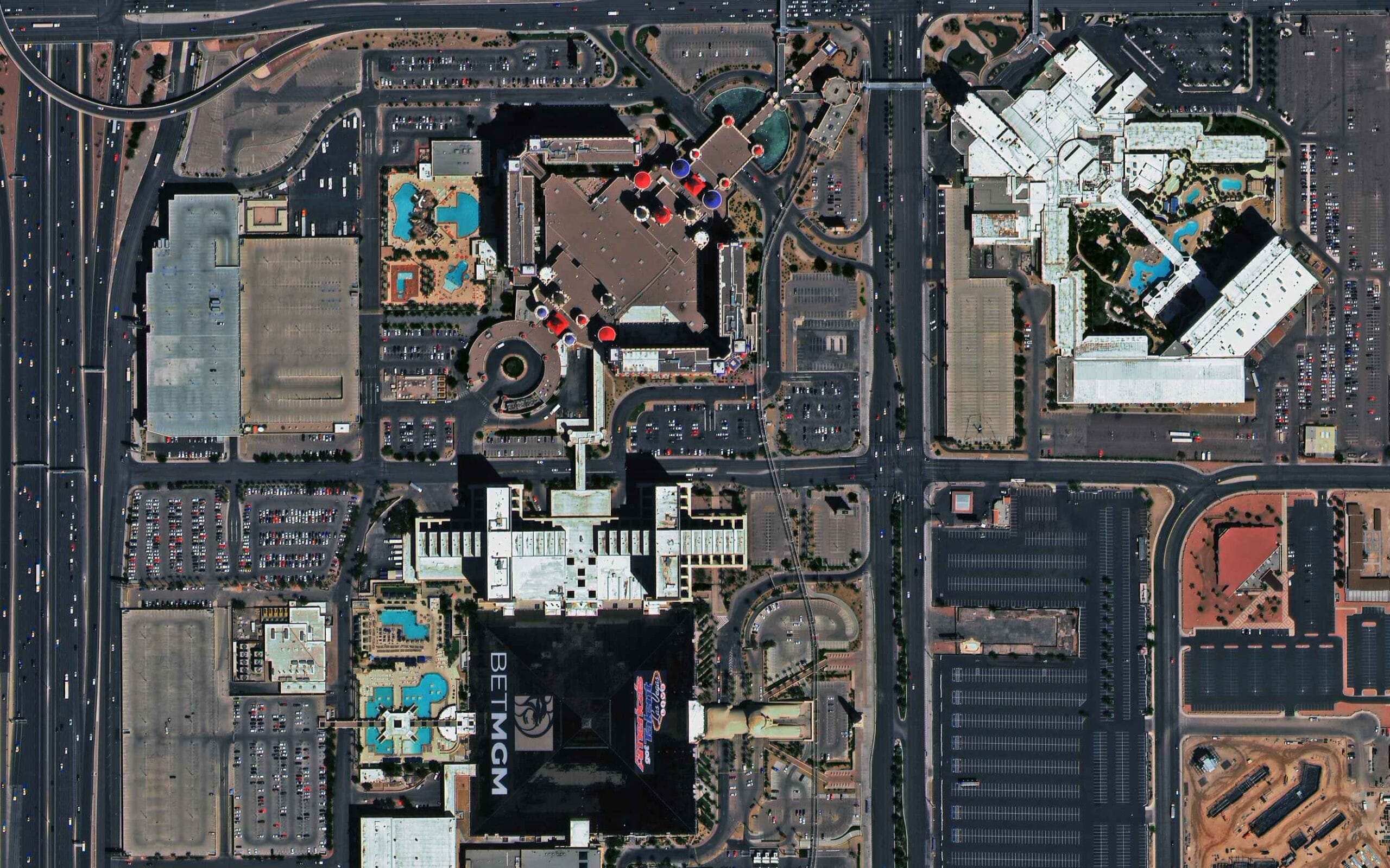
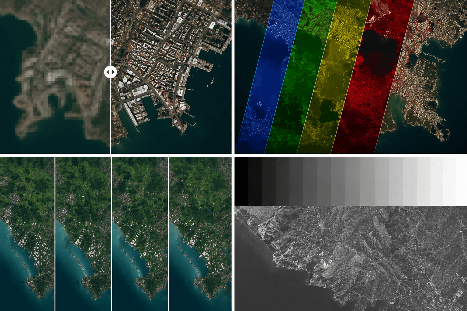
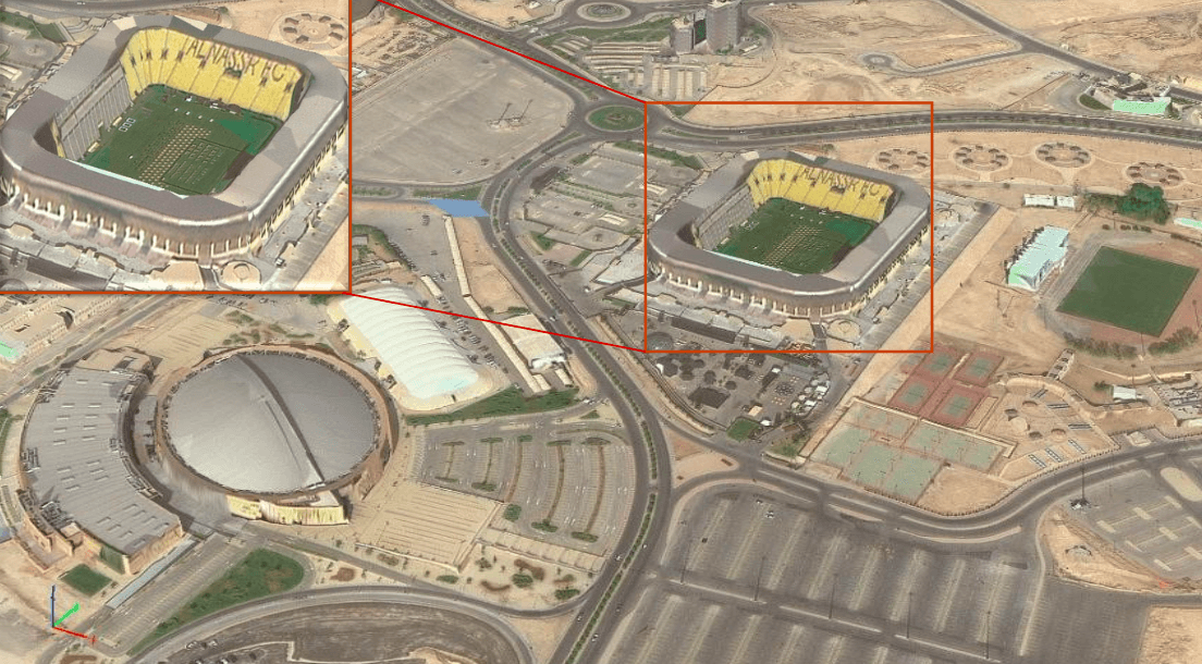
Spatial resolution is the area on the ground that one pixel represents. It is also called Ground Sample Distance or GSD. A pixel in a 10m image covers a 10m x 10m square on the ground. A pixel in a 0.3m image covers a 30cm x 30cm square.
The lower the GSD number, the finer the detail. This is why 0.3m is called “very high resolution” and 30m is called “medium resolution.”
Spatial Resolution Tiers:
What Can You Actually See at Each Resolution?
A standard car is about 4m x 2m. At 10m resolution it is invisible. At 1m resolution it appears as a single pixel. At 0.3m resolution you can see the shape of the vehicle clearly.
A basketball court is 28m x 15m. At 10m resolution it resolves as about 4 pixels. At 0.3m resolution it resolves as over 4,500 pixels.
The practical test is this: count how many pixels your target feature would occupy. If you get fewer than 4 pixels, the feature is not detectable. If you get 25 or more, you have enough to analyse it.
When Spatial Resolution Is Critical
Urban mapping at building level, infrastructure monitoring, damage assessment of individual structures, and vehicle counting all require sub-5m data.
For regional vegetation monitoring, water body mapping, agricultural field analysis, and land cover classification, Our Gaofen-2 provides 0.8m panchromatic and 3.2m multispectral imagery for land use mapping, urban planning and agricultural monitoring. Effective wide-area coverage with a 45km swath. Available through XRTech Group for environmental monitoring and land administration projects.
2. Spectral Resolution
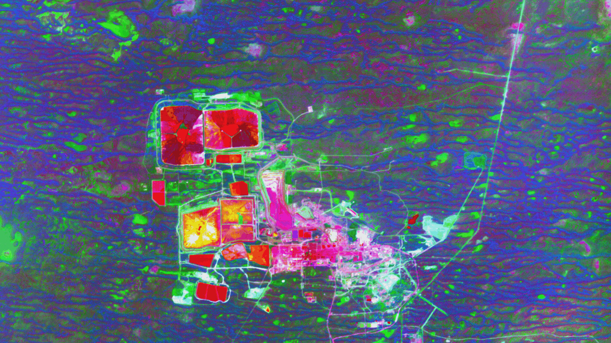
Spectral resolution is the number, width, and placement of wavelength bands the sensor captures. A standard camera captures three bands: red, green, and blue. A multispectral satellite captures 4 to 13 bands across visible, near-infrared, red edge, and shortwave infrared wavelengths. A hyperspectral sensor captures hundreds of narrow bands.
Each band reveals different surface properties. This is what makes spectral resolution so important for analytical work.
Key Spectral Bands and What They Reveal:
Multispectral vs Hyperspectral
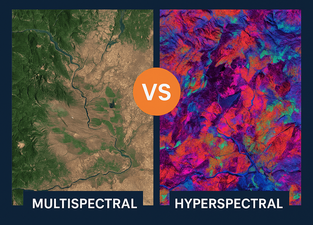
Multispectral sensors capture data in a small number of broad, specific bands. Sentinel-2 has 13 bands. The SuperView-2 satellite has 8 multispectral bands. These are the standard for most agricultural, environmental, and land cover applications.
Hyperspectral sensors capture hundreds of narrow, contiguous bands across the full electromagnetic spectrum. They are used in mineral exploration, precision agriculture, and material identification where subtle spectral differences matter.
Read – Multispectral vs Hyperspectral imagining satellite Sensors
Why Spectral Resolution Matters More Than Most People Think
Two satellites with identical spatial resolution can have completely different analytical capabilities depending on their spectral bands. A 4-band satellite capturing red, green, blue, and near-infrared cannot detect soil moisture or map burn severity. A satellite with SWIR bands can. The pixel size is the same but the information content is fundamentally different.
Our GF-5B Hyperspectral carries a hyperspectral imager with over 300 spectral bands at 30m resolution. Captures visible, near-infrared and shortwave infrared signatures for mineral identification, vegetation health and pollution monitoring. Used for mineral exploration, carbon monitoring and environmental compliance.
3. Temporal Resolution

Temporal resolution is how often the satellite captures the same location. It is also called revisit rate and is measured in days. A satellite with a 1-day revisit rate has higher temporal resolution than one with a 16-day revisit rate.
Revisit Rates by Satellite
| Satellite | Revisit Rate | Notes |
|---|---|---|
| Sentinel-2 (A+B combined) | 5 days | Free, global, 10m optical |
| Sentinel-1 SAR | 6 days | Free, all-weather, C-band radar |
| Landsat 8 + 9 combined | 8 days | Free, 30m, long archive |
| Planet Dove constellation | 1 day | Commercial, 3m to 5m |
| SuperView Neo-1 | 1 day | Commercial, 0.3m |
| Commercial tasking (XRTech) | On demand | Any location, delivered in under 7 days |
When Temporal Resolution Is the Deciding Factor
- Agriculture: Crop growth stages change week by week. Missing the flowering window or early stress period means the analysis loses most of its value regardless of how sharp the image is.
- Disaster response: After a flood or earthquake you need the first available image. Hours and days matter more than pixel size in these situations.
- Change detection: Detecting urban expansion, deforestation, or land cover change requires consistent repeat captures. A single very high resolution image tells you what an area looks like today, not how it is changing.
- Tropical regions: Cloud cover is the hidden problem with optical imagery. Over tropical areas, any given observation has a 60 to 70 percent chance of being cloud-contaminated. With a 5-day revisit you might get one usable image per month. This is why SAR imagery, which sees through cloud and operates day and night, is so important for temporal consistency.
4. Radiometric Resolution
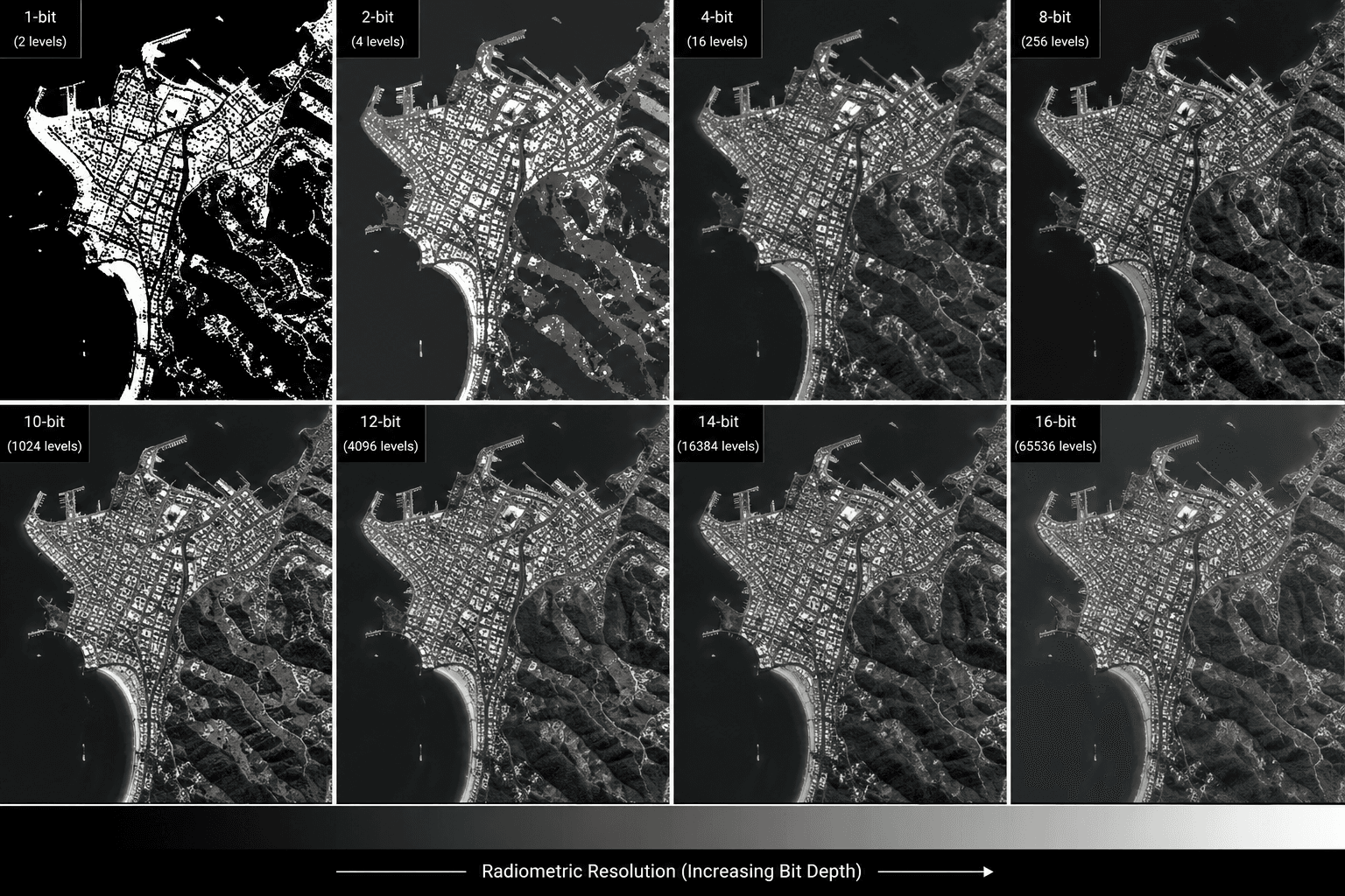
Radiometric resolution is the number of brightness levels the sensor can record per pixel. It is measured in bits. An 8-bit sensor records 256 possible values per pixel. A 12-bit sensor records 4,096 values. A 16-bit sensor records 65,536 values.
Higher radiometric resolution means the sensor can detect more subtle differences in reflected or emitted energy. This matters when the distinction between two surface types is a slight difference in brightness rather than a clear colour contrast.
Radiometric Resolution by Sensor:
| Bit Depth | Possible Values (Levels) | Associated Sensor / Data Product |
|---|---|---|
| 8-bit | 256 | Visual outputs, standard image viewing, and most image deliverables |
| 10-bit | 1,024 | GF-2 and GF-1 satellites (PMC and WFI cameras) |
| 11-bit | 2,048 | SuperView Neo-1 and SuperView-1 satellite constellations |
| 12-bit | 4,096 | SuperView-2 (GFDM) satellite imagery |
| 16-bit | 65,536 | L1B Basic imagery and TOA (Top of Atmosphere) corrected data products |
When Radiometric Resolution Matters
Water quality monitoring is a good example. Detecting subtle differences in chlorophyll concentration across a lake requires the sensor to distinguish between values that look almost identical in brightness. An 8-bit sensor may record both as the same value. A 12-bit sensor separates them clearly.
Shadow analysis is another case. In an 8-bit image, deep shadows and dark surfaces all collapse into the same handful of values near zero. In a 12-bit image, there is enough differentiation to extract useful information from shadow areas.
For most standard mapping, land cover, and vegetation work, modern 12-bit sensors are more than sufficient. Radiometric resolution was a more limiting factor with older 8-bit satellite programmes.
The Resolution Tradeoff
Satellite engineers face a physical constraint: you cannot maximise all four resolution types at once. Improving one usually requires a compromise in another.
Get the Right Type of Satellite Imagery Resolution for Your Project
Buy commercial satellite imagery from SuperView Neo-1 at 0.3m, SuperView-2 with 8-band multispectral data, and SAR satellites including GF-3 and LT-1 for all-weather capture. Archive imagery starts at $1/km2 and new tasking starts at $8/km2 for any location on Earth.
Contact XRTech to discuss resolution requirements for your project.
FAQs for Types of Satellite Imagery Resolution
What are the 4 types of satellite imagery resolution?
The four types are spatial resolution (pixel size on the ground), spectral resolution (number and width of wavelength bands), temporal resolution (revisit rate), and radiometric resolution (brightness levels per pixel). Each affects what information can be extracted from the image.
What is the difference between spatial and spectral resolution?
Spatial resolution determines how small a feature you can see. Spectral resolution determines what surface properties you can identify. Two images can have the same spatial resolution but completely different analytical value depending on their spectral bands.
What is a good spatial resolution for satellite imagery?
It depends on the application. For vehicle and building detection, 0.3m to 1m is needed. For field boundary mapping and vegetation indices, 10m is sufficient. For regional land cover and weather monitoring, 30m to 300m is standard.
What does 10m resolution mean in satellite imagery?
It means each pixel in the image represents a 10m x 10m area on the ground. Objects smaller than roughly 10m across will not be individually visible, though patterns and boundaries at that scale are detectable.
Why does temporal resolution matter more than spatial resolution for some projects?
Because some processes change faster than the satellite revisits the area. For crop stress monitoring, disaster response, and change detection, getting a timely image matters more than getting a sharper one. A cloud-free 10m image from yesterday is more useful than a 0.3m image from last month.
What is radiometric resolution in satellite imagery?
Radiometric resolution is the number of brightness levels the sensor records per pixel. A 12-bit sensor records 4,096 levels compared to 256 for an 8-bit sensor. Higher radiometric resolution helps detect subtle differences in reflectance, which is important for water quality, shadow analysis, and precise spectral measurements.
What is the highest resolution commercial satellite imagery available?
The highest publicly available commercial spatial resolution is 0.3m, available from satellites including WorldView-3 and SuperView Neo-1. XRTech provides SuperView Neo-1 imagery at 0.3m resolution for any location on Earth.
Can you have high spatial and high temporal resolution in the same satellite?
Not easily. Higher spatial resolution means a narrower imaging swath, which reduces the area covered per pass and increases revisit time. To achieve both, commercial operators use constellations of multiple satellites. Planet’s Dove constellation achieves daily revisit at 3m to 5m resolution through this approach.
What is the difference between multispectral and hyperspectral imagery?
Multispectral imagery captures a small number of broad, specific bands, typically 4 to 13. Hyperspectral imagery captures hundreds of narrow, contiguous bands. Multispectral is standard for most agricultural, environmental, and land cover work. Hyperspectral is used for mineral mapping, material identification, and precision agriculture where subtle spectral differences are important.
How do I know which resolution type to prioritise for my project?
Start with temporal resolution based on how fast your subject changes. Then determine spectral requirements based on what surface properties you need to measure. Finally, set the minimum spatial resolution by identifying the smallest feature that must be detectable. Contact XRTech if you need help matching the right satellite to your project requirements.
Blog Summary
- Spatial resolution is the most visible type and refers to pixel size on the ground, from 30cm for commercial satellites to 30m for free Landsat data
- Spectral resolution determines what surface materials and vegetation conditions you can detect, not just what you can see
- Temporal resolution is how fast you get a repeat image of the same area, which matters more than pixel size for change detection
- Radiometric resolution sets how many brightness levels the sensor records per pixel, with modern sensors at 12-bit giving 4,096 levels
- You cannot maximise all four types at once because each involves a physical tradeoff in satellite design
- A 10m pixel is more than enough for crop field analysis, land cover mapping, and vegetation indices
- For vehicle detection, building footprints, and infrastructure inspection you need 0.3m to 1m spatial resolution
- SAR imagery is independent of cloud cover and daylight, which makes it essential for temporal consistency in tropical regions
- Spectral bands in the red edge and SWIR range reveal crop stress, soil moisture, and mineral composition that visible bands cannot
- XRTech provides satellite imagery from 25cm to 2m resolution across optical and SAR sensors, with archive from $1/km2 and new tasking from $8/km2

